Gulf of Mexico — Geography
Table of Contents
Countries
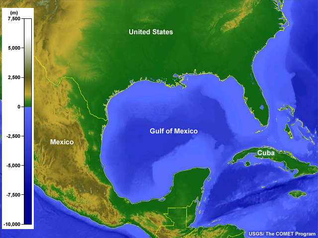
The Gulf of Mexico is bordered by only three countries, the United States, Mexico, and Cuba.
Major Topographical Features
The Gulf of Mexico is bordered by mountainous regions in the west and plains in the north, east, and south.
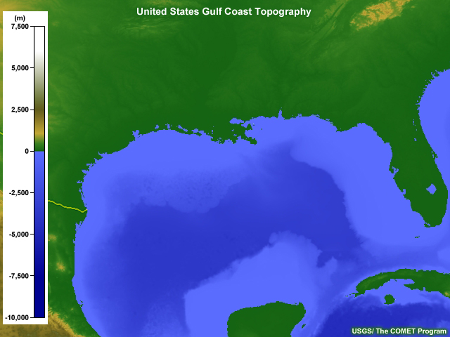
The US Gulf Coast is made up entirely of coastal plains that extend from South Texas to western Florida. The coast has no mountains and is punctuated by numerous bays and inlets. This low-lying topography makes the area vulnerable to storm surges and sea level rise.
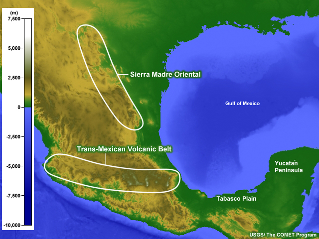
The Sierra Madre Oriental, the mountain range closest to the Gulf of Mexico, begins near the Big Bend area of the border between Texas and Mexico and extends south more than 1,000 km (600 mi). The southern part of the range ends at the Trans-Mexican Volcanic Belt (Cordillera Neovolcánica), a region of volcanoes that runs east-west.
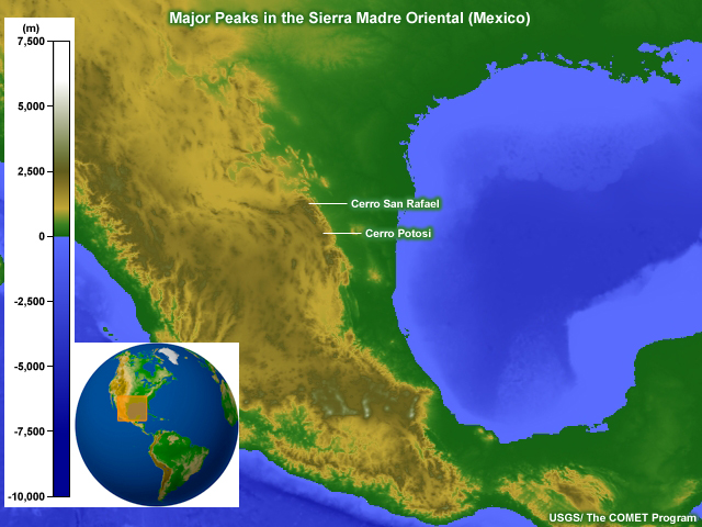
The peaks of the Sierra Madre Oriental generally exceed 2,000 m (6,500 ft) in elevation, with the highest mountains, Cerro el Potosi and Cerro San Rafael, both at about 3,720 m (12,200 ft) above sea level.
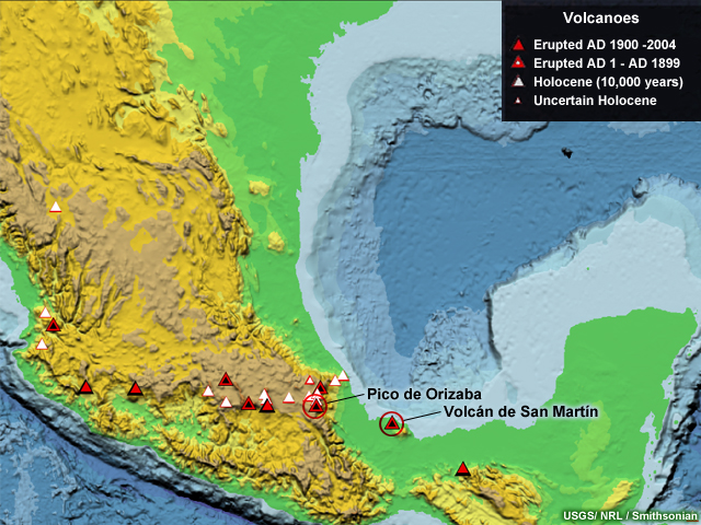
The mountains in the Trans-Mexican Volcanic Belt are active or dormant volcanoes, many of which surpass 4,500 m (15,000 ft) in elevation. Volcán de San Martín (also known as San Martín Tuxtla) is a smaller volcano but sits closest to the Gulf of Mexico coast. Its last major eruption was in 1793.
The highest peak in this mountain range is Pico de Orizaba, a currently dormant volcano that last erupted in 1846. Located about 100 km (60 mi) from the Gulf of Mexico coast with a summit at 5,675 m (18,619 ft), this mountain is also the highest in Mexico.

The eastern flanks of the Sierra Madre Oriental lead to coastal plains that border the Gulf of Mexico. These lowlands extend south into the Tabasco Plain and the Yucatan Peninsula, which lies between the Gulf of Mexico and the Caribbean Sea.
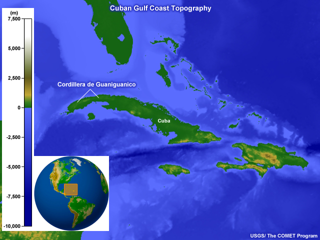
The northwestern part of Cuba borders the southeastern end of the Gulf of Mexico and consists mainly of plains, with the exception of the Cordillera de Guaniguanico, which rises to a maximum elevation of about 700 m (2,300 ft). The topography of the rest of Cuba will be discussed in the Caribbean Sea section.
Major Rivers
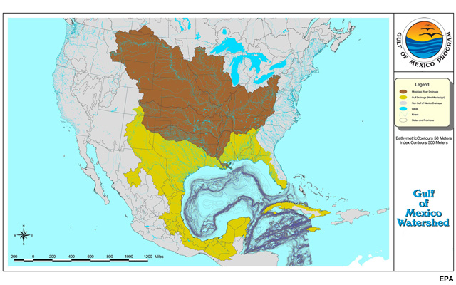
The Gulf of Mexico watershed is massive, encompassing two-thirds of the continental US, part of Canada, Mexico, Cuba, and even Jamaica. While its watershed is large, drainage is mainly through a few major rivers.
What defines a major river can be complicated. Some definitions rely on length, some on water discharge rates, while others reflect political or historical events. In this module, we will generally use discharge as the defining characteristic.
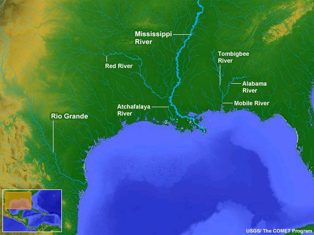
However, by any definition, the largest and best known is the Mississippi, the main river in the largest river system in North America and a hub of commercial activity. The Mississippi river system discharges over 16,000 m3s-1 (more than 500,000 ft3s-1) into the Gulf just south of New Orleans. This accounts for about 85% of the fresh water flow into the Gulf, causing wide variations in the salinity and the ecological conditions in the area.
The next largest US rivers that flow into the Gulf are the Mobile River in Alabama and Louisiana’s Atchafalaya River (a tributary of the Mississippi and Red River). Both of these rivers discharge considerably less than the Mississippi. The Mobile River, which is the confluence of the Tombigbee and Alabama Rivers, flows at about 1,900 m3s-1 (67,200 ft3s-1) and the Atchafalaya at about 1,600 m3s-1 (58,000 ft3s-1). In Texas, the Rio Grande (as it is known in the US) or Río Bravo del Norte (as it is called in Mexico) is commonly listed among major rivers because it marks the border between the US and Mexico. However, water usage and drought have decreased its flow such that its drainage into the Gulf is relatively minor. While numerous other US rivers end in the Gulf, they all have flow rates two orders of magnitude less than the Mississippi and will not be considered here.
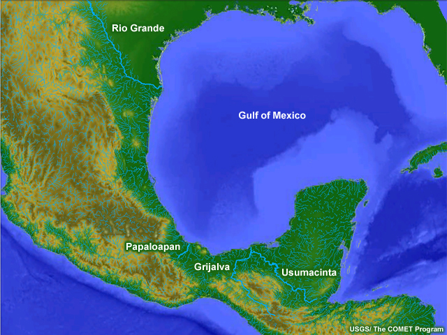
In Mexico, the largest river system that enters the Gulf from Mexico is the Grijalva and Usumacinta, which start as separate rivers but merge near the coast. Their combined discharge is about 3,000 m3s-1 (106,000 ft3s-1). The next largest is the Papaloapan River, which flows at about 1,400 m3s-1 (~50,000 ft3s-1).
Major Ports and Cities
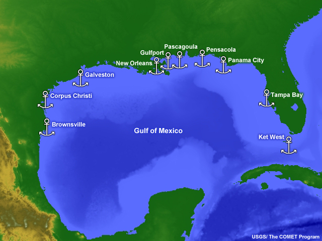
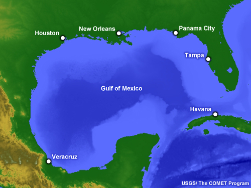
As shown on this map, important Navy facilities in the Gulf region include four in Florida, two in Mississippi, one in Louisiana, and three in Texas.
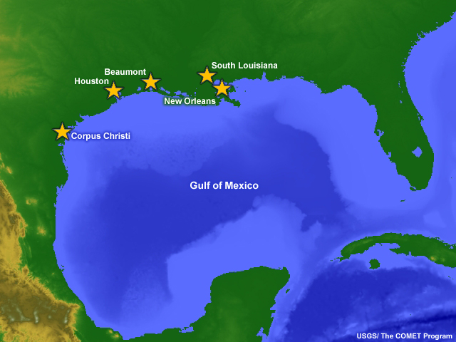
Of the top six commercial ports in the US, five are on the Gulf Coast. Note that the Port of South Louisiana, which is the busiest in the entire country, stretches 87 km (54 mi) along the Mississippi River. Similarly, the Port of Beaumont in Texas is 68 km (42 mi) upstream from the Gulf on the Sabine-Neches Ship Channel.
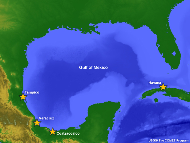
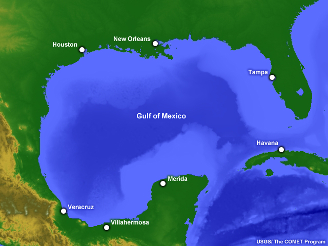
Outside of the US, the largest ports on the Gulf are Veracruz, Tampico, and Coatzacoalco in Mexico and Havana in Cuba.
The three largest US metropolitan areas on the Gulf Coast are
- The Houston-Sugar Land-Bayton area with a population of over 6 million,
- The Tampa-St. Petersburg-Clearwater area with close to 3 million, and
- The New Orleans-Metairie-Kenner with a population of slightly more than 1 million.
The city of Havana is also quite large, with over 2 million inhabitants. In Mexico, none of the Gulf cities reach a population of one million, and the largest two (Merida and Villahermosa) are inland some 25-35 km (16-22 mi). Merida has a population of more than 800,000, while Villahermosa has about 640,000. The largest city on the coast is Veracruz, with a little over a half million people.
Questions
Questions Question 1
Below is the properly labeled image:
Questions Question 2
A line of volcanoes runs north-south through Mexico next to the coastal plains.
The correct answer is False.
The Trans-Mexico Volcanic Belt runs east-west across the southern part of Mexico.