Overview — Geography
Table of Contents
Countries
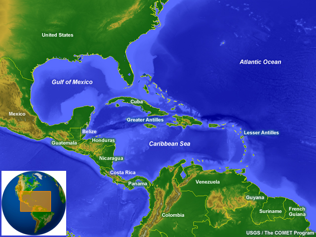
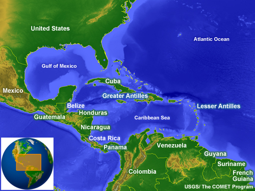
The Gulf of Mexico and the Caribbean Sea lie between North and South America, an area sometimes referred to as the Inter-American Seas or the Central American Sea. The Gulf of Mexico is surrounded by the United States of America, Mexico, and the northern parts of the island of Cuba. The Caribbean Sea is encompassed by:
- The islands of the West Indies,
- Venezuela and Colombia in South America,
- The Central American countries of Panama, Costa Rica, Nicaragua, Honduras, Guatemala, Belize,
- and, Mexico�s Yucatan Peninsula
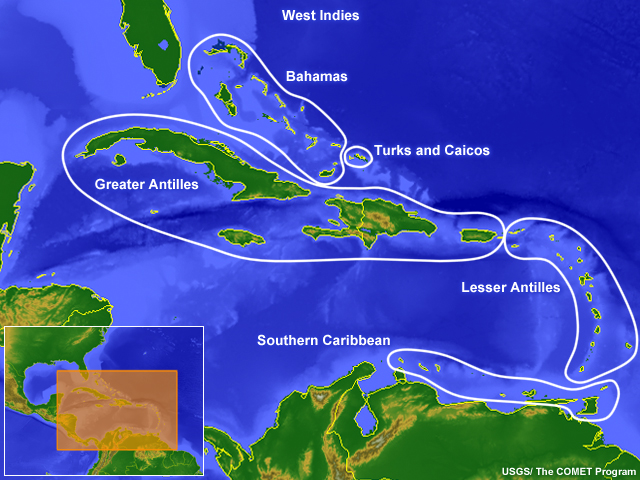
The islands of the West Indies consist of four main groups:
- The Great Antilles
- The Lesser Antilles
- The islands in the southern Caribbean that are part of the South American continental shelf, and
- The Bahamas and Turks and Caicos Islands. This last group is part of the North American continental shelf but considered part of the Caribbean region, mainly for historic and cultural reasons.
Major Topographic Features
Major Topographic FeaturesMountains and Plains
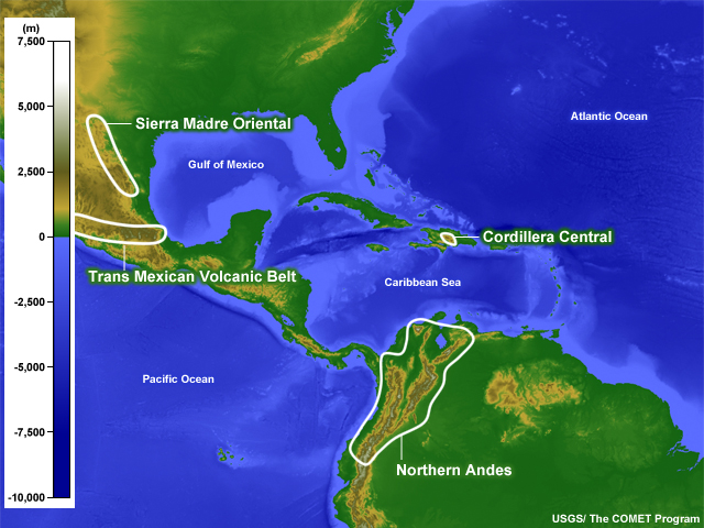
The coastal areas in this region are primarily lowlands, some of which (such as the U.S. Gulf Coast and the Yucatan Peninsula) are quite extensive. The largest mountain ranges are the:
- Sierra Madre Oriental in eastern Mexico,
- the Trans-Mexican Volcanic Belt (also called the Cordillera Neovolcanica), which runs east-west,
- the Cordillera Central on the island of Hispaniola, and
- the northern end of the Andes Mountains of South America, which is the longest continental mountain range in the world.
Major Topographic FeaturesRivers
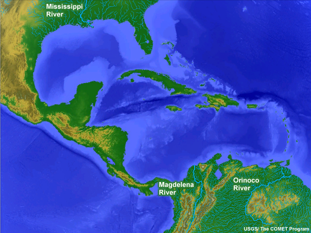
The largest river in the area is the Mississippi, which discharges more than 16,000 m3s-1 (565,000 ft3s-1) of fresh water into the Gulf of Mexico. The next largest are the Orinoco River of Venezuela and Rio Magdalena in Colombia. The Orinoco River discharges mainly into the Atlantic; however, it is included in this discussion because it affects the salinity of the Caribbean Sea.
Major Volcanic Areas
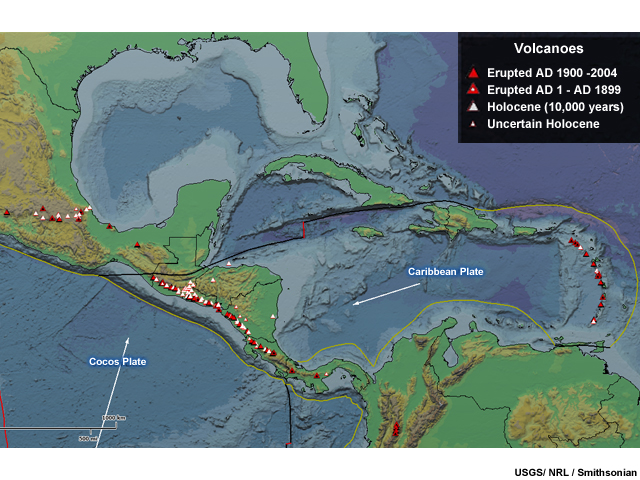
Volcanoes in the Gulf of Mexico and the Caribbean are found primarily in Mexico, the Lesser Antilles in the eastern Caribbean, and Central America. In the latter case, most of the volcanoes are along the Pacific coast. Volcanoes in the eastern Caribbean are part of a mountain chain near the boundary where the Caribbean tectonic plate meets the Atlantic. Central American volcanoes arise where the Caribbean Plate is converging with the Cocos Plate.
Volcanic eruptions cause major hazards to operations including reduced visibility, falling ash with potential to damage engines and other mechanical parts, and risk of respiratory problems in humans.
Questions
Questions Question 1
Below is the properly labeled image:
Questions Question 2
Use the selection box to choose the answer that best completes the statement.
Questions Question 3
Use the selection boxes to choose the answers that best complete the statement.
The Mississippi River accounts for about 85% of fresh water flow into the Gulf of Mexico.
Questions Question 4
The Sierra Madre Oriental mountain range is the northern extension of the Andes in South America.
The correct answer is False.
The Sierra Madre Oriental is found in Mexico; the Andes are in South America.