Introduction
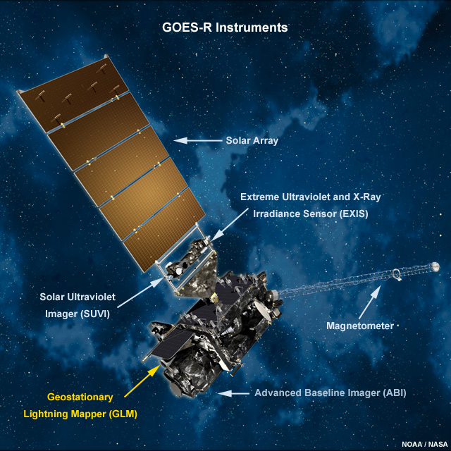
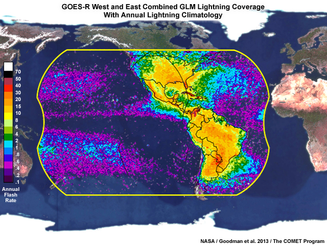
The Geostationary Lightning Mapper (GLM) on the GOES-R satellite series is the first operational lightning detector in geostationary orbit. The GLM continuously measures all lightning activity across most of the Western Hemisphere in real time. These observations are collected 24 hours a day with near-uniform, thunderstorm-scale resolution. For more information about the GLM and its capabilities, see the following COMET MetEd resources:
- NWS Satellite Foundational Course for GOES-R: Introduction to the GLM
- GOES-R Series Faculty Virtual Course: Geostationary Lightning Mapper
- GOES-R GLM: Introduction to the Geostationary Lightning Mapper
Question
GLM provides users with continuous lightning observations. How are these data advantageous to weather forecasting and communication? Choose all that apply.
The correct answers are a, c, d.
The GLM data can help improve nowcasts and warnings of thunderstorms, lightning activity, hail, damaging winds, flash floods, and tornadoes. Gathered across large geographical regions, the lightning data will provide vital information to weather-sensitive communities and industries.
Option (b) is incorrect because the GLM has at least 70% detection efficiency during both day and night, and a low 5% false detection rate. Although the GLM provides measurements of total lightning activity (intra-cloud, inter-cloud, and cloud-to-ground flashes), it cannot distinguish between the flash types, making option (e) incorrect.
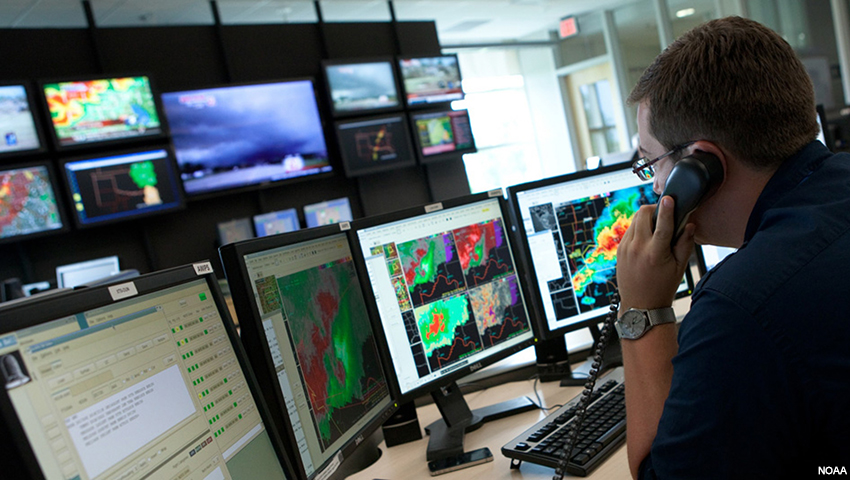
A meteorologist monitors a severe weather outbreak.
The GLM’s continuous observation feed is beneficial to severe weather forecasting and decision-making. A weather forecaster continuously monitors the weather, adjusts his or her forecast to reduce uncertainties, and considers other factors that may increase the significance of the expected weather. This process of monitoring information and adjusting one’s perspective is known as situational awareness. In this lesson, we will explore how GLM observations can be used to build situational awareness during a past severe weather event near Buenos Aires in Argentina. Throughout these exercises, we will learn how GLM observations can be used: to provide initial indications of cloud electrification, be used with other convective-monitoring tools to assess tendencies in storm strength, and to suggest the potential for severe weather. This information can improve our understanding of the severe weather event and highlight the value of GLM data in nowcasting.
Let’s begin by taking a look at the weather across South America prior to the severe weather event.