Media elements used in this module are protected by a variety of copyright licenses. Please use the "copyright terms" link associated with each item below for more information.
Description:
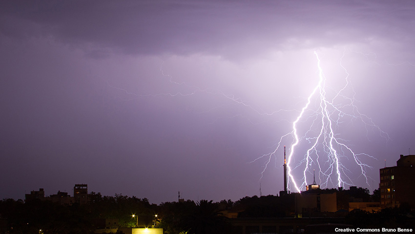
Lightning in Montevideo, Uruguay.
File Name:
ba_lightning.jpg
Credits:
Creative Commons Bruno Bense
Copyright Terms:
Creative Commons Attribution-Noncommercial 2.0 Generic
Description:
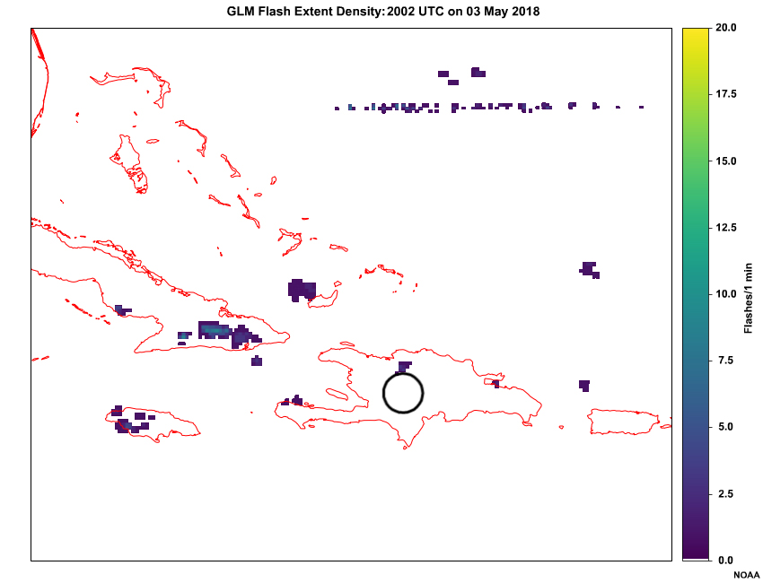
A loop of GLM flash extent density (every 5 minutes) across the Caribbean from 2006 UTC to 2046 UTC on May 03, 2018.
File Name:
carib_glm.htm
Credits:
NOAA
Copyright Terms:
COMET Standard Terms of Use
Description:
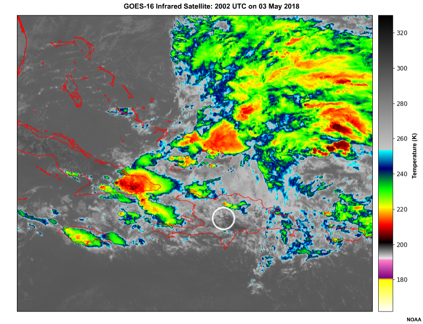
A loop of infrared satellite imagery (every 5 minutes) across the Caribbean from 2007 UTC to 2047 UTC on May 03, 2018.
File Name:
carib_ir.htm
Credits:
NOAA
Copyright Terms:
COMET Standard Terms of Use
Description:
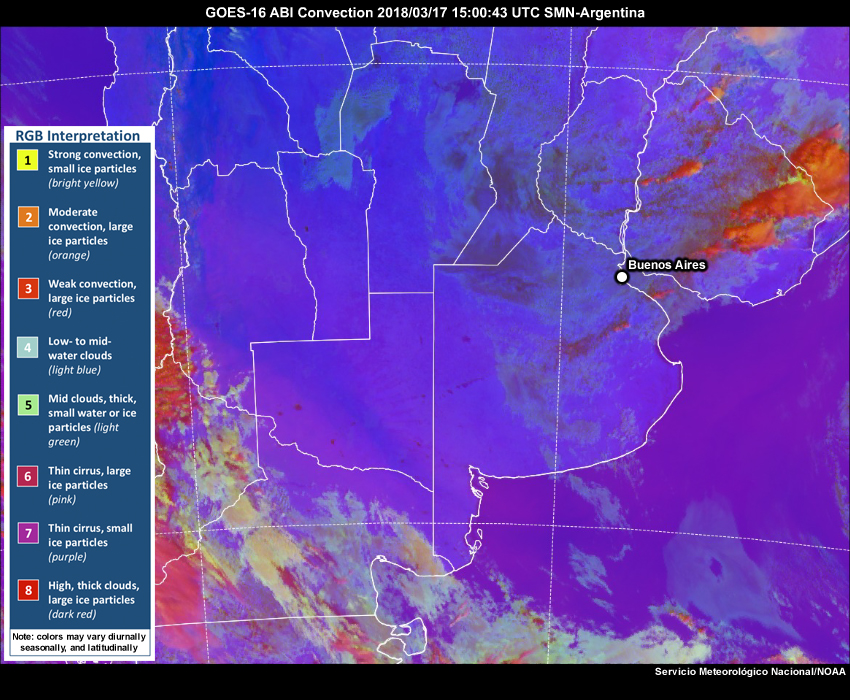
GOES-16 Day Convection RGB satellite imagery from 1500 UTC to 1900 UTC on 17 March 2018.
File Name:
day_convection_15-19.htm
Credits:
Servicio Meteorológico Nacional/NOAA
Copyright Terms:
COMET Standard Terms of Use
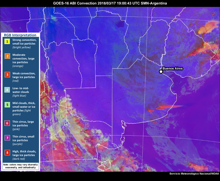
Description:
GOES-16 Day Convection RGB satellite imagery from 1900 UTC to 2345 UTC on 17 March 2018.
File Name:
day_convection_19-00.htm
Credits:
Servicio Meteorológico Nacional/NOAA
Copyright Terms:
COMET Standard Terms of Use

Description:
GOES-16 Day Convection RGB satellite imagery from 1900 UTC to 2130 UTC on 17 March 2018.
File Name:
day_convection_19-2130.htm
Credits:
Servicio Meteorológico Nacional/NOAA
Copyright Terms:
COMET Standard Terms of Use
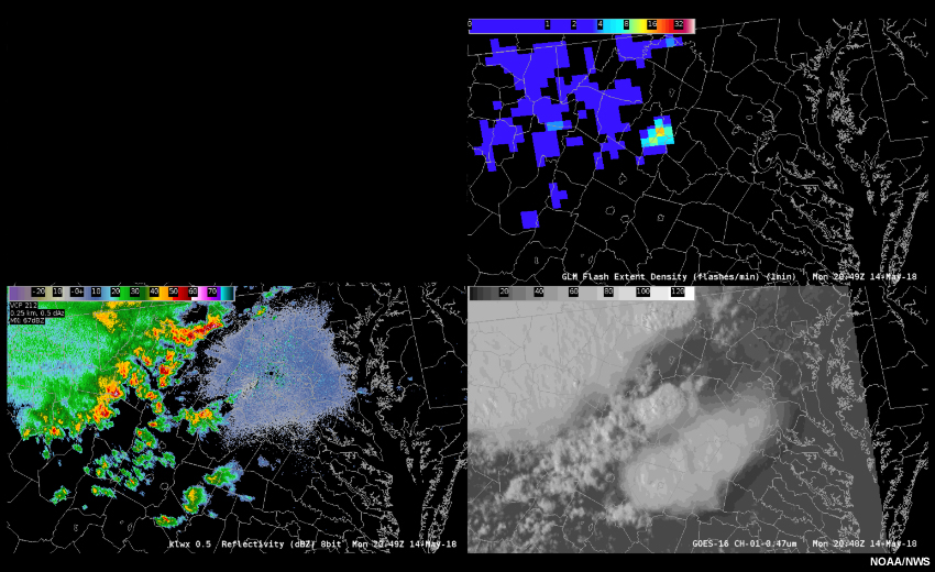
Description:
A loop of GLM flash density, radar reflectivity, and visible satellite imagery across Virginia and Maryland, USA from about 2100 Z to 2300 Z on May 14, 2018.
File Name:
dc_convection.htm
Credits:
NOAA/NWS
Copyright Terms:
COMET Standard Terms of Use
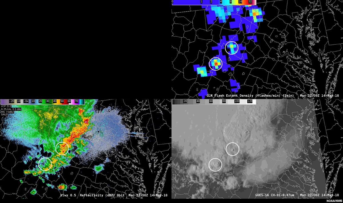
Description:
An image of GLM flash density, radar reflectivity, and visible satellite imagery across Virginia and Maryland, USA at 2138 Z on May 14, 2018.
File Name:
dc_convection_2138.jpg
Credits:
NOAA/NWS
Copyright Terms:
COMET Standard Terms of Use
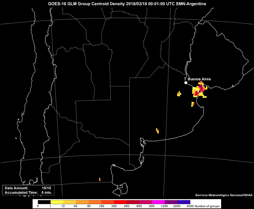
Description:
GLM group density from 0001 UTC to 0256 UTC 18 March 2018.
File Name:
glm_00-03.htm
Credits:
Servicio Meteorológico Nacional/NOAA
Copyright Terms:
COMET Standard Terms of Use
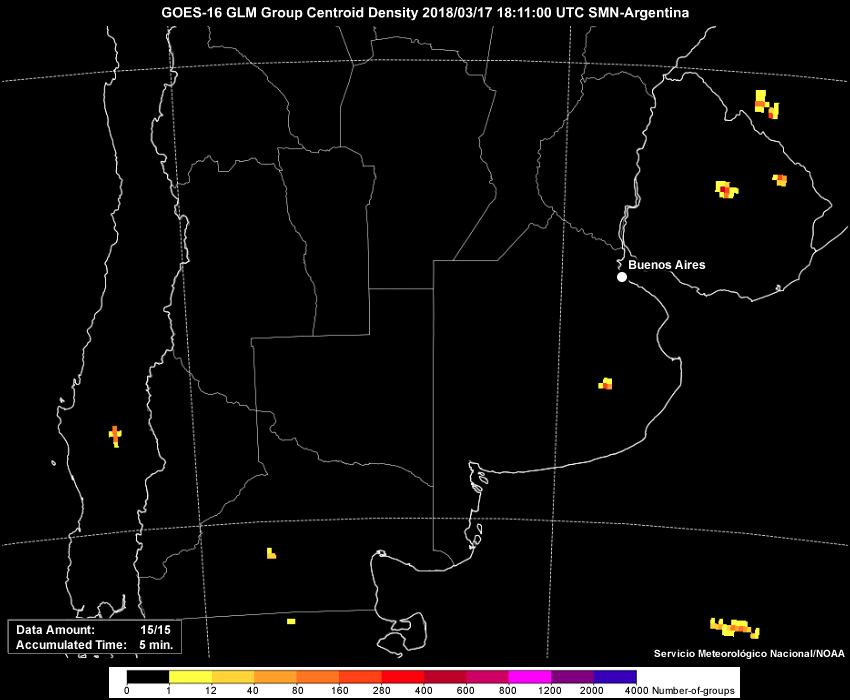
Description:
GLM group density from 1811 UTC to 1901 UTC on 17 March 2018.
File Name:
glm_15-19.htm
Credits:
Servicio Meteorológico Nacional/NOAA
Copyright Terms:
COMET Standard Terms of Use

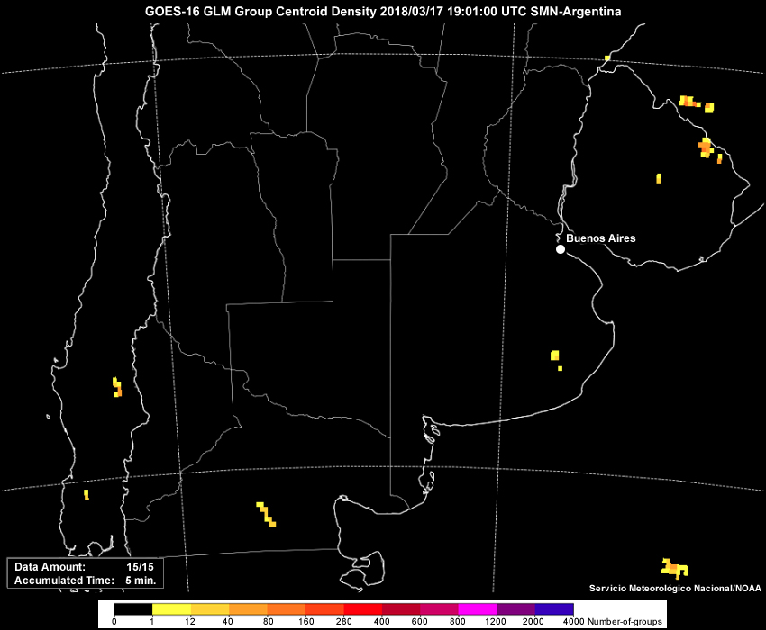
Description:
GLM group density from 1901 UTC 17 March to 0001 UTC on 18 March 2018.
File Name:
glm_19-00.htm
Credits:
Servicio Meteorológico Nacional/NOAA
Copyright Terms:
COMET Standard Terms of Use
Description:
GLM group density from 1901 UTC to 2131 UTC on 17 March 2018.
File Name:
glm_19-2130.htm
Credits:
Servicio Meteorológico Nacional/NOAA
Copyright Terms:
COMET Standard Terms of Use
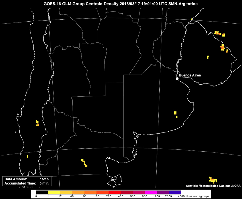
Description:
GLM group density image at 1901 UTC on 17 March 2018.
File Name:
glm_1901.jpg
Credits:
Servicio Meteorológico Nacional/NOAA
Copyright Terms:
COMET Standard Terms of Use
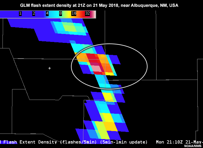
Description:
GLM flash extent density at 21Z on 21 May 2018, near Albuquerque, NM, USA.
File Name:
glm_ABX_blockage.jpg
Credits:
NOAA/NWS
Copyright Terms:
COMET Standard Terms of Use
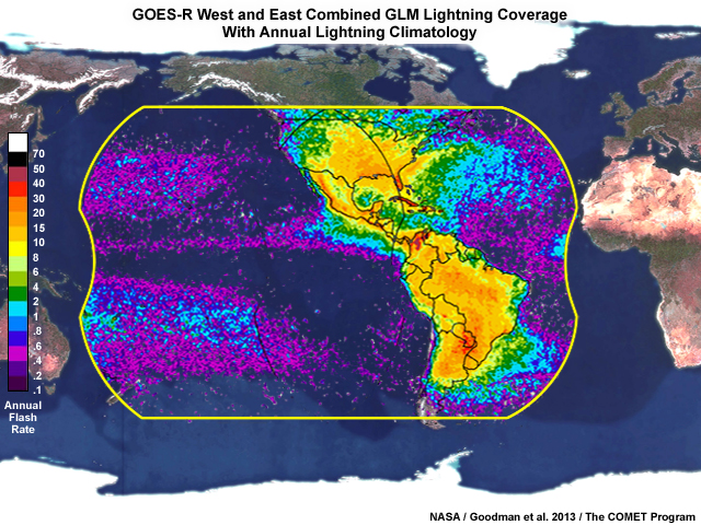
Description:
Geostationary Lightning Mapper combined coverage from GOES-West and GOES-East satellite locations.
File Name:
glm_coverage_goes_west_east_combined.jpg
Credits:
NASA / Goodman et al. 2013 / The COMET Program
Copyright Terms:
COMET Standard Terms of Use
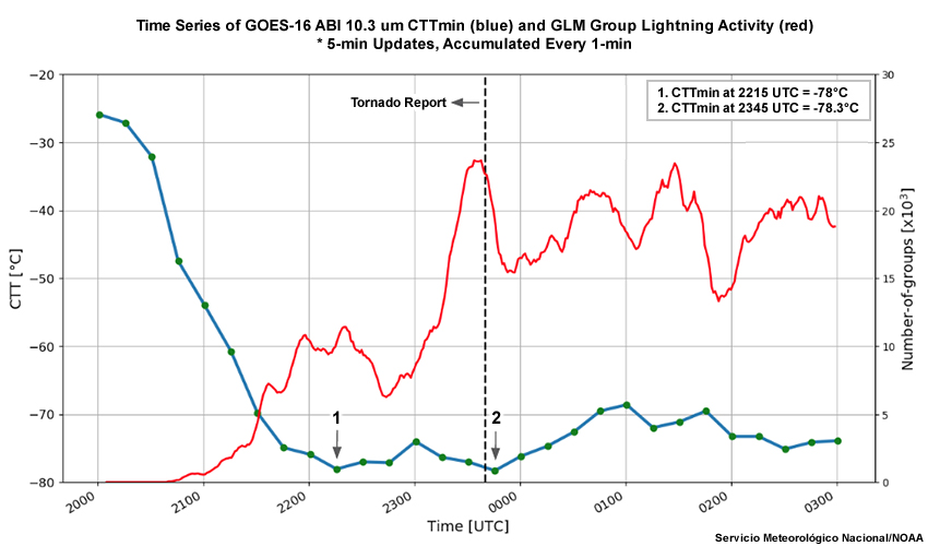
Description:
A time series of the GOES-16 ABI 10.3 micrometer cloud top temperature (blue line) and GLM group lightning activity (red line).
File Name:
glm_time_series.jpg
Credits:
Servicio Meteorológico Nacional/NOAA
Copyright Terms:
COMET Standard Terms of Use
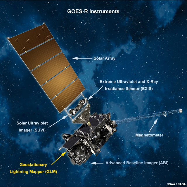
Description:
Picture of GOES-R and its instruments in space.
File Name:
goes_r_instruments.jpg
Credits:
NOAA/NASA
Copyright Terms:
COMET Standard Terms of Use
Description:
GOES-16 infrared satellite imagery from 2345 UTC 17 March to 0300 UTC 18 March 2018.
File Name:
infrared_00-03.htm
Credits:
Servicio Meteorológico Nacional/NOAA
Copyright Terms:
COMET Standard Terms of Use
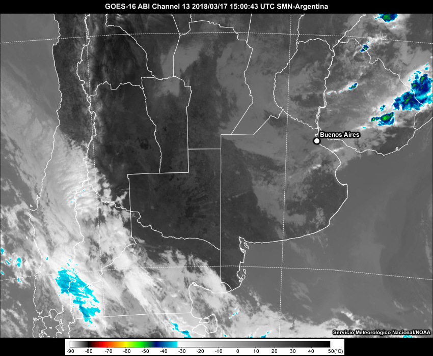
Description:
GOES-16 infrared satellite imagery from 1500 UTC to 1900 UTC on 17 March 2018.
File Name:
infrared_15-19.htm
Credits:
Servicio Meteorológico Nacional/NOAA
Copyright Terms:
COMET Standard Terms of Use
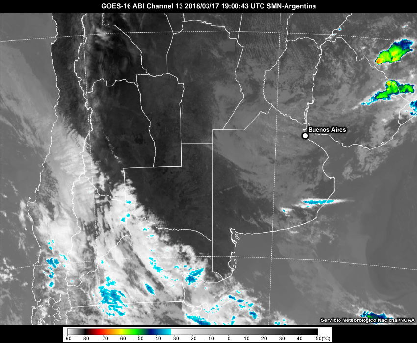
Description:
GOES-16 infrared satellite imagery from 1900 UTC to 2345 UTC March 2018.
File Name:
infrared_19-00.htm
Credits:
Servicio Meteorológico Nacional/NOAA
Copyright Terms:
COMET Standard Terms of Use

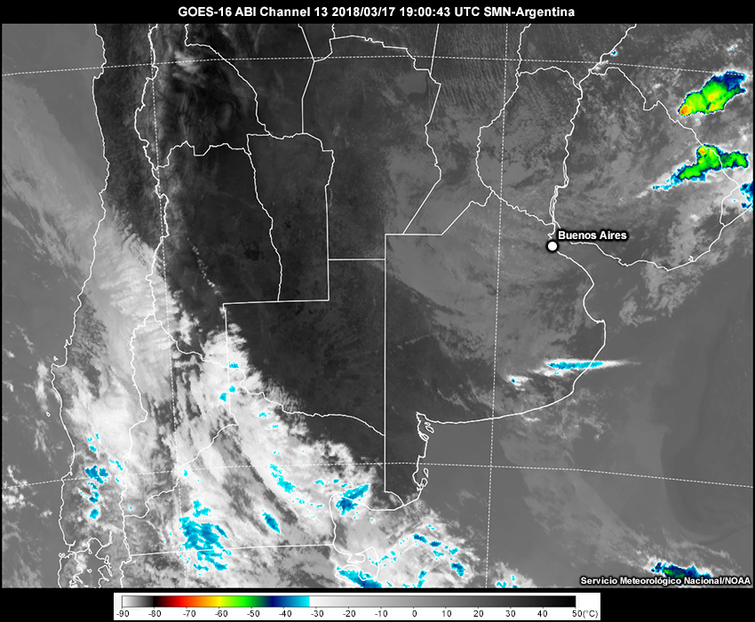
Description:
GOES-16 infrared satellite imagery from 1900 UTC to 2130 UTC on 17 March 2018.
File Name:
infrared_19-2130.htm
Credits:
Servicio Meteorológico Nacional/NOAA
Copyright Terms:
COMET Standard Terms of Use
Description:
GOES-16 infrared satellite imagery at 1900 UTC on 17 March 2018.
File Name:
ir_19.jpg
Credits:
Servicio Meteorológico Nacional/NOAA
Copyright Terms:
COMET Standard Terms of Use
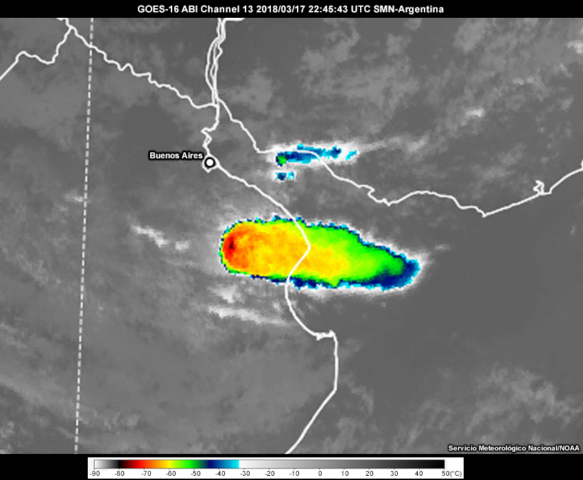
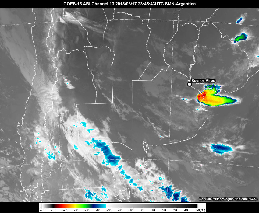
Description:
GOES-16 infrared satellite imagery at 2245 UTC on 17 March 2018.
File Name:
ir_2245.jpg
Credits:
Servicio Meteorológico Nacional/NOAA
Copyright Terms:
COMET Standard Terms of Use
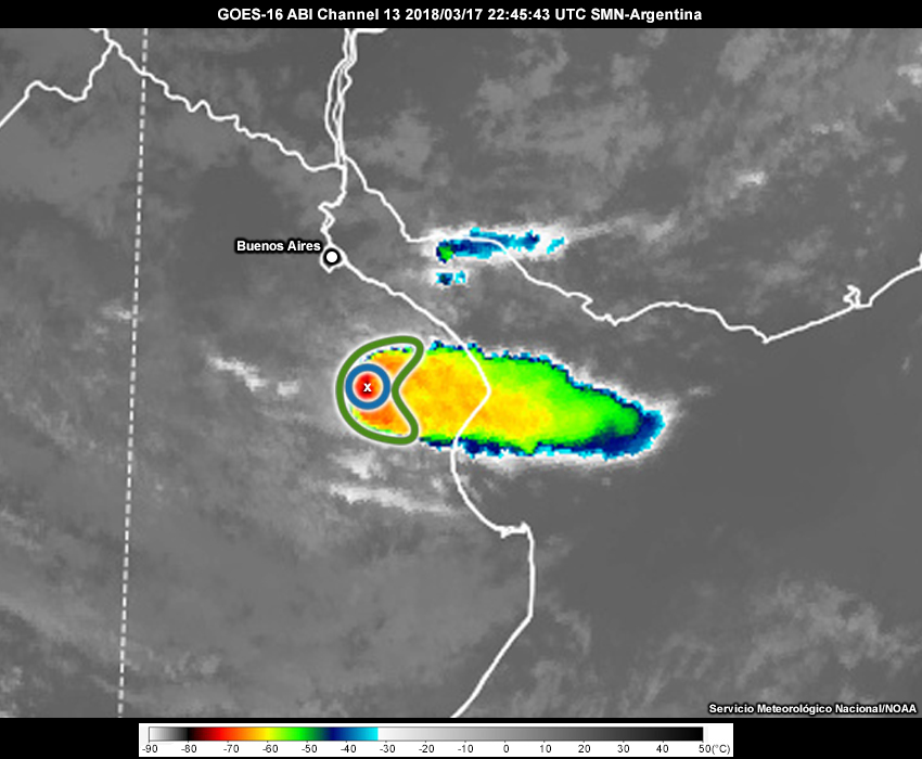
Description:
GOES-16 infrared satellite imagery at 2245 UTC on 17 March 2018 with features annotated.
File Name:
ir_2245_feedback.jpg
Credits:
Servicio Meteorológico Nacional/NOAA
Copyright Terms:
COMET Standard Terms of Use
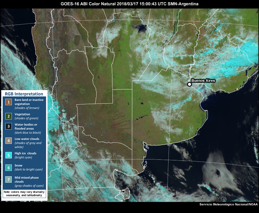
Description:
GOES-16 Natural Color RGB satellite imagery from 1500 UTC to 1900 UTC on 17 March 2018.
File Name:
natural_15-19.htm
Credits:
Servicio Meteorológico Nacional/NOAA
Copyright Terms:
COMET Standard Terms of Use

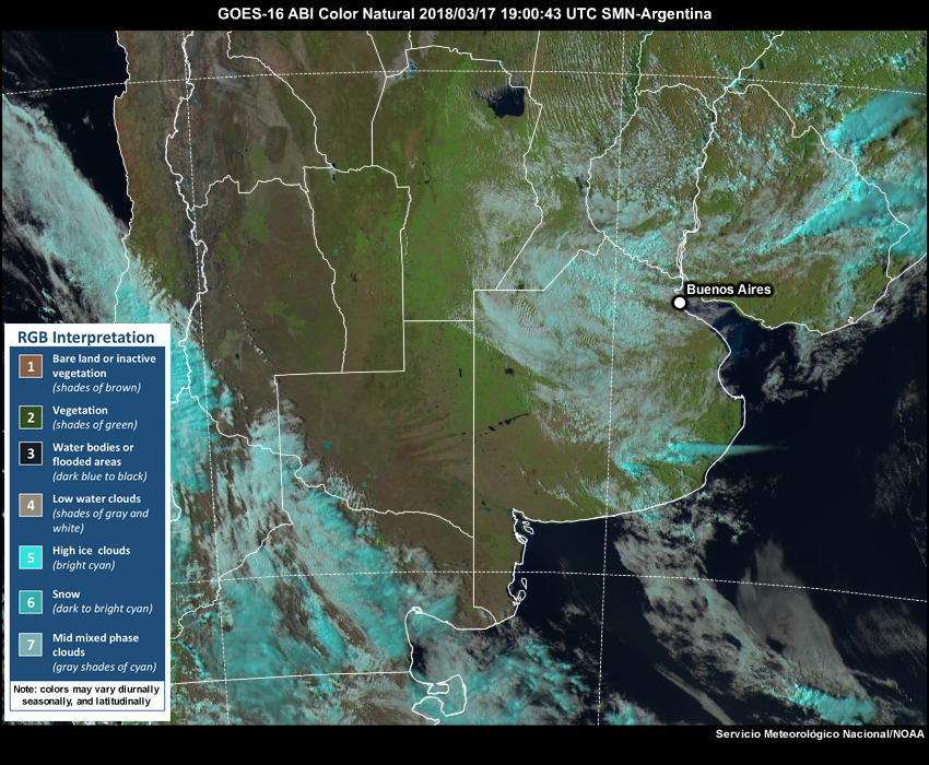
Description:
GOES-16 Natural Color RGB satellite imagery from 1900 UTC to 2345 UTC on 17 March 2018.
File Name:
natural_19-00.htm
Credits:
Servicio Meteorológico Nacional/NOAA
Copyright Terms:
COMET Standard Terms of Use
Description:
GOES-16 Natural Color RGB satellite imagery from 1900 UTC to 2130 UTC on 17 March 2018.
File Name:
natural_19-2130.htm
Credits:
Servicio Meteorológico Nacional/NOAA
Copyright Terms:
COMET Standard Terms of Use
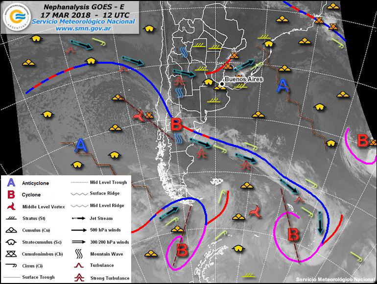
Description:
A nephanalysis valid 1200 UTC on 17 March 2018.
File Name:
nephanalysis_18031712.jpg
Credits:
Servicio Meteorológico Nacional
Copyright Terms:
COMET Standard Terms of Use
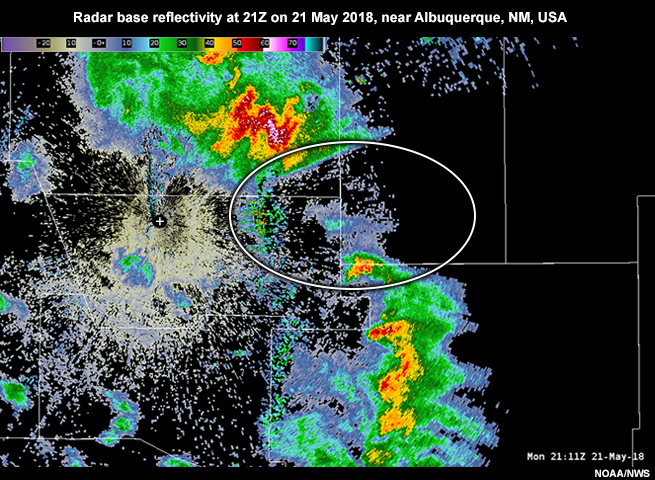
Description:
Radar base reflectivity at 21Z on 21 May 2018, near Albuquerque, NM, USA.
File Name:
radar_ABX_blockage.jpg
Credits:
NOAA/NWS
Copyright Terms:
COMET Standard Terms of Use

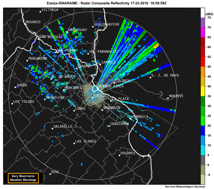
Description:
Radar composite reflectivity at 1859 UTC on 17 March 2018.
File Name:
radar_comp_1859.jpg
Credits:
Servicio Meteorológico Nacional
Copyright Terms:
COMET Standard Terms of Use
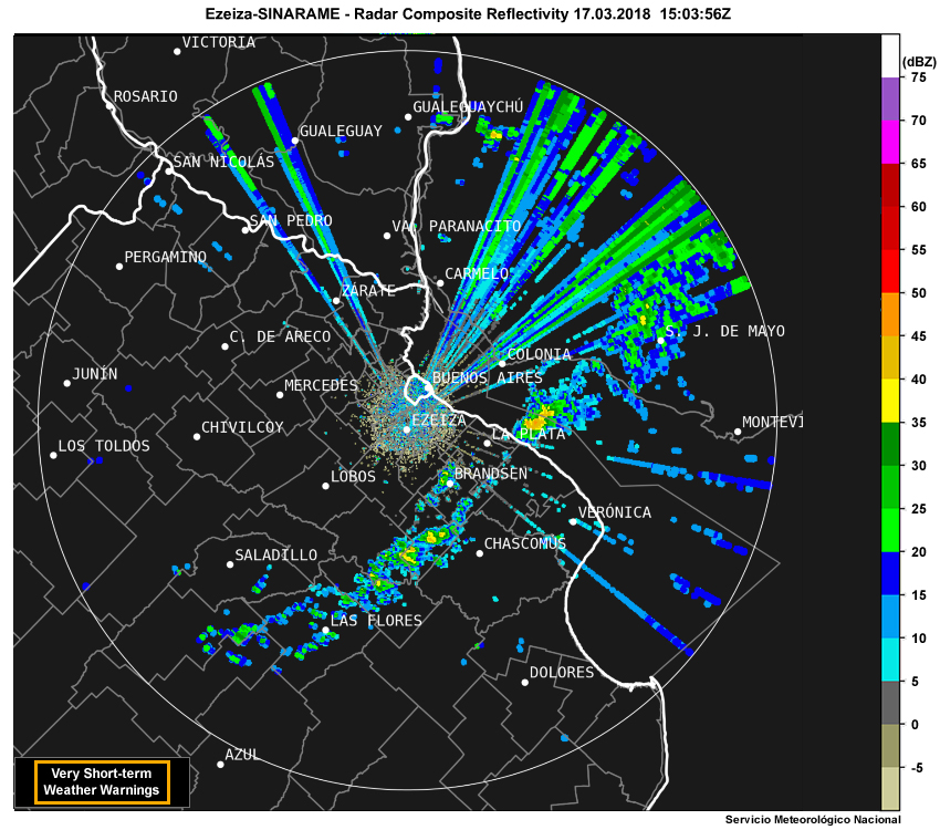
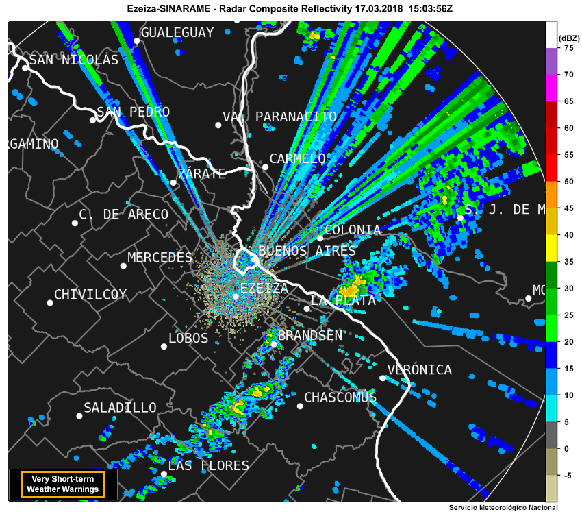
Description:
Radar composite reflectivity from 1503 UTC to 1859 UTC on 17 March 2018.
File Name:
radar_composite_15-19.htm
Credits:
Servicio Meteorológico Nacional
Copyright Terms:
COMET Standard Terms of Use
Description:
Radar composite reflectivity from 1503 UTC to 2129 UTC on 17 March 2018.
File Name:
radar_composite_15-2130.htm
Credits:
Servicio Meteorológico Nacional
Copyright Terms:
COMET Standard Terms of Use
Description:
Radar composite reflectivity from 1859 UTC to 2357 UTC on 17 March 2018.
File Name:
radar_composite_19-00.htm
Credits:
Servicio Meteorológico Nacional
Copyright Terms:
COMET Standard Terms of Use

Description:
500 mb observations and analysis across South America valid 1200 UTC on 17 March 2018.
File Name:
sa_2018031712_500.jpg
Credits:
University of Wyoming
Copyright Terms:
COMET Standard Terms of Use
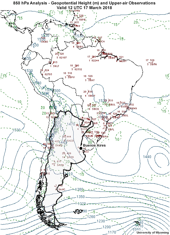
Description:
850 mb observations and analysis across South America valid 1200 UTC on 17 March 2018.
File Name:
sa_2018031712_850.jpg
Credits:
University of Wyoming
Copyright Terms:
COMET Standard Terms of Use
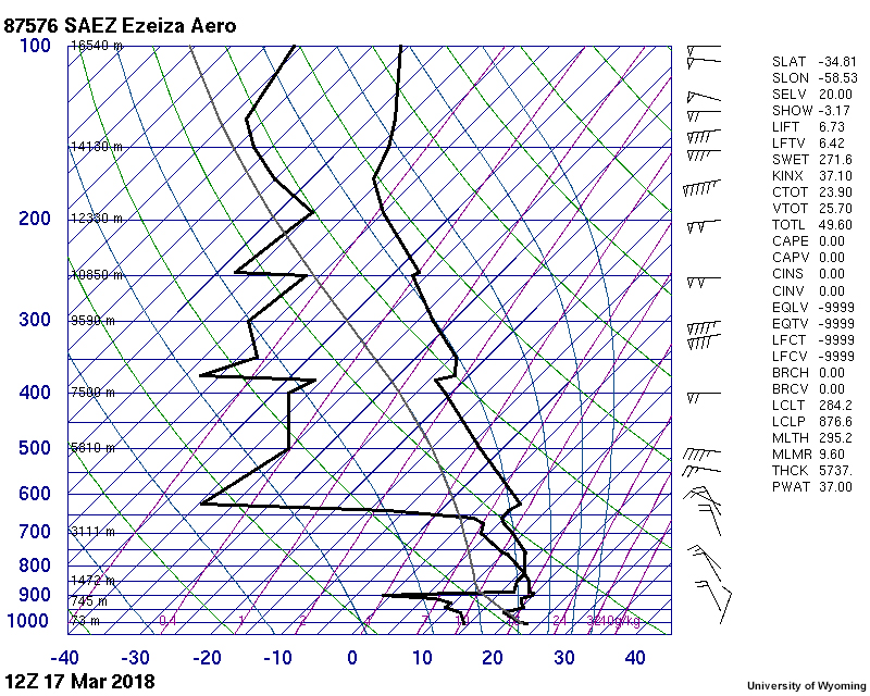
Description:
Upper-air sounding for Ezeiza International Airport in Argentina valid 1200 UTC on 17 March 2018.
File Name:
saez_sounding.jpg
Credits:
University of Wyoming
Copyright Terms:
COMET Standard Terms of Use
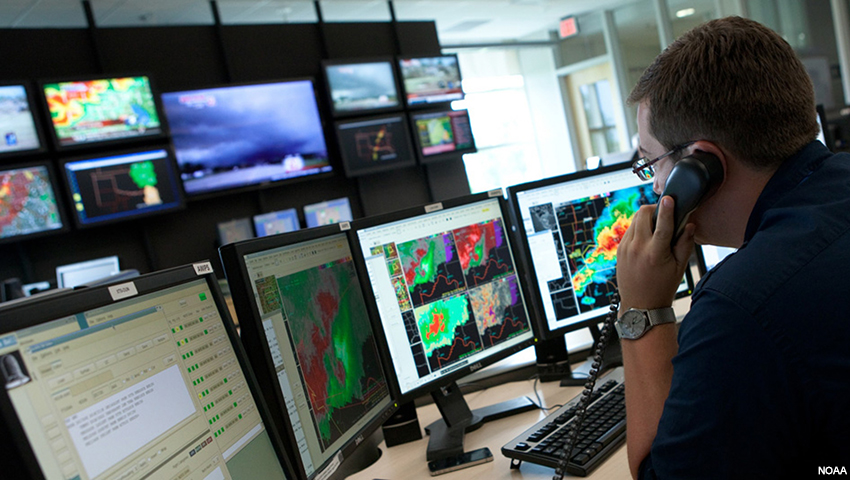
Description:
A meteorologist monitors a severe weather outbreak.
File Name:
severe_wx_sa.jpg
Credits:
NOAA
Copyright Terms:
COMET Standard Terms of Use
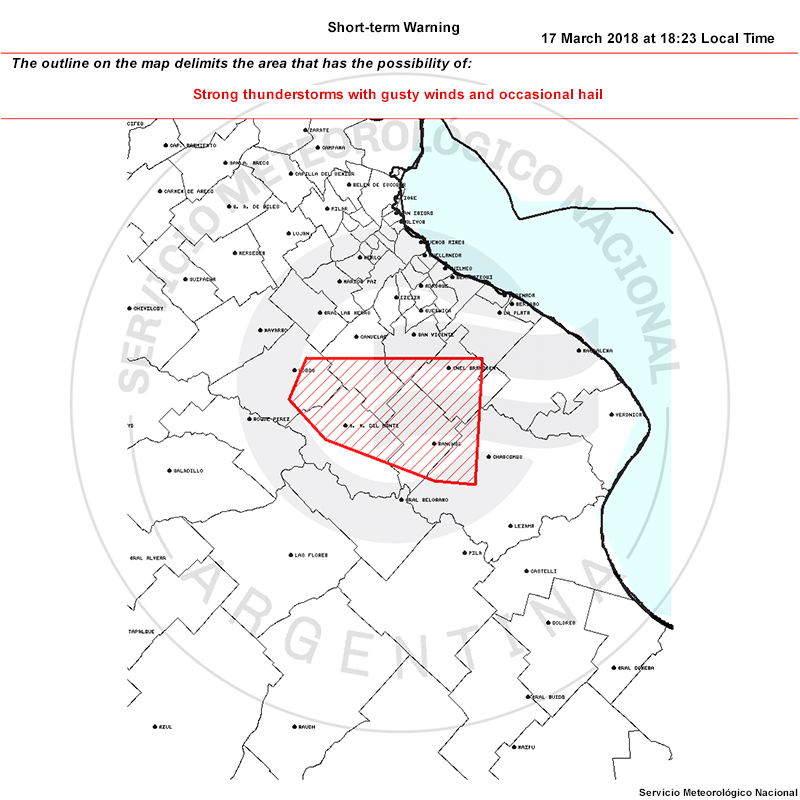
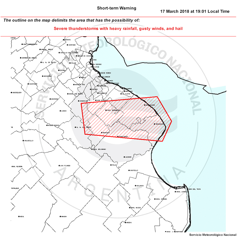
Description:
A weather warning issued by the Servicio Meteorológico Nacional at 1823 Local Time (2123 UTC) on 17 March 2018.
File Name:
svrwarn_1823.jpg
Credits:
Servicio Meteorológico Nacional
Copyright Terms:
COMET Standard Terms of Use
Description:
A weather warning issued by the Servicio Meteorológico Nacional at 1901 Local Time (2201 UTC) on 17 March 2018.
File Name:
svrwarn_1901.jpg
Credits:
Servicio Meteorológico Nacional
Copyright Terms:
COMET Standard Terms of Use
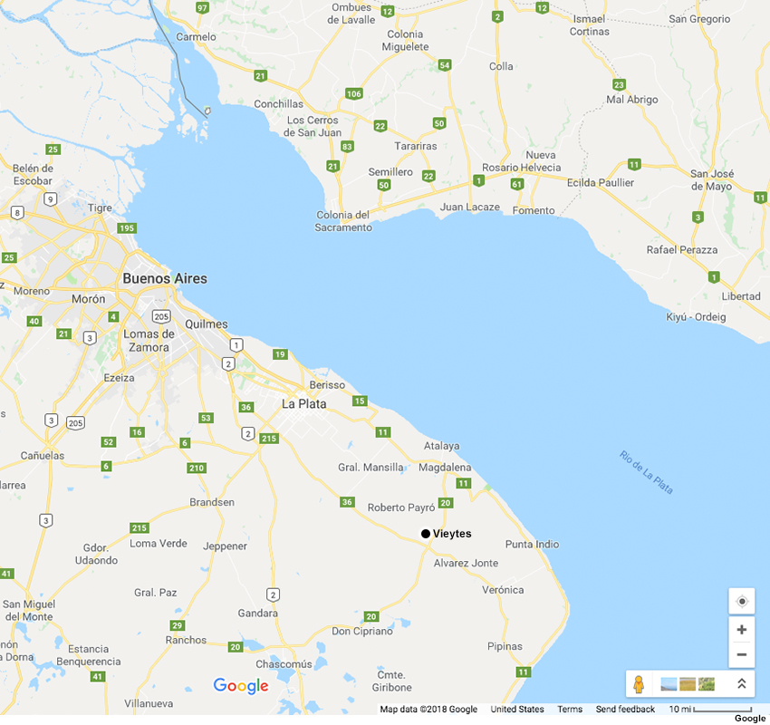
Description:
A map showing where the town of Vieytes is located in Argentina.
File Name:
vieytes.jpg
Credits:
Google
Copyright Terms:
COMET Standard Terms of Use
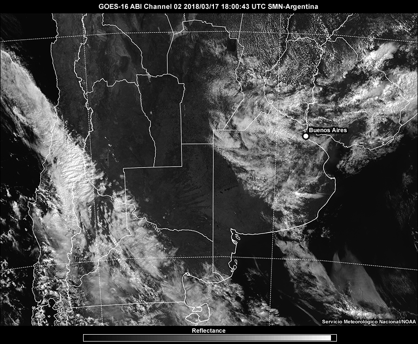
Description:
GOES-16 visible satellite imagery at 1800 UTC on 17 March 2018.
File Name:
vis_18.jpg
Credits:
Servicio Meteorológico Nacional/NOAA
Copyright Terms:
COMET Standard Terms of Use
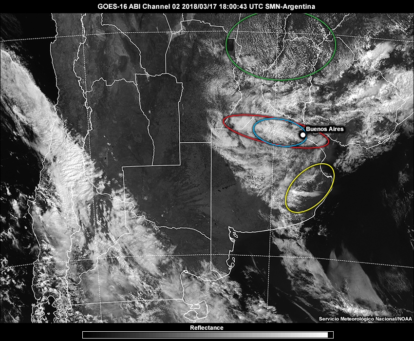
Description:
GOES-16 visible satellite imagery at 1800 UTC on 17 March 2018 with features annotated.
File Name:
vis_18_feedback.jpg
Credits:
Servicio Meteorológico Nacional/NOAA
Copyright Terms:
COMET Standard Terms of Use
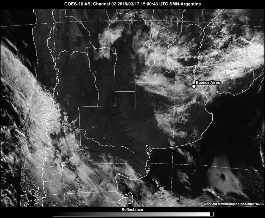
Description:
GOES-16 visible satellite imagery from 1500 UTC to 1900 UTC on 17 March 2018.
File Name:
visible_15-19.htm
Credits:
Servicio Meteorológico Nacional/NOAA
Copyright Terms:
COMET Standard Terms of Use
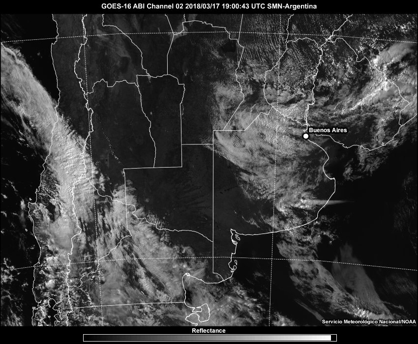
Description:
GOES-16 visible satellite imagery from 1900 UTC to 2345 UTC on 17 March 2018.
File Name:
visible_19-00.htm
Credits:
Servicio Meteorológico Nacional/NOAA
Copyright Terms:
COMET Standard Terms of Use

Description:
GOES-16 visible satellite imagery from 1900 UTC to 2130 UTC on 17 March 2018.
File Name:
visible_19-2130.htm
Credits:
Servicio Meteorológico Nacional/NOAA
Copyright Terms:
COMET Standard Terms of Use