Introduction
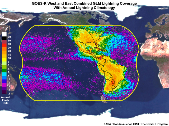
The Geostationary Lightning Mapper (GLM) on the GOES-R satellite series is the first operational lightning detector in geostationary orbit. The GLM continuously measures all lightning activity across most of the Western Hemisphere in real time. These observations are collected 24 hours a day with near-uniform, thunderstorm-scale resolution.
GLM products can aid forecasters and decision makers in a variety of situations ranging from situational awareness to active warning decision support. This lesson shows several recent examples from forecasters participating in NOAA’s Hazardous Weather Testbed (HWT) Spring Experiment 2018. Specifically, we will look at the flash extent density gridded product, and how it can add value to diagnosis and nowcasting of convective initiation, storm intensification, and areal extent of lightning. We’ll also discuss limitations to keep in mind while using GLM gridded products, and we’ll take a peek at other gridded products currently in development.
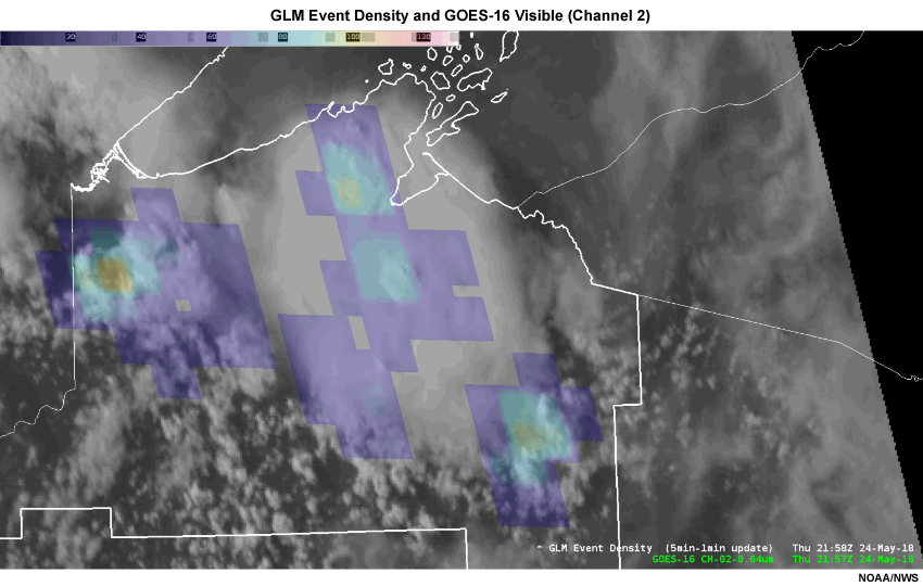
GOES-16 Channel 2 visible imagery with color-shaded GLM Event Density
For more information about the GLM instrument and its capabilities, see the following COMET MetEd resources: