Media elements used in this module are protected by a variety of copyright licenses. Please use the "copyright terms" link associated with each item below for more information.
Description:
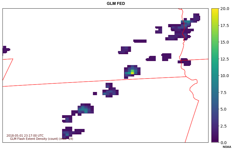
GLM Flash Extent Density (FED) over Nebraska and Kansas
File Name:
050118_GLM_FED_UEX_loop1.htm
Credits:
NOAA
Copyright Terms:
COMET Standard Terms of Use
Description:
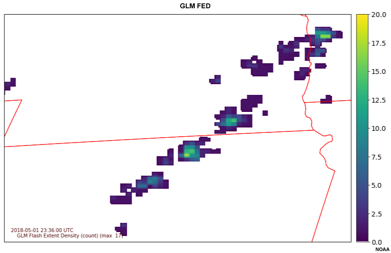
GLM Flash Extent Density (FED) over Nebraska and Kansas
File Name:
050118_GLM_FED_UEX_loop2.htm
Credits:
NOAA
Copyright Terms:
COMET Standard Terms of Use
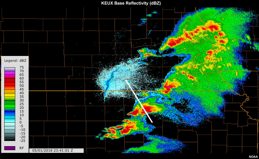
Description:
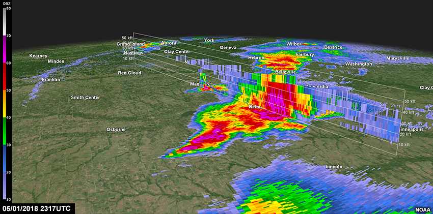
Base Reflectivity (dbZ) cross-section from Hastings, NE radar
File Name:
050118_radar_KUEX_cross.htm
Credits:
NOAA
Copyright Terms:
COMET Standard Terms of Use
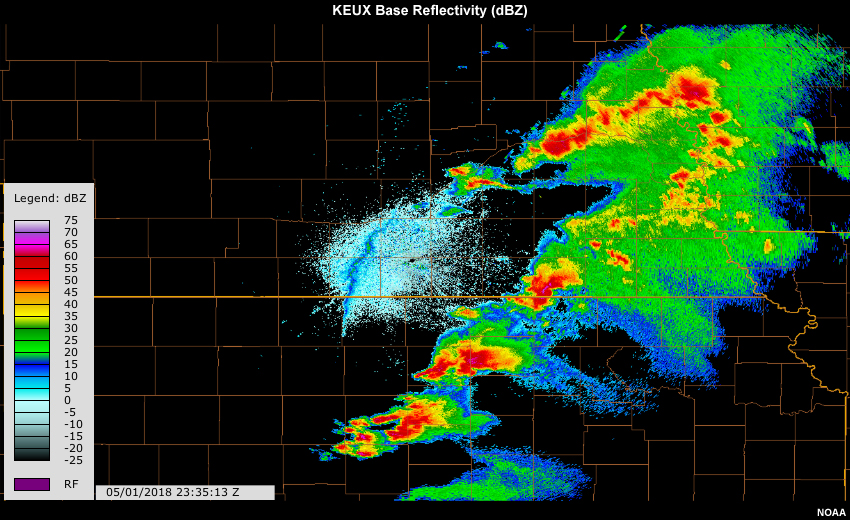
Description:
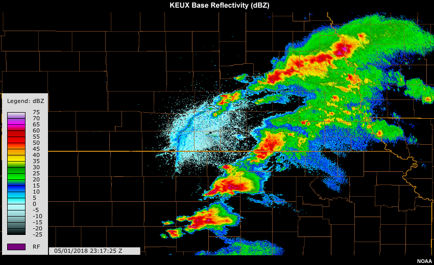
Base Reflectivity (dbZ) from Hastings, NE radar
File Name:
050118_radar_UEX_loop1.htm
Credits:
NOAA
Copyright Terms:
COMET Standard Terms of Use
Description:
Base Reflectivity (dbZ) from Hastings, NE radar
File Name:
050118_radar_UEX_loop2.htm
Credits:
NOAA
Copyright Terms:
COMET Standard Terms of Use
Description:
Base Reflectivity (dbZ) from Hastings, NE radar with cross section
File Name:
050118_radar_UEX_PPI_cross.jpg
Credits:
NOAA
Copyright Terms:
COMET Standard Terms of Use
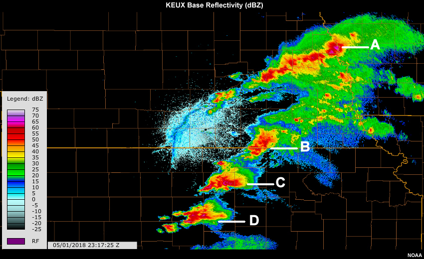
Description:
KUEX radar reflectivity with several cells labeled A-D
File Name:
050118_UEX_cell_labels_map.jpg
Credits:
NOAA
Copyright Terms:
COMET Standard Terms of Use
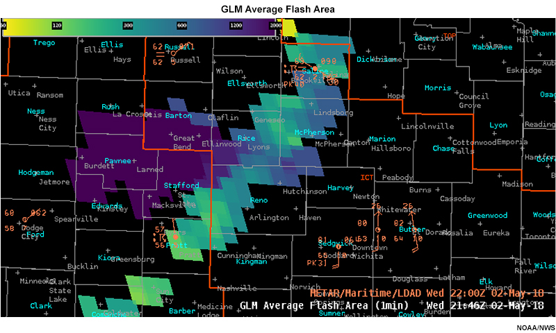
Description:
GLM Average Flash Area overlaid on GOES-16 Channel 2 visible imagery for storms in the midwest
File Name:
050218_GLM_AFA.jpg
Credits:
NOAA/NWS
Copyright Terms:
COMET Standard Terms of Use
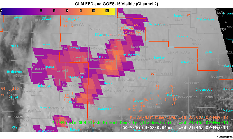
Description:
GLM FED overlaid on GOES-16 Channel 2 visible imagery for storms in the midwest
File Name:
050218_GLM_FED.jpg
Credits:
NOAA/NWS
Copyright Terms:
COMET Standard Terms of Use
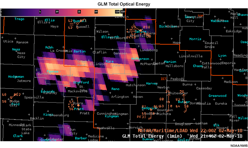
Description:
GLM Total Optical Energy for a storm system in the Midwest region of USA
File Name:
050218_GLM_TOE.jpg
Credits:
NOAA/NWS
Copyright Terms:
COMET Standard Terms of Use
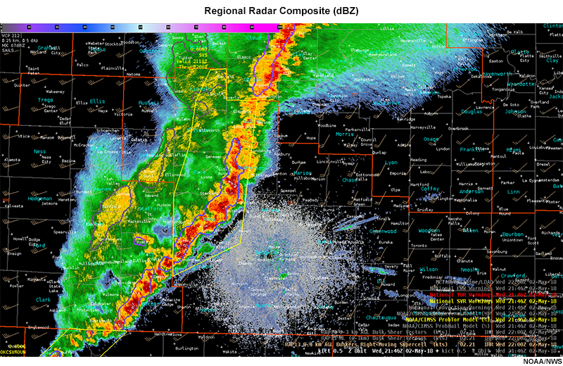
Description:
Regional radar composite for storm system in Midwest region of USA
File Name:
050218_radar_singlepanel.jpg
Credits:
NOAA/NWS
Copyright Terms:
COMET Standard Terms of Use
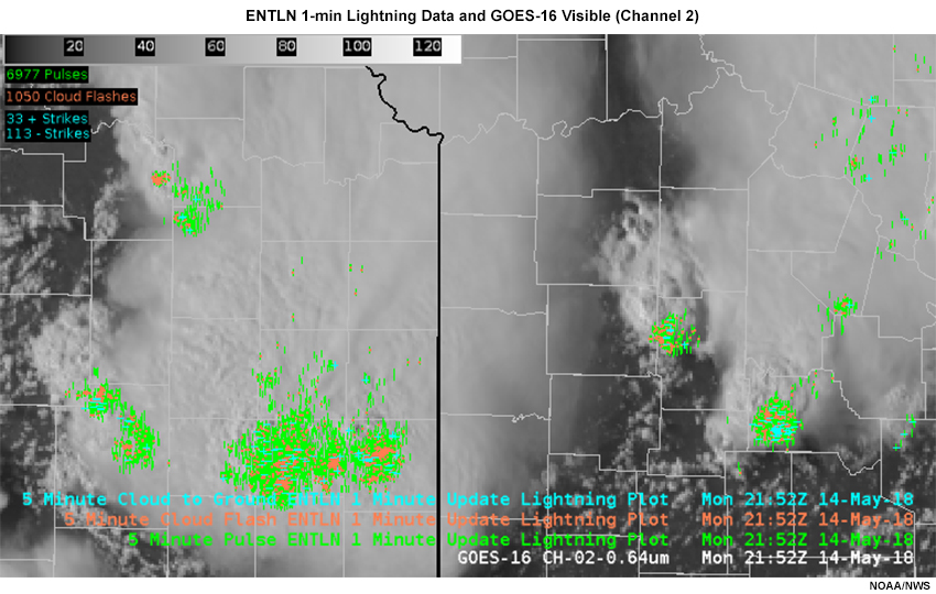
Description:
1-minute ENTLN pulses, flashes and strikes overlaid on GOES-16 Channel 2 visible imagery for storms in the midwest
File Name:
051418_GLM_ENTLN_anvil_example.jpg
Credits:
NOAA/NWS
Copyright Terms:
COMET Standard Terms of Use
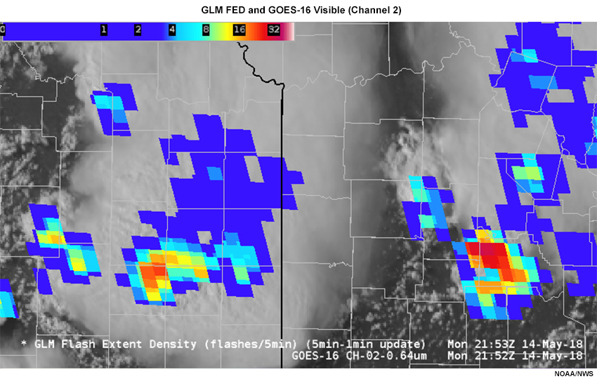
Description:
5-minute GLM FED overlaid on GOES-16 Channel 2 visible imagery for storms in the midwest
File Name:
051418_GLM_FED_anvil_example.jpg
Credits:
NOAA/NWS
Copyright Terms:
COMET Standard Terms of Use
Description:
GLM flash extent density showing line of convection with strong central cell coincident with high lightning activity
File Name:
051518_GLM_FED_new_cell.htm
Credits:
NOAA/NWS
Copyright Terms:
COMET Standard Terms of Use
Description:
Radar reflectivity showing line of convection with strong central cell developing
File Name:
051518_radar_new_cell.htm
Credits:
NOAA/NWS
Copyright Terms:
COMET Standard Terms of Use
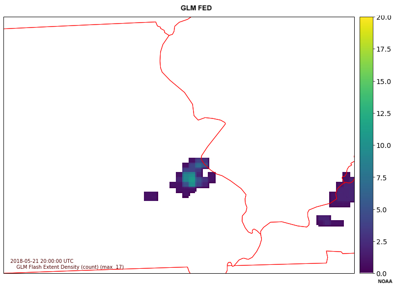
Description:
GLM Flash Extent Density (FED) over St. Louis area
File Name:
052118_GLM_FED_STL.htm
Credits:
NOAA
Copyright Terms:
COMET Standard Terms of Use
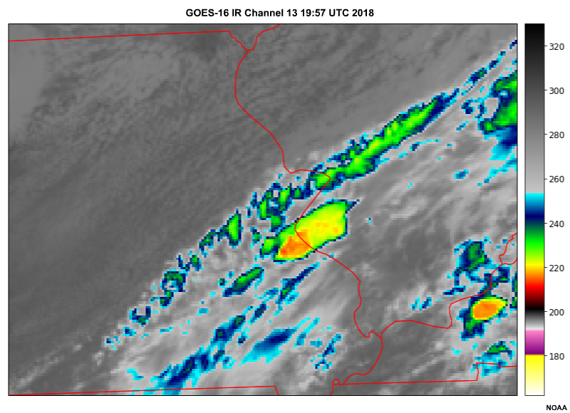
Description:
GOES-16 Band 13 Infrared imagery over St. Louis area
File Name:
052118_GLM_IR_STL.htm
Credits:
NOAA
Copyright Terms:
COMET Standard Terms of Use
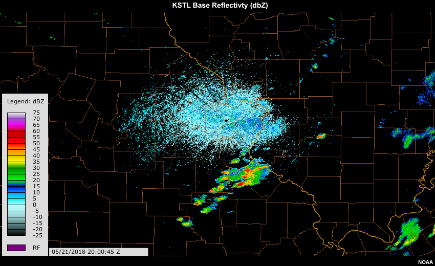
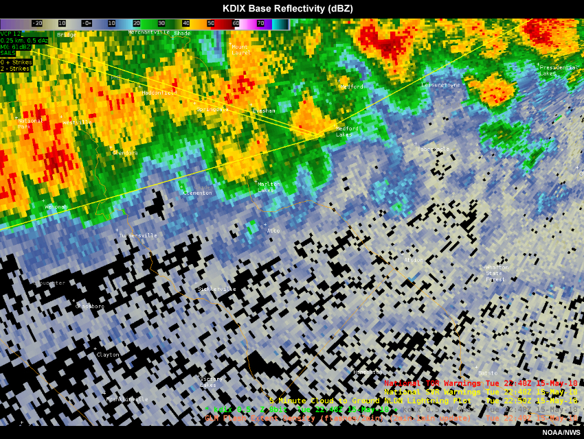
Description:
Base reflectivity imagery over St. Louis area
File Name:
052118_radar_STL.htm
Credits:
NOAA
Copyright Terms:
COMET Standard Terms of Use
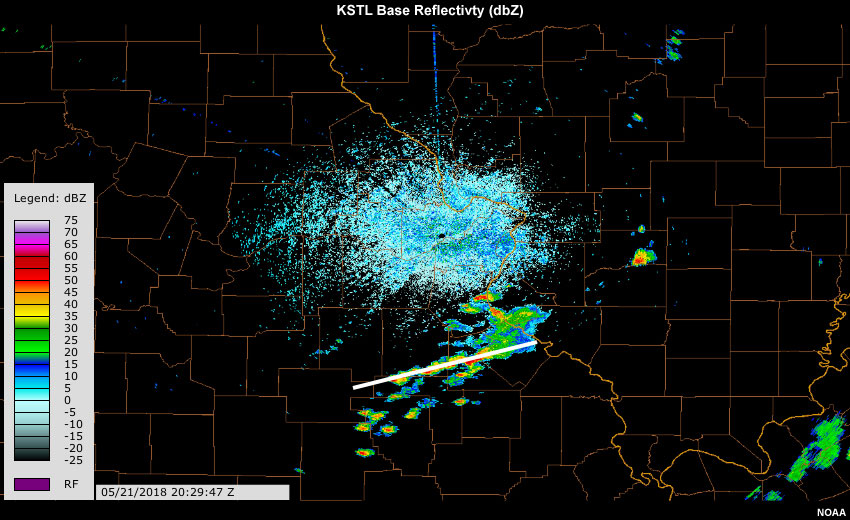
Description:
Base reflectivity imagery cross-section over St. Louis area
File Name:
052118_radar_STL_cross.htm
Credits:
NOAA
Copyright Terms:
COMET Standard Terms of Use
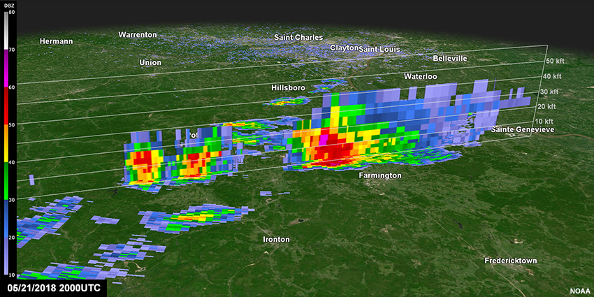
Description:
Base Reflectivity (dbZ) from St Louis radar with cross section
File Name:
052118_radar_STL_PPI_cross.jpg
Credits:
NOAA
Copyright Terms:
COMET Standard Terms of Use
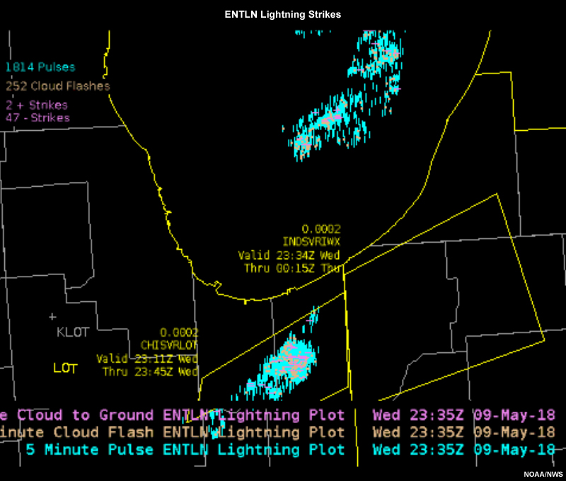
Description:
ENTLN lightning strike data plotted over Chicago, IL and Gary, IN areas.
File Name:
052418_GLM_AWIPS_Gary_ENTLN.htm
Credits:
NOAA/NWS
Copyright Terms:
COMET Standard Terms of Use

Description:
Geostationary Lightning Mapper (GLM) Flash Extent Density plotted over the Chicago, IL and Gary, IN areas
File Name:
052418_GLM_AWIPS_Gary_FED.htm
Credits:
NOAA/NWS
Copyright Terms:
COMET Standard Terms of Use
Description:
Geostationary Lightning Mapper (GLM) Flash Extent Density plotted over northern Wisconsin.
File Name:
052418_GLM_AWIPS_WI_CI_FED.htm
Credits:
NOAA/NWS
Copyright Terms:
COMET Standard Terms of Use
Description:
GOES-16 Infrared (IR) from Band 13 plotted over northern Wisconsin.
File Name:
052418_GLM_AWIPS_WI_CI_IR.htm
Credits:
NOAA/NWS
Copyright Terms:
COMET Standard Terms of Use
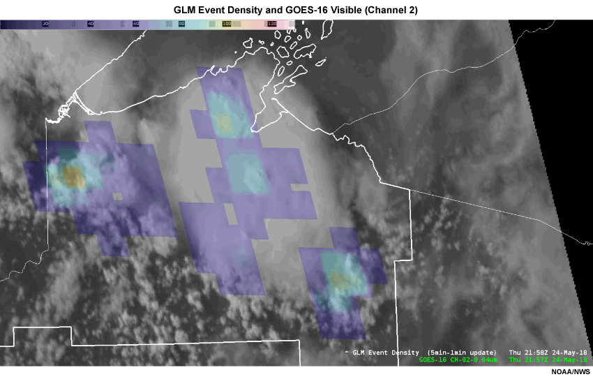
Description:
GLM event density plotted over visible satellite field, showing updrafts collocated with stronger lightning activity
File Name:
052418_GLM_ED_updraft_collocation.htm
Credits:
NOAA/NWS
Copyright Terms:
COMET Standard Terms of Use
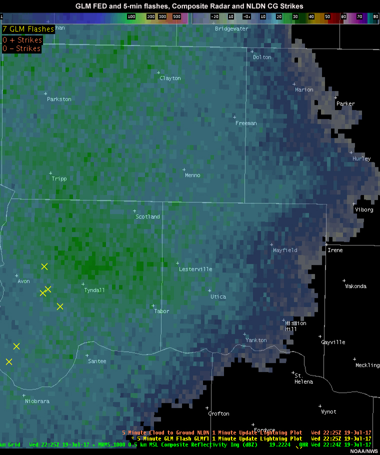
Description:
GLM flash extent density and flashes, NLDN lightning strikes and local composite radar of a large thunderstorm anvil
File Name:
071917_GLM_FED_radar_NLDN_anvil.htm
Credits:
NOAA/NWS
Copyright Terms:
COMET Standard Terms of Use
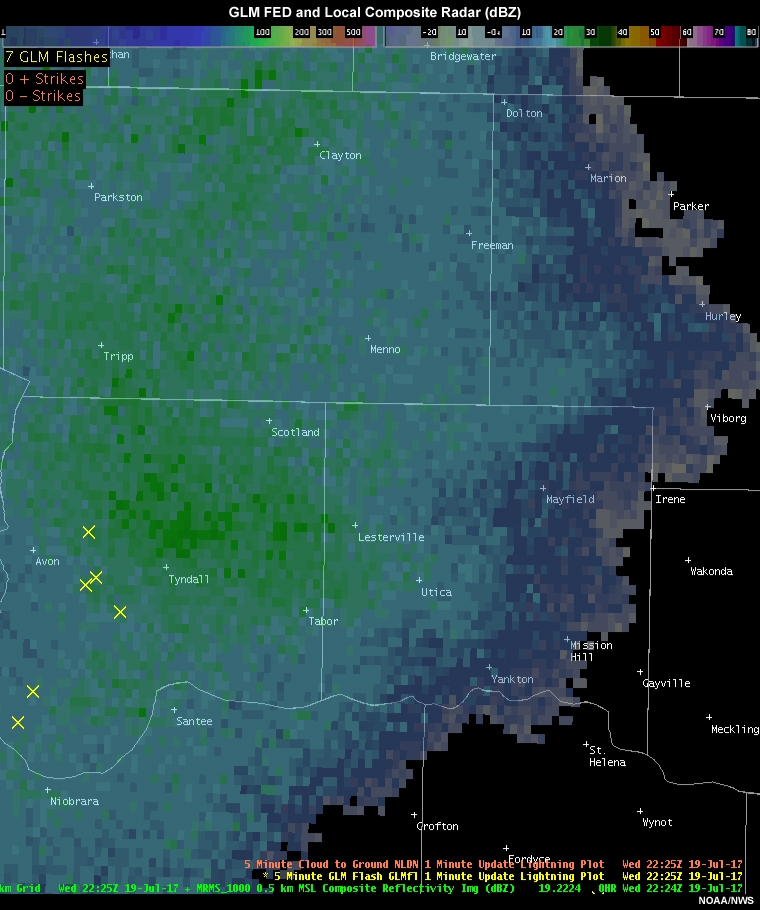
Description:
GLM flash extent density and flashes, NLDN lightning strikes and local composite radar of a large thunderstorm anvil
File Name:
071917_GLM_FED_radar_NLDN_expanded.jpg
Credits:
NOAA/NWS
Copyright Terms:
COMET Standard Terms of Use
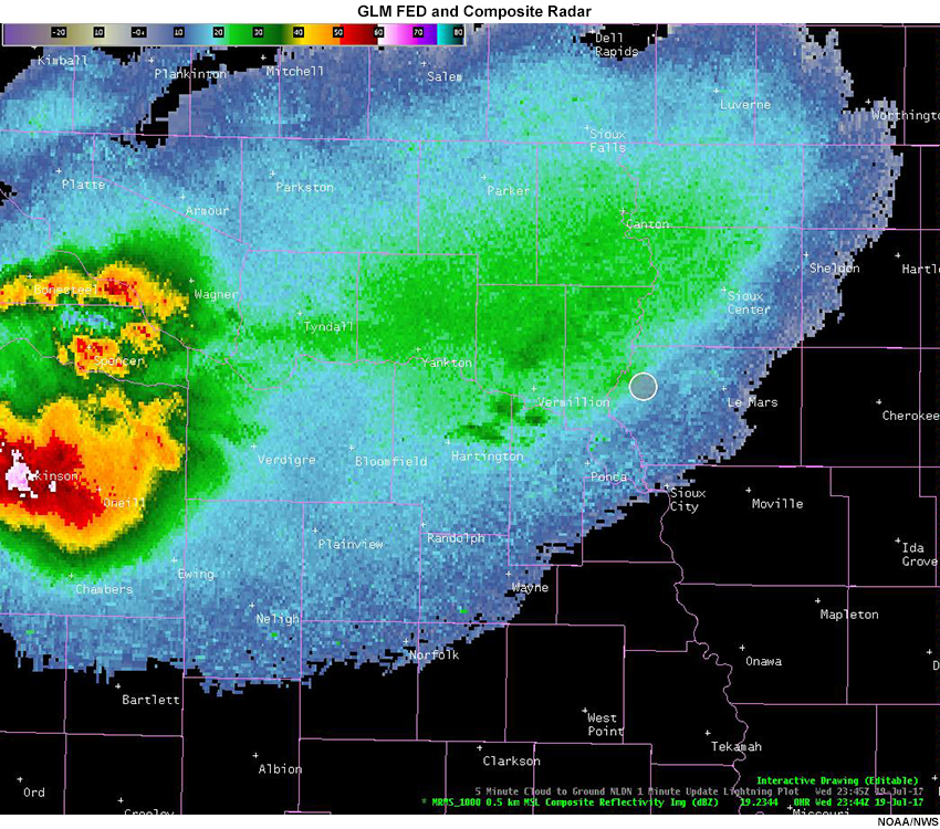
Description:
GLM flash extent density plotted over local composite radar imagery
File Name:
anvil_lightning_loop.htm
Credits:
NOAA/NWS
Copyright Terms:
COMET Standard Terms of Use
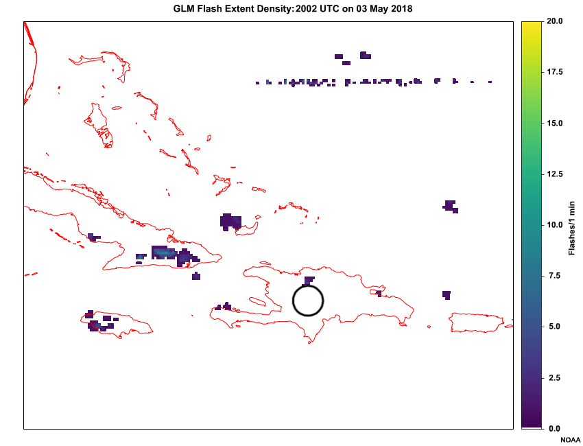
Description:
A loop of GLM flash extent density (every 5 minutes) across the Caribbean from 2006 UTC to 2046 UTC on May 03, 2018.
File Name:
carib_glm.htm
Credits:
NOAA
Copyright Terms:
COMET Standard Terms of Use
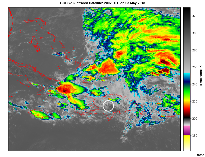
Description:
A loop of infrared satellite imagery (every 5 minutes) across the Caribbean from 2007 UTC to 2047 UTC on May 03, 2018.
File Name:
carib_ir.htm
Credits:
NOAA
Copyright Terms:
COMET Standard Terms of Use
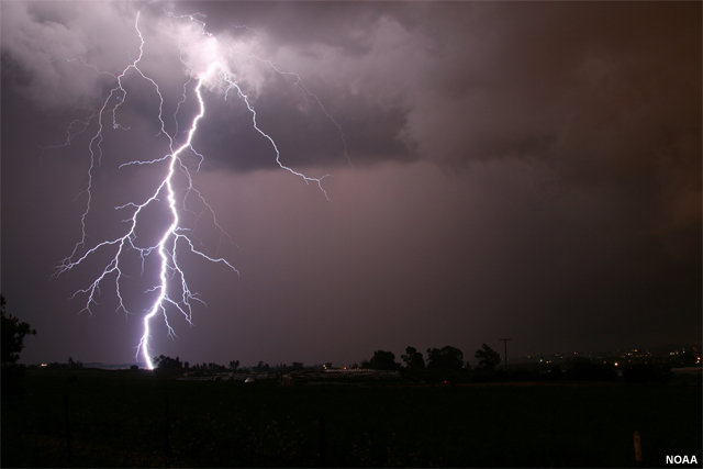
Description:
Photo of cloud-to-ground lightning
File Name:
cloud_to_ground_lightning.jpg
Credits:
NOAA
Copyright Terms:
COMET Standard Terms of Use
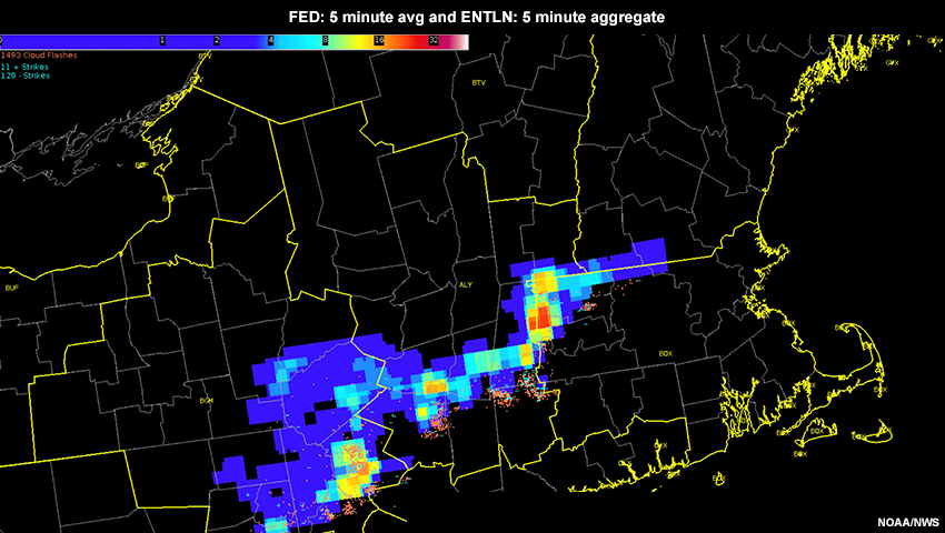
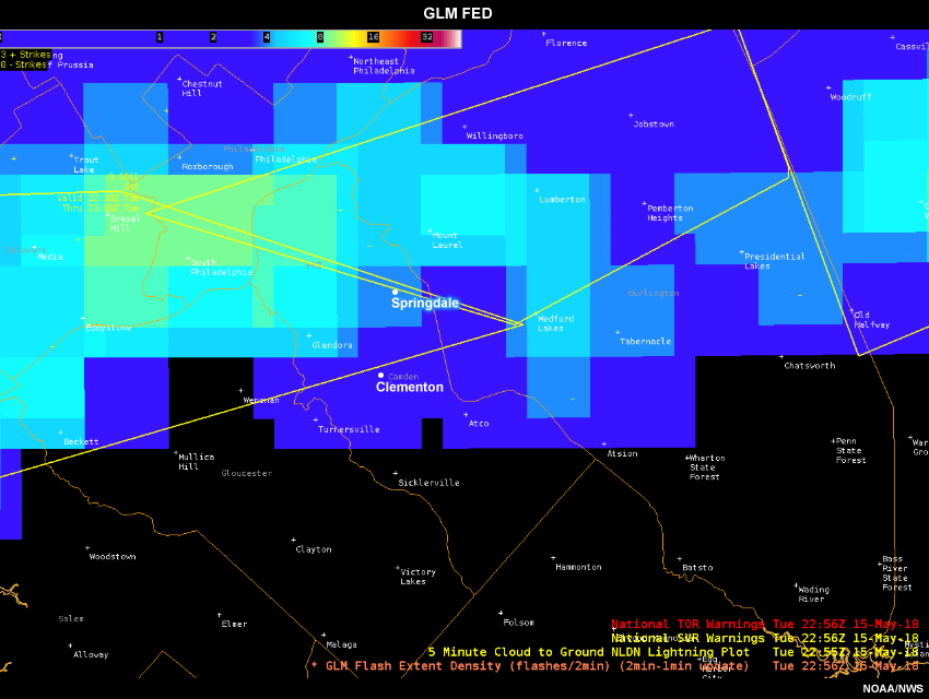
Description:
ENTLN lightning data and GLM flash extent density data for a convective line over the mid-atlantic
File Name:
entln_fed_midatlantic_051518.jpg
Credits:
NOAA/NWS
Copyright Terms:
COMET Standard Terms of Use
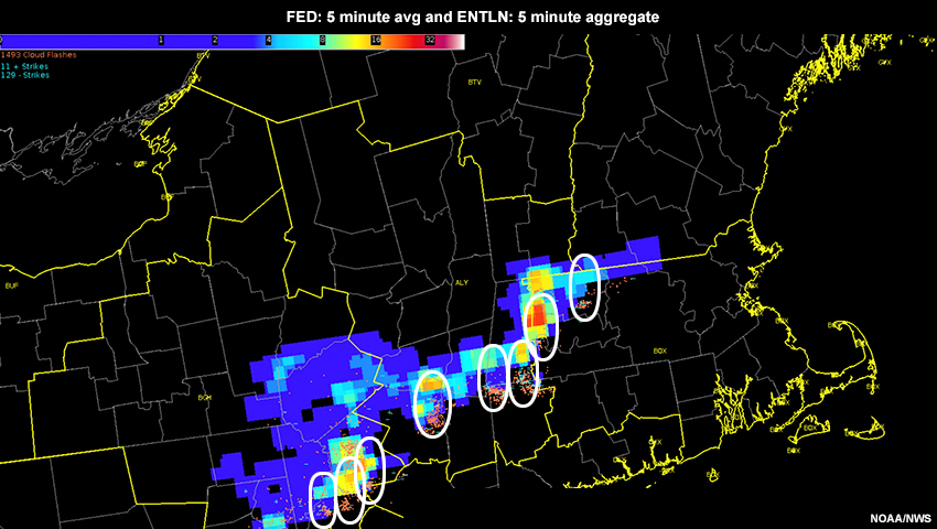
Description:
ENTLN lightning data and GLM flash extent density data for a convective line over the mid-atlantic, with highlighted outlines around parallax errors
File Name:
entln_fed_midatlantic_051518_feedback.jpg
Credits:
NOAA/NWS
Copyright Terms:
COMET Standard Terms of Use

Description:
Simplified steps for creating flash extent density product.
File Name:
FED_gridded_guide_method.jpg
Credits:
NOAA/NASA
Copyright Terms:
COMET Standard Terms of Use
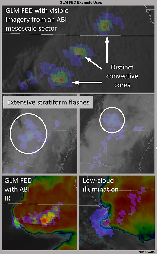
Description:
Examples of GLM FED usage
File Name:
FED_guide_use_examples.jpg
Credits:
NOAA/NASA
Copyright Terms:
COMET Standard Terms of Use
Description:
GLM flash extent density plotted over visible satellite field. The first half of the loop shows flash extent density calculated using a 1-minute average, while the latter half uses a 5-minute running average.
File Name:
GLM_050118_timeavg_1min.htm
Credits:
NOAA/NWS
Copyright Terms:
COMET Standard Terms of Use
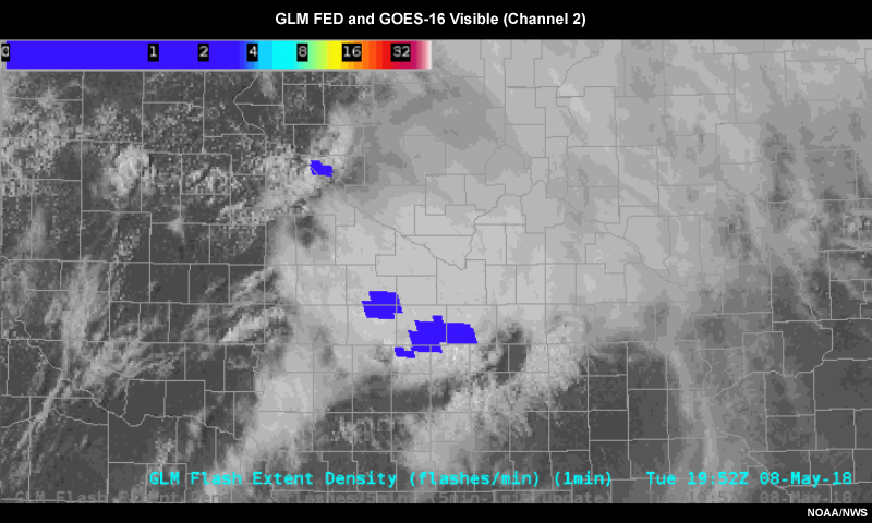
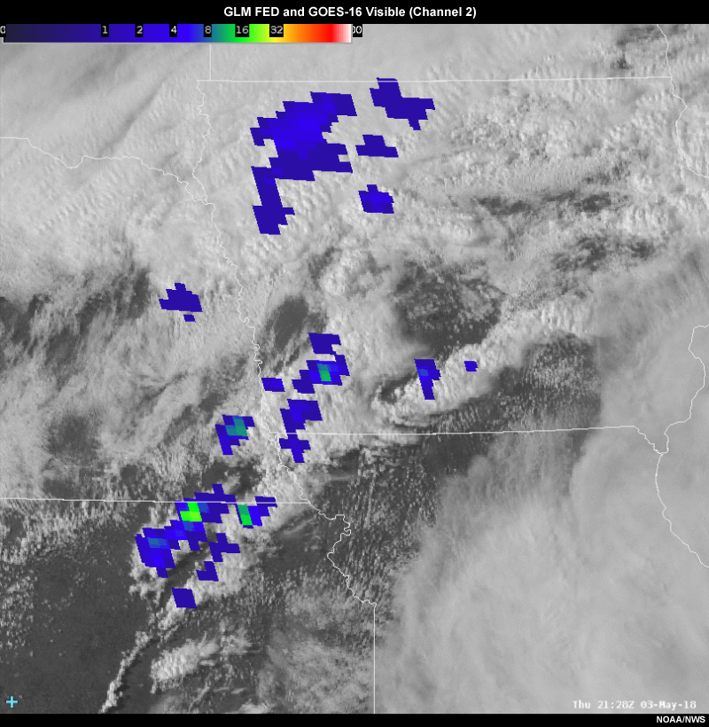
Description:
GLM flash extent density plotted over visible satellite field.
File Name:
GLM_050818_4panel_1min.htm
Credits:
NOAA/NWS
Copyright Terms:
COMET Standard Terms of Use
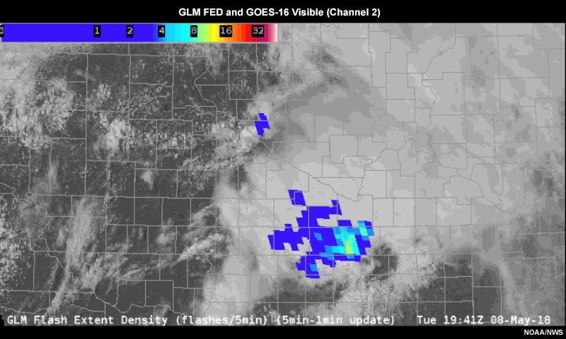
Description:
GLM flash extent density plotted over visible satellite field.
File Name:
GLM_050818_4panel_5min.htm
Credits:
NOAA/NWS
Copyright Terms:
COMET Standard Terms of Use
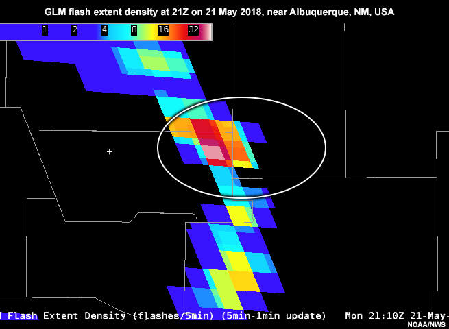
Description:
GLM flash extent density at 21Z on 21 May 2018, near Albuquerque, NM, USA.
File Name:
glm_ABX_blockage.jpg
Credits:
NOAA/NWS
Copyright Terms:
COMET Standard Terms of Use
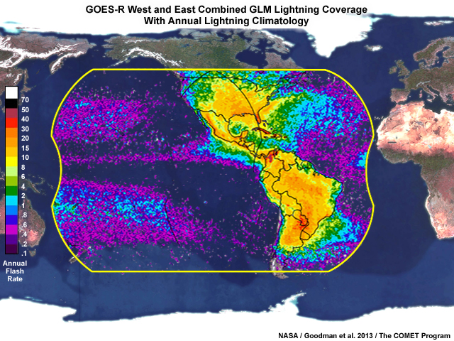
Description:
Geostationary Lightning Mapper combined coverage from GOES-West and GOES-East satellite locations.
File Name:
glm_coverage_goes_west_east_combined.jpg
Credits:
NASA / Goodman et al. 2013 / The COMET Program
Copyright Terms:
COMET Standard Terms of Use
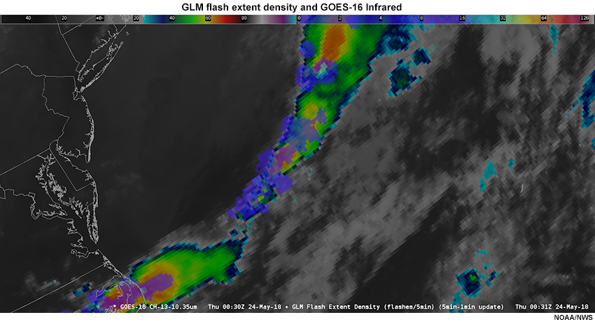
Description:
GLM flash extent density and GOES-16 Infrared imagery showing line of convection over the western Atlantic.
File Name:
GLM_FED_IR_W_Atlc.jpg
Credits:
NOAA/NWS
Copyright Terms:
COMET Standard Terms of Use
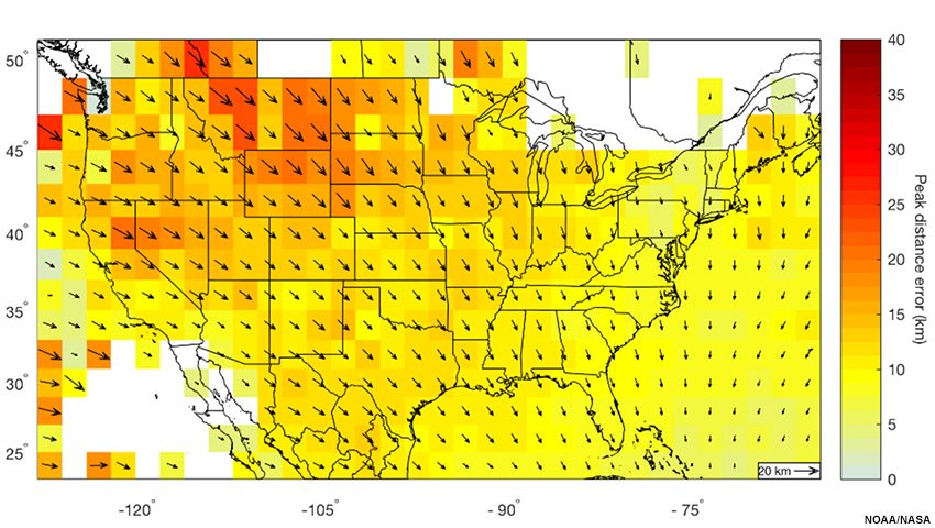
Description:
Color-shaded parallax error amount and directional vector over US
File Name:
glm_parallax_vectors_map.jpg
Credits:
NOAA/NASA
Copyright Terms:
COMET Standard Terms of Use
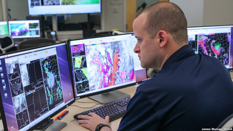
Description:
Forecaster participating in Hazardous Weather Testbed Spring Experiment in Norman, Oklahoma, USA
File Name:
HWT_forecaster_desk.jpg
Credits:
James Murnan, NOAA
Copyright Terms:
COMET Standard Terms of Use
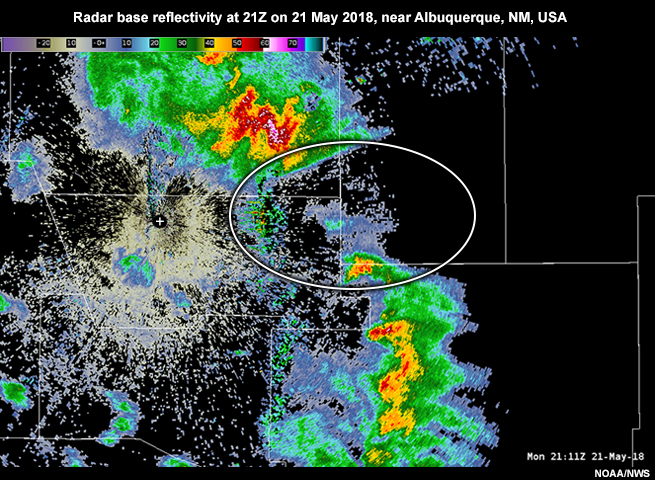
Description:
Radar base reflectivity at 21Z on 21 May 2018, near Albuquerque, NM, USA.
File Name:
radar_ABX_blockage.jpg
Credits:
NOAA/NWS
Copyright Terms:
COMET Standard Terms of Use