Overview
The rainy season in Sahelian West Africa extends from June to September and is tied to the position of the intertropical front (ITF). During this period, westward propagating squall lines and other mesoscale convective systems often produce significant rainfall. This impacts agriculture, water resources management, and other activities. It can also lead to flooding, which can be severe.
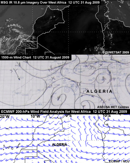
Since flooding in the Sahel region is a nowcasting problem, weather forecasters need to consider all available real-time data from synoptic observation networks, satellites, and radar as well as numerical weather prediction model forecasts. Given the area’s sparse synoptic observations and limited radar coverage, forecasters rely heavily on satellite products and model output. These typically include single channel imagery and RGB composites from Meteosat Second Generation (MSG) satellites, synoptic observations, and model output from world numerical weather prediction (NWP) centers, notably ECMWF, Météo France, NCEP, and the UK-Met Office.
In this module, you'll assume the role of a weather forecaster on duty in Ouagadougou, Burkina Faso on 31 August 2009. Your task is to assess the meteorological conditions in the Sahel region and determine if a mesoscale convective system (MCS) is likely to develop that could lead to heavy rain and flooding. You will follow a forecast process presented in the next section. Basically, it involves checking satellite data from the past 24 hours and the current time, examining synoptic charts and model data for both periods, and then integrating the information into a forecast.
If you are not familiar with West Africa, you can view maps of the area via the West Africa Maps link in the navigational bar on the left.