Introduction
A variety of tools exist for evaluating and predicting the presence and dispersion of volcanic ash. This module will focus on forecast tools used in aviation operations to ensure the safety of aircraft crews and passengers. These tools include both in situ and remote sensing instruments as well as numerical models.
Please note that before a volcanic event occurs, you should be familiar with your regional Interagency Operating Plan for Volcanic Ash Events. These plans detail interagency protocols and response procedures in case of a volcanic event. Plans currently exist for Alaska, the Pacific Northwest, and the Marianas Islands. Plans are under development for Hawaii and California. You can find existing planning documents at this website: https://www.ofcm.gov/publications/volcanicash/volash2.htm
When volcanic unrest or eruptions occur in or near your forecast area, it is vitally important that you remain in close communication with the Volcano Observatory responsible for the volcano. A list of observatories worldwide is available at http://www.wovo.org/observatories.html. Volcanic eruptions can be detected by ground-based monitoring instruments, pilots, webcams if available, or observed on satellite imagery. It is important to coordinate with all the agencies mentioned in your region’s operating plan to ensure consistent and helpful warning information.
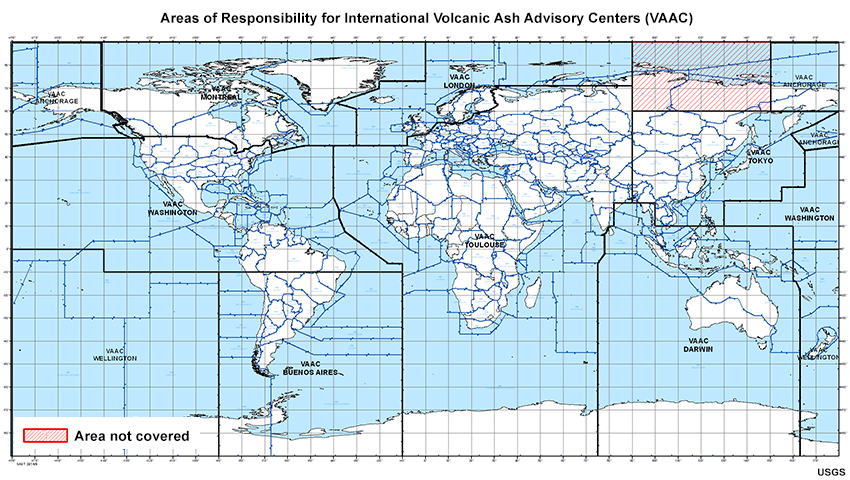
Nine Volcanic Ash Advisory Centers (VAACs) worldwide issue Volcanic Ash Advisories when a volcanic event occurs within their area of responsibility. These Advisories provide information about the volcano's location, eruption details, and altitude and geographic coverage of any volcanic ash cloud.
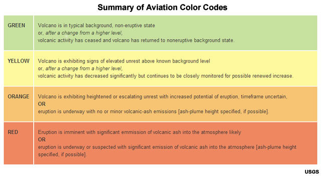
The level of threat to aviation is indicated by an Aviation Color Code, proceeding in increasing severity from green to yellow to orange to red. Volcanic activity alert notifications are issued whenever the Aviation Color Code changes (up or down). Notifications are available through the VAACs and additional information can be accessed via the U.S. Geological Survey (USGS).