Introduction
Imagine you are the lead forecaster at the National Weather Service’s (NWS) Monterey, CA Weather Forecast Office (WFO), comparing the Real-Time Mesoscale Analysis/Un-Restricted Mesoscale Analysis (RTMA/URMA) and MatchObsAll temperature analyses in the BIg Sur area of the Central California coast.
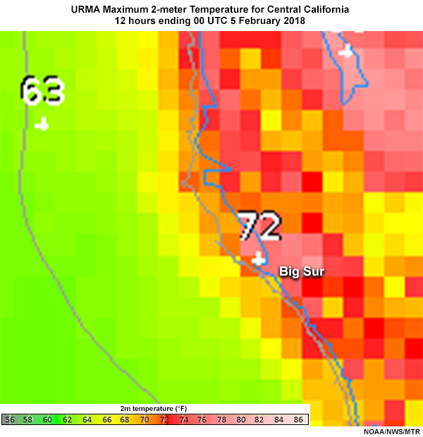
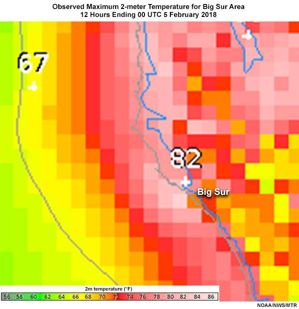
URMA maximum 2-meter temperature analysis (°F) and observed maximum 2-meter temperature analysis (°F), 4 February 2018. For both graphics, the dark grey line off the coast represents the outer boundary of WFO responsibility for marine forecasts. The blue line is the land-sea boundary in AWIPS2, and the lighter gray represents the actual land-sea boundary.
“We’ve seen this kind of difference around Big Sur every time we have an offshore wind event,” you think. “It’s a big tourist area, so temperature errors have a significant impact.”
You ask your Science and Operations Officer (SOO) about the source of the difference. “Well, the MatchObsAll tool draws close to the observations,” she says. “While the RTMA/URMA also uses observations, it’s starting point (or first guess) blends the current 1-hour 3km HRRR forecast and the most recent (00, 06, 12, or 18 UTC) NAM-Nest forecast. Terrain, coastline location, the forecast-observation difference, and observation quality relative to the first guess are then used to complete the analysis.”
You note, ”Because the RTMA/URMA depends on the first guess, observations, terrain, and coastline location, problems with any of these could result in big analysis errors. The Big Sur observation is good, but our rugged terrain often results in features being missed in the first guess. If a feature isn’t in the first guess, it’s hard to get it into the analysis, even if you have an observation that captures it. Also, I’ve been hearing about problems with inconsistencies with the terrain and the coastlines, and even a good first guess won’t help with that.”