Dust as Seen in Meteosat Visible, IR Window, and RGB Composite Imagery (Page 4 of 8)
Return to the previous menu.
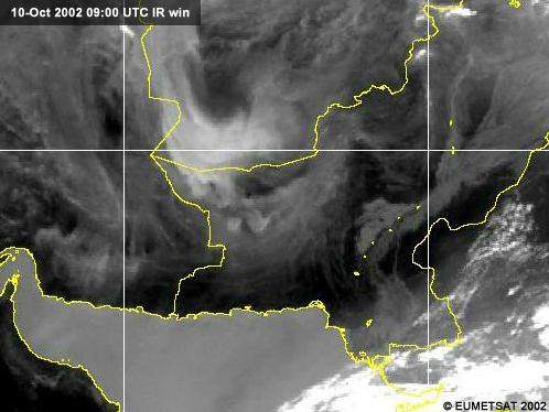
Here is the Meteosat-5 IR image on which dust shows up well over land. Unlike multispectral satellites like AVHRR and SeaWIFS, Meteosat has only two channels that show dust well: visible and longwave infrared.
Here, the Meteosat-5 visible image that shows dust over the ocean. Notice that the dust that was invisible over land becomes easy to see as it blows over the Gulf of Oman.
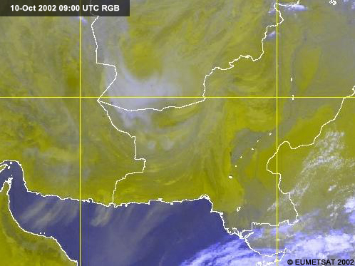
This is a red/green/blue (RGB) color image that combines both the visible and infrared images into a single false-color product. Notice that the dust now appears over both land and sea in a grayish-blue color. This color image can make the forecaster's job easier, eliminating the need to switch between visible and infrared images. To make the RGB color image the visible image was projected into the green and red guns, and the longwave infrared image was projected into the blue gun. This combination makes oceans blue, clouds mostly white, and dust grayish-blue.
Next | Previous | Main Menu | Page: 1 | 2 | 3 | 4 | 5 | 6 | 7 | 8