Introduction
Typhoons are considered the most dangerous natural disaster in Taiwan, even when they do not make landfall. In the past one hundred years, an average of 3 to 4 typhoons approached Taiwan annually.
The image below shows that typhoons originating in the Northwest Pacific Ocean travel westbound because they are mainly steered by the Pacific subtropical high. In general, a typhoon follows a predictable path when the large-scale steering flow is prominent, and behaves more erratically otherwise.
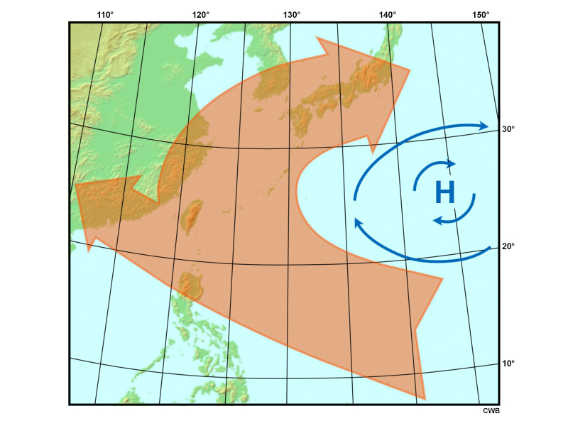
Typical paths of typhoons originating in the Northwest Pacific Ocean that are influenced by the Pacific subtropical high.
The image below categorizes the typical paths of the typhoons that have approached Taiwan. Nearly 67% of the typhoons move westward, emphasizing the influence of the subtropical high on the track of a typhoon in the western Pacific Ocean.
Categorical Paths
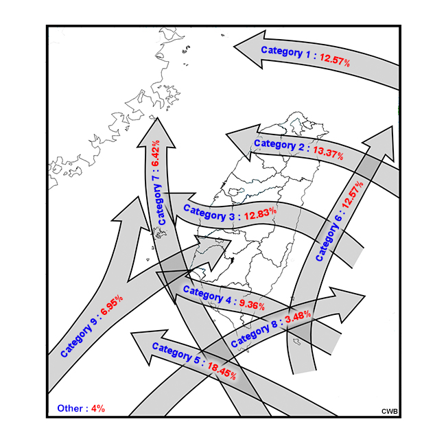
Categorical distribution of the typical paths of typhoons that impact Taiwan, and the percent of storms that fall into each category.
侵臺颱風之路徑分類
侵臺颱風之主要路徑分類及其所對應的百分比。
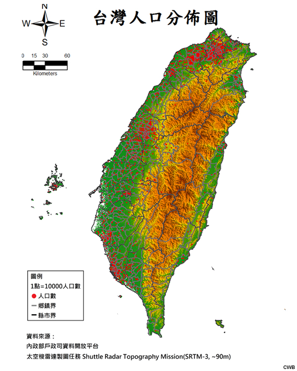
Taiwan is a subtropical island (400 km long and 150 km wide) with a steep, north-south orientated mountain range called the Central Mountain Range (CMR). The CMR rises above 3,000 m over a distance of 50 km.
Taiwan Population
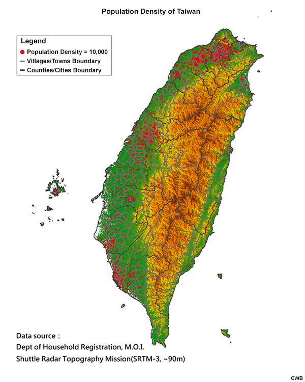
臺灣人口分佈圖
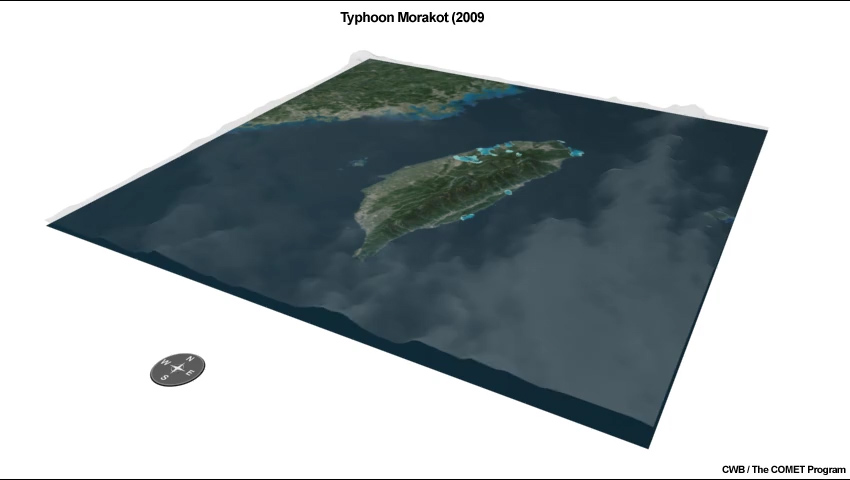
Consequently, the elevated terrain has an influence on the typhoon-related torrential rainfalls, which can cause great devastation in the form of flooding, landslides, and debris flows. For example, Typhoon Morakot (2009) brought 2,855 mm of rain over a 4-day period that led to “massive mudslides and severe flooding, resulting in 619 deaths and 76 missing persons” (Wu and Yang 2011).
Road Damage Content
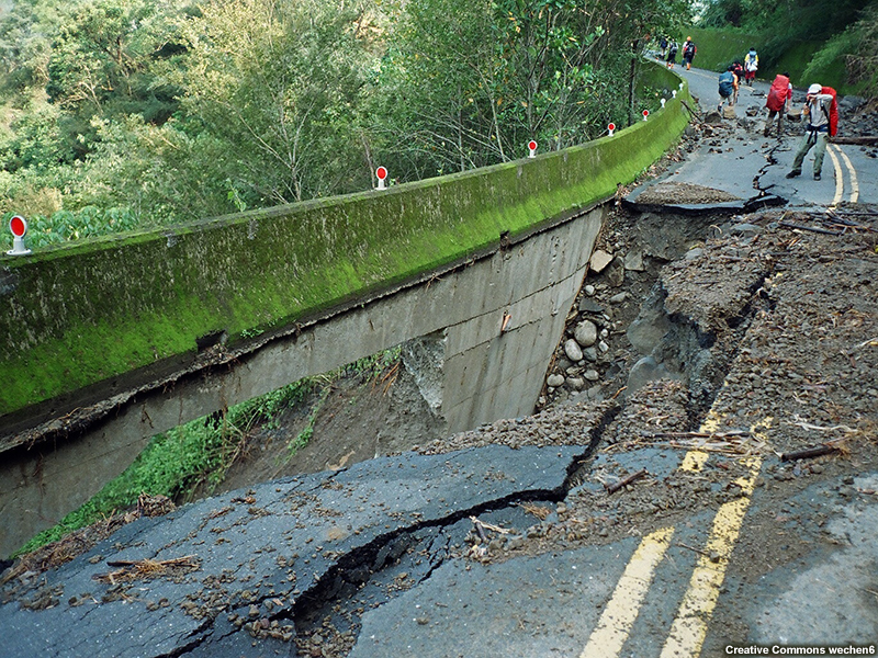
Road damage due to Typhoon Morakot (2009).
Landslides Content
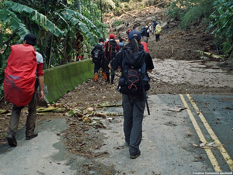
Landslides blocking roads due to Typhoon Morakot (2009).
Flooding Content
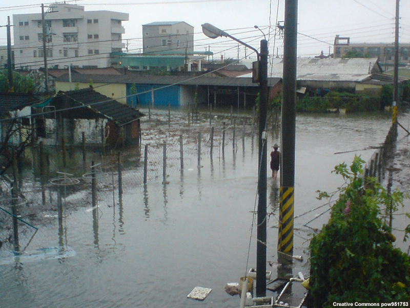
Flooding due to Typhoon Morakot (2009).
Structural Damage Content
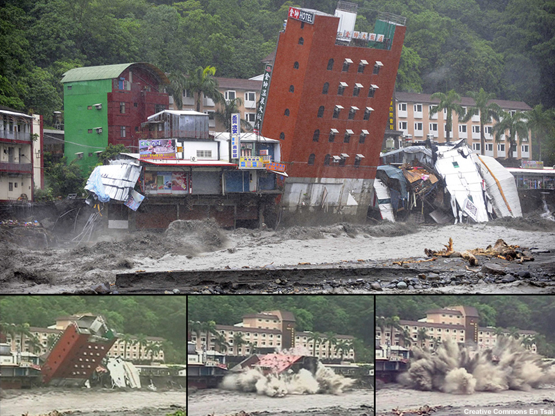
Damage to the Jinshuai Hotel due to Typhoon Morakot (2009).
The torrential rainfall threat makes it imperative for forecasters to provide the best possible quantitative precipitation forecasts (QPFs). These QPFs may help emergency operation centers (EOCs) in their preparation, mitigation, and recovery efforts for typhoon-related events in Taiwan. However, the interaction between the CMR and a typhoon’s circulation, structure, and intensity presents a major challenge to producing accurate precipitation forecasts.
A typhoon's rainfall pattern is usually phase-locked with the elevated terrain of Taiwan's CMR, an interaction known as the "topographic phase-locked effect". Certain parts of the island can experience great amounts of precipitation, depending on the typhoon's specific position relative to the CMR and how its moisture interacts with the topography when it is in that position.
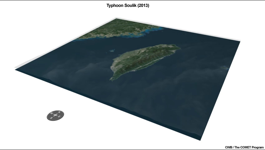
The animations in the tabs below show how the interaction between the CMR and the typhoon’s circulation, structure, and intensity influence precipitation distributions across the island.
Morakot (2009) Content
Soulik (2013) Content
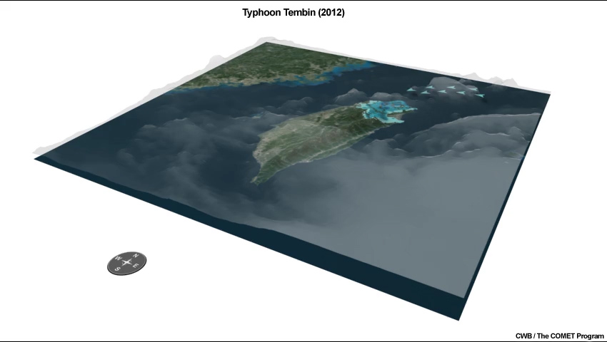
Tembin (2012) Content
Consequently, several QPF techniques have been developed based on these interactions. These include historical case guidance, such as the analogue method and the typhoon rainfall climatology model (hereafter climatology model), and ensemble forecasting from numerical weather prediction (NWP) models.
After completing this lesson, you will be able to:
● Describe the forecast process and the QPF guidance used to make typhoon QPFs in Taiwan.
- Explain why the confidence level of each QPF guidance changes along with the forecast hour.
● Explain how the climatology model generates typhoon QPFs and describe its advantages and disadvantages.
● Explain how the Ensemble Typhoon QPF (ETQPF) model creates precipitation forecasts and describe its advantages and disadvantages.
● Explain the advantages of using forecast uncertainty information to estimate and convey the typhoon threat instead of a deterministic-only approach.
- Use the ETQPF model to estimate the risk of heavy precipitation for locations in Taiwan based on the uncertainty of a typhoon’s track.