Introduction
You work for an NWS coastal office and your mentor Karine asked you to review the events surrounding Hurricane Sandy from the 2012 Atlantic hurricane season. After reviewing archived products and news stories about the hurricane, you meet with Karine to discuss it.
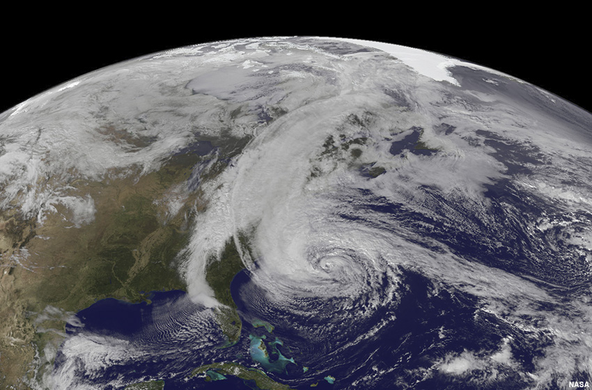
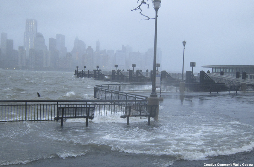
“Hurricane Sandy was a storm to remember. It packed 70-kt maximum sustained winds when it made landfall as a post-tropical system. And because of its tremendous size, Sandy drove catastrophic storm surge into the coastlines. There were about 150 fatalities and $50 billion in damage. It is hard to believe what I am reading.”
“It was an impressive and challenging storm to deal with,” Karine agrees. “Not only did we expect the hurricane to affect a large area with a variety of hazards, but it was also forecast to lose its tropical characteristics and evolve into a post-tropical cyclone at some point before landfall.”
After a brief pause, Karine continues. “In the past, the NHC used to discontinue advisories whenever a tropical cyclone became extratropical, or no longer possessed characteristics to be classified as a tropical cyclone. When that happened, tropical watches and warnings were discontinued since they were tied to the NHC advisory products.”
“Wait, that would explain why there was conflicting information about the severity of potential impacts from Sandy ahead of the storm,” you say, nodding your head. “There were reports about why hurricane watches and warnings were not issued. That caused confusion and disruption for emergency managers trying to prepare and evacuate coastal residents in advance of the storm.”
“That is precisely why I asked you to review the Hurricane Sandy case,” Karine says, shuffling some papers on her desk. “Sandy uncovered this communication weakness in the NWS tropical watch/warning program. It became apparent that there needed to be a way for the NWS to issue and maintain tropical watches and warnings for systems transitioning from tropical to extratropical. Now, the NHC and NWS have the option to issue and maintain tropical watches and warnings during the transition phase.”
“Sounds like that was a major step towards improving how we communicate our forecast and warning information to the public,” you respond.
“Yes, with this policy change, we can work on improving our collaboration and decision-making processes on product issuance and public weather communications as a tropical cyclone transitions to extratropical,” she continues. “We want forecasters to focus on hazards and impacts, to collaborate with NHC and neighboring offices, and provide consistent messaging to our partners before, during, and after the transition takes place.”
“It would be great if I can practice issuing products and communicating information using the new policy with a transitioning cyclone,” you say, thinking aloud.
“Great! That is exactly what the next exercise is about,” says Karine.