Introduction » Overview
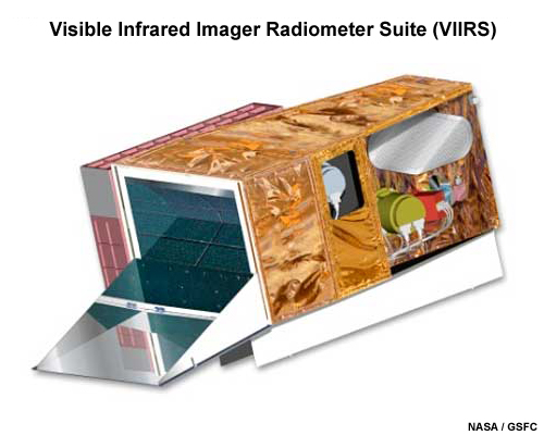
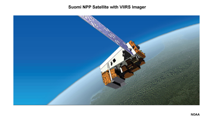
This module introduces the next-generation imagery that is being produced from the Visible/Infrared Imager/Radiometer Suite (or VIIRS) starting with the recently launched Suomi NPP polar-orbiting satellite and continuing on board future U.S. JPSS (Joint Polar Satellite System) weather satellites.
The VIIRS imager has many advanced features that improve both spectral and spatial resolution. Together with modernized data communication and processing systems, VIIRS will provide consistent, high quality, and high resolution data to users. The module covers the enhanced capabilities of VIIRS by examining the systems that contributed to its development. Special attention is paid to the Day/Night Visible channel as VIIRS will be the first civilian satellite to image atmospheric and terrestrial features with and without moonlight.
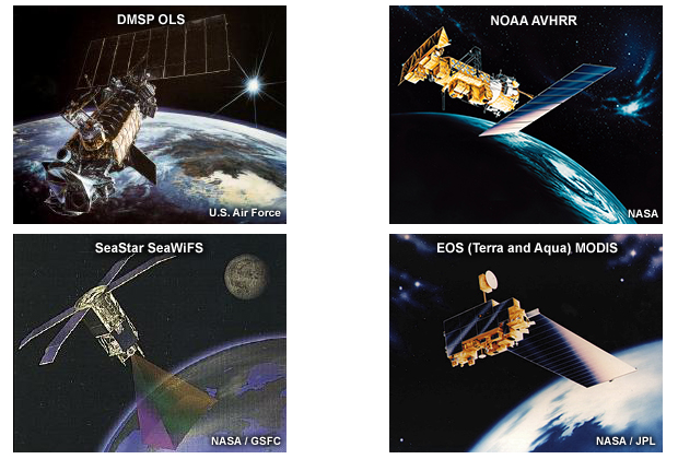
VIIRS represents the culmination of years of experience with both research and operational satellites. The concept came into being as the planned convergence of the capabilities of the Advanced Very High Resolution Radiometer (AVHRR) from the NOAA civilian operational satellites and the Operational Linescan System (OLS) from the Defense Meteorological Satellite Program (DMSP). In addition, VIIRS technology draws heavily from the Earth Observation System (EOS) Moderate Resolution Imaging Spectroradiometer (MODIS), a research instrument that is advancing our ability to observe and understand the earth and its atmosphere. VIIRS also owes a considerable debt to the SeaStar OrbView-2 Sea-viewing Wide Field-of-view Sensor (SeaWiFS). This is an ocean color imager that has given us vital new information about Earth's oceans.
While the initial motivation for a new imager came from AVHRR and OLS, the advanced engineering of VIIRS represents a synthesis of the architectures of MODIS and SeaWiFS.
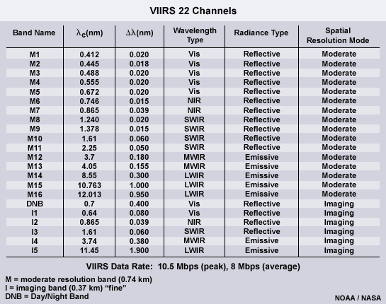
VIIRS has 22 channels meticulously chosen to produce a large array of Environmental Data Records or EDRs. Since we are considering imagery, spatial resolution is the key. The higher the resolution the better the imagery. VIIRS engineers built an instrument that both improves and preserves resolution across the scan.
This module will examine the strengths and the limitations of VIIRS predecessor systems for two important reasons. First, the existing constellation of polar-orbiting imagers is making important contributions to a much improved imaging capability coming online with VIIRS. And second, for several years to come, some of these existing satellites will continue to satisfy a large number of meteorological and environmental needs. The module will also devote important attention to the OLS sensor since online educational materials about it are not readily available elsewhere, and the OLS makes crucial contributions to the sensor suite on VIIRS. Less emphasis will be placed on the AVHRR because materials about it are available from existing materials elsewhere.
After completing the module, learners will be able to:
- Name the important heritage instruments that led to the development of the VIIRS imager
- State the advantages of multispectral imagery in fire and hot spot detection and interpretation
- Use true color imagery to identify surface, atmospheric, and ocean surface features and characteristics
- Discriminate between nadir and edge of scan passes from AVHRR
- Describe the difference between fine and smooth OLS data
- State the advantages of the nighttime visible channel on OLS
- State features that can be seen during no-moon, half-moon, and full-moon illuminations
- Identify features in no-moon, half-moon, and full-moon illuminations