Media elements used in this module are protected by a variety of copyright licenses. Please use the "copyright terms" link associated with each item below for more information.
Description:
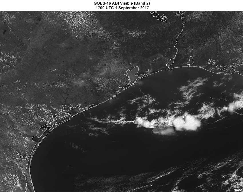
GOES-16 ABI Visible (Band 2) 1700 UTC 1 September 2017
File Name:
1Sep17_1700z_GOES16_band2.jpg
Credits:
NOAA
Copyright Terms:
COMET Standard Terms of Use
Description:
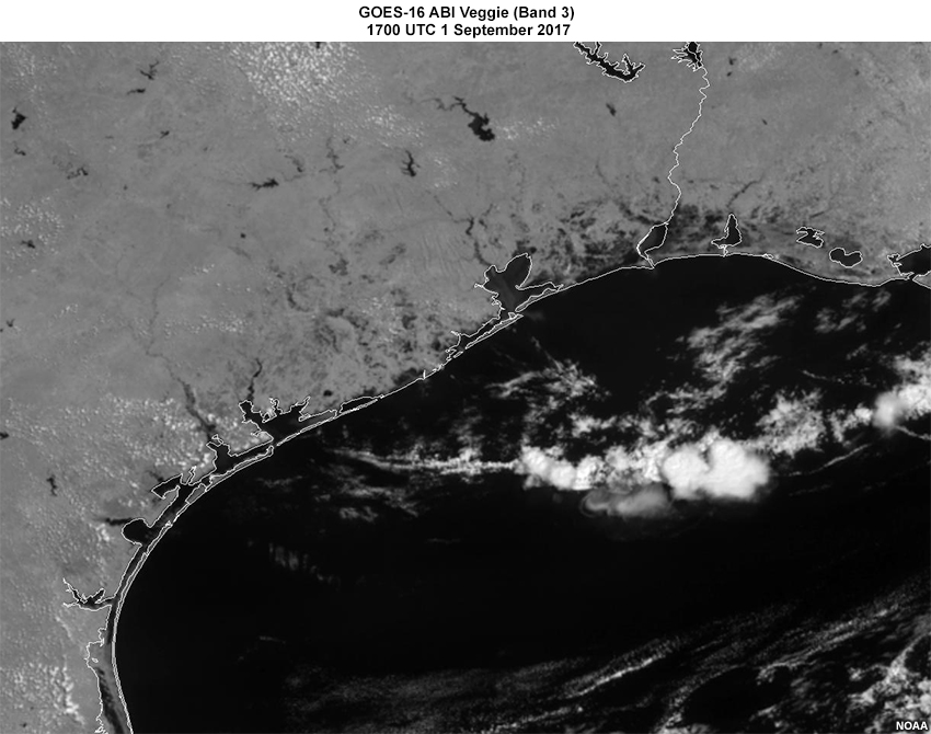
GOES-16 ABI Veggie (Band 3) 1700 UTC 1 September 2017
File Name:
1Sep17_1700z_GOES16_band3.jpg
Credits:
NOAA
Copyright Terms:
COMET Standard Terms of Use
Description:
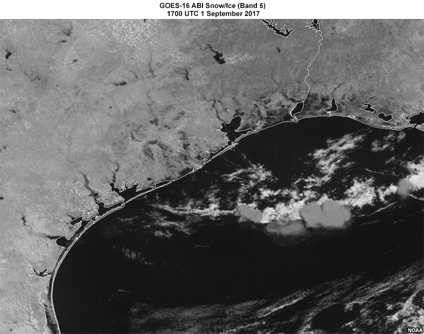
GOES-16 ABI Snow/Ice (Band 5) 1700 UTC 1 September 2017
File Name:
1Sep17_17z_GOES16_band5.jpg
Credits:
NOAA
Copyright Terms:
COMET Standard Terms of Use
Description:
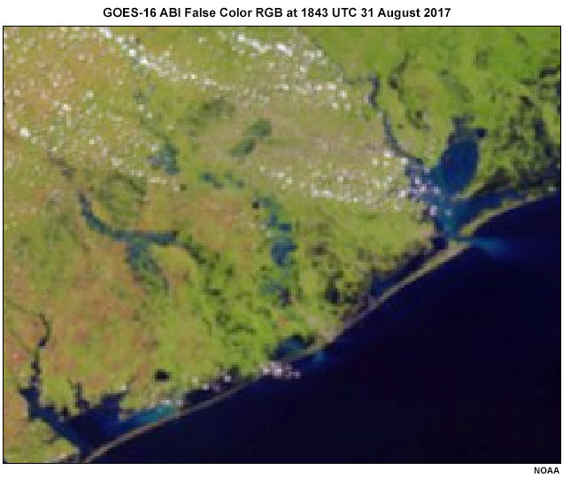
GOES-16 ABI false color RGB from August 31st 2017
File Name:
ABI_falsecolor_Aug31_2017_1843_noriverline.jpg
Credits:
NOAA
Copyright Terms:
COMET Standard Terms of Use
Description:
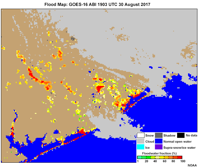
Flood Map: GOES-16 ABI 1903 UTC 30 August 2017
File Name:
ABI_floodmap_Aug30_2017_1903_noriverline.jpg
Credits:
NOAA
Copyright Terms:
COMET Standard Terms of Use
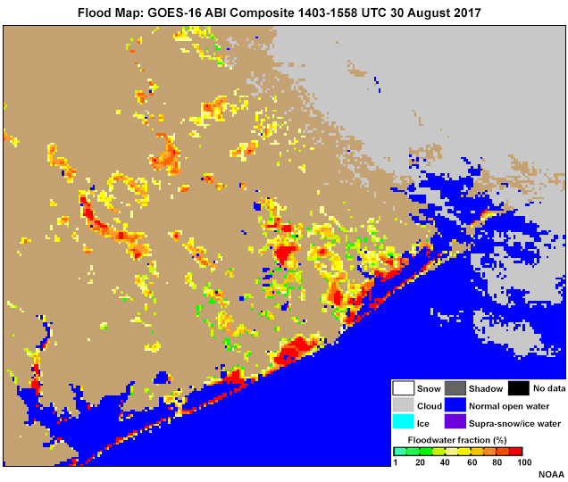
Description:
Flood Map: GOES-16 ABI Composite 1403-1558 UTC 30 August 2017
File Name:
ABI_floodmap_Aug30_2017_composite_noriverline.jpg
Credits:
NOAA
Copyright Terms:
COMET Standard Terms of Use
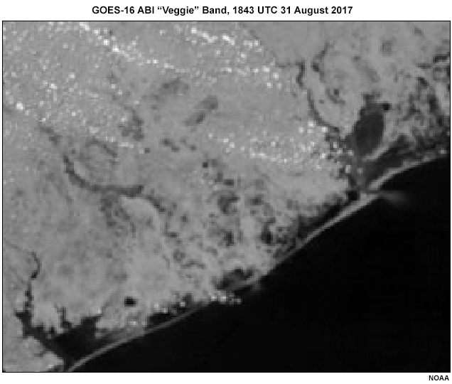
Description:
GOES-16 ABI “Veggie” Band, 1843 UTC 31 August 2017
File Name:
ABI_veggieband_Aug31_2017_1843_noriverline.jpg
Credits:
NOAA
Copyright Terms:
COMET Standard Terms of Use
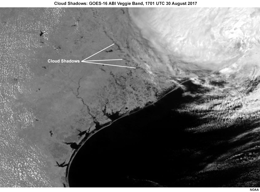
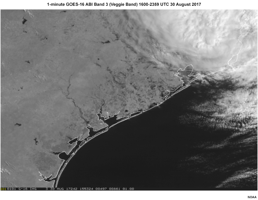
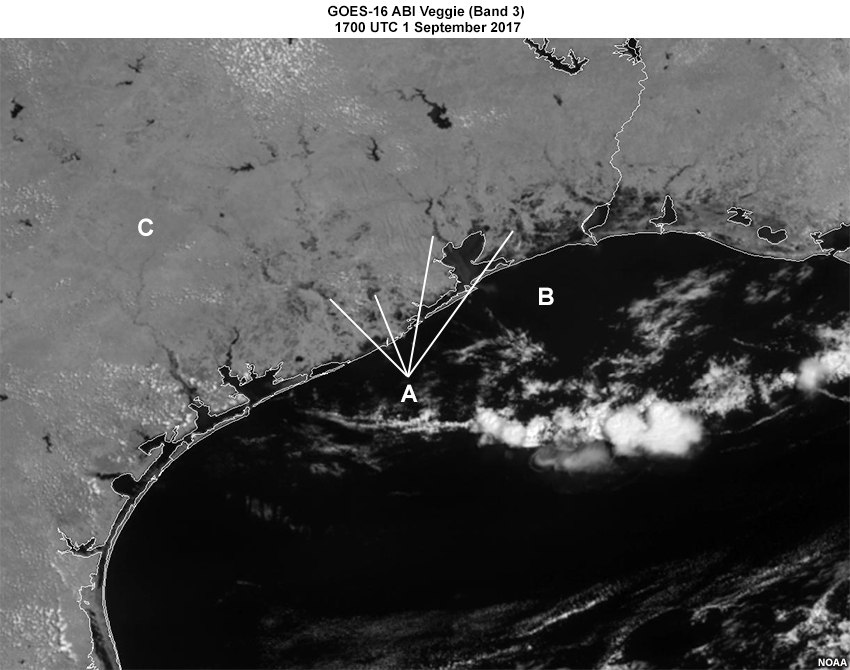
Description:
GOES 16 0.86𝞵 (band 3, the “veggie” band) on 30 August 2017 with Cloud shadows
File Name:
CloudShadows_1701z-30Aug17.jpg
Credits:
NOAA
Copyright Terms:
COMET Standard Terms of Use
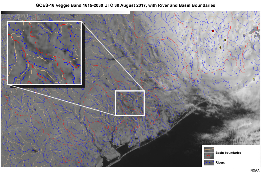
Description:
GOES-16 ABI Animation, 1615-2030 UTC 30 August 2017
File Name:
ColoradoBrazos.Aug30.16to20z.mp4
Credits:
NOAA
Copyright Terms:
COMET Standard Terms of Use
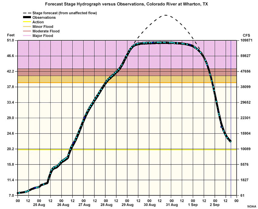
Description:
Forecast Stage Hydrograph versus Observations, Colorado River at Wharton, TX
File Name:
ColoradoRiverTX_HG_loss.jpg
Credits:
NOAA
Copyright Terms:
COMET Standard Terms of Use
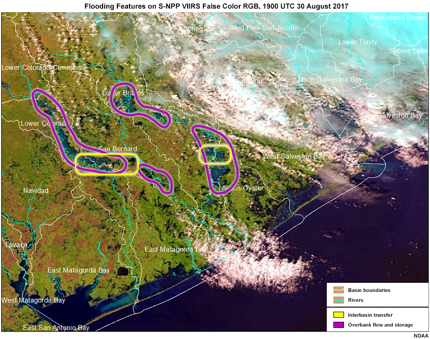
Description:
Flooding Features on S-NPP VIIRS False Color RGB, 1900 UTC 30 August 2017
File Name:
Features_on_RGB_30Aug.jpg
Credits:
NOAA
Copyright Terms:
COMET Standard Terms of Use
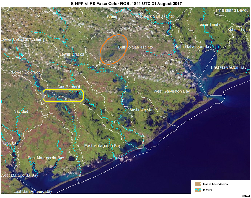
Description:
VIIRS False Color RGB with flood features highlighted
File Name:
Features_on_RGB_31Aug.jpg
Credits:
NOAA
Copyright Terms:
COMET Standard Terms of Use

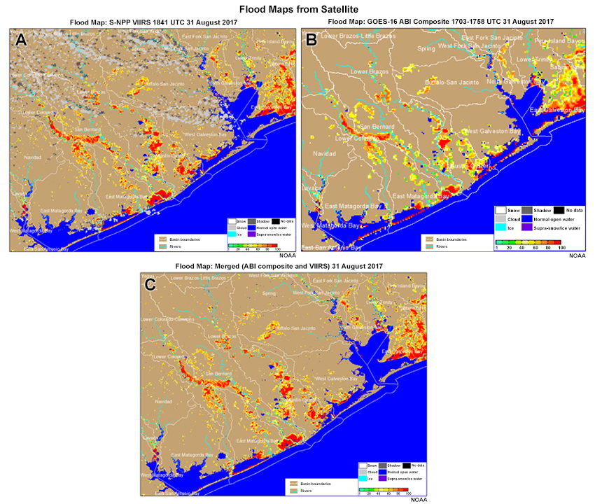
Description:
Flood maps from Satellite ABI, VIIRS and Merged maps
File Name:
FloodMap_3panel.jpg
Credits:
NOAA
Copyright Terms:
COMET Standard Terms of Use
Description:
Flood maps from Satellite ABI, VIIRS and Merged maps
File Name:
FloodMap_3panel_quiz.jpg
Credits:
NOAA
Copyright Terms:
COMET Standard Terms of Use
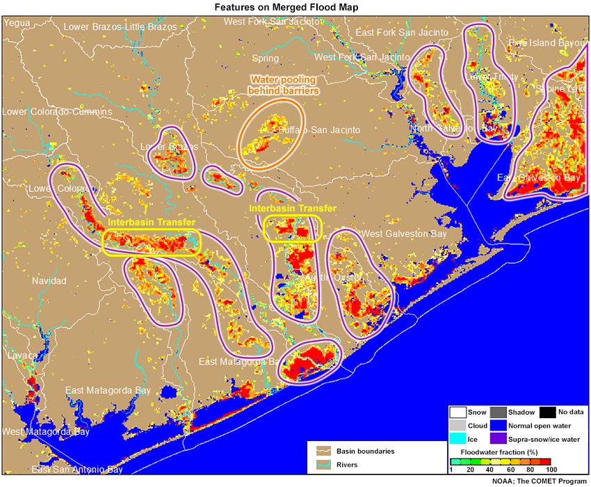
Description:
Features on Merged ABI & VIIRS Flood Map
File Name:
FloodMapFeatures_31Aug17.jpg
Credits:
NOAA; The COMET Program
Copyright Terms:
COMET Standard Terms of Use
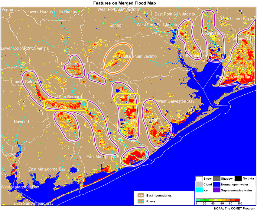
Description:
Features on Merged ABI & VIIRS Flood Map
File Name:
FloodMapFeatures_31Aug17_quiz.jpg
Credits:
NOAA; The COMET Program
Copyright Terms:
COMET Standard Terms of Use
Description:
GOES 16 animation of the 0.86𝞵 (band 3, the “veggie” band) on 30 August 2017
File Name:
g16_band3_30aug17_loop.mp4
Credits:
NOAA
Copyright Terms:
COMET Standard Terms of Use
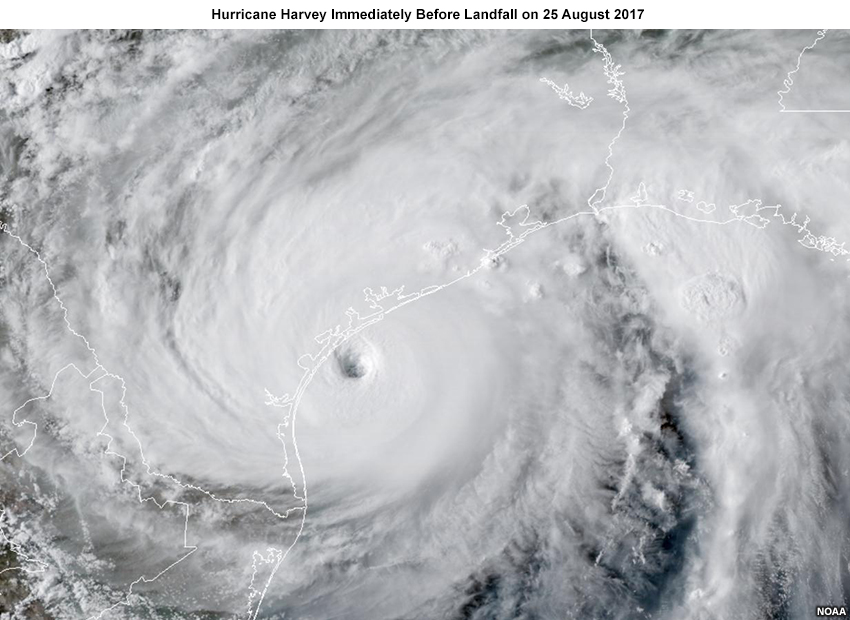
Description:
Hurricane Harvey Immediately Before Landfall on 25 August 2017
File Name:
GOES_25Aug17_2230z_Harvey.jpg
Credits:
NOAA
Copyright Terms:
COMET Standard Terms of Use
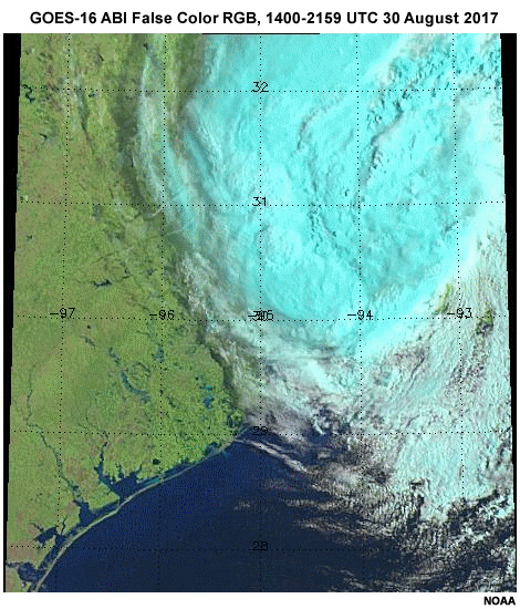
Description:
GOES-16 ABI False Color RGB at 1400-2159 UTC 30 August 2017
File Name:
GOES16_ABI_falsecolor_5minute_loop_Aug30_2017_1400_2159utc.mp4
Credits:
NOAA
Copyright Terms:
COMET Standard Terms of Use
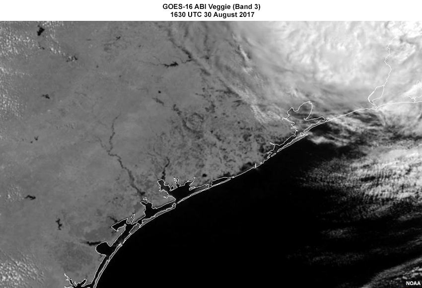
Description:
GOES-16 ABI Veggie (Band 3) 1630 UTC 30 August 2017
File Name:
GOES16_veggie_1630z_30aug2017.jpg
Credits:
NOAA
Copyright Terms:
COMET Standard Terms of Use
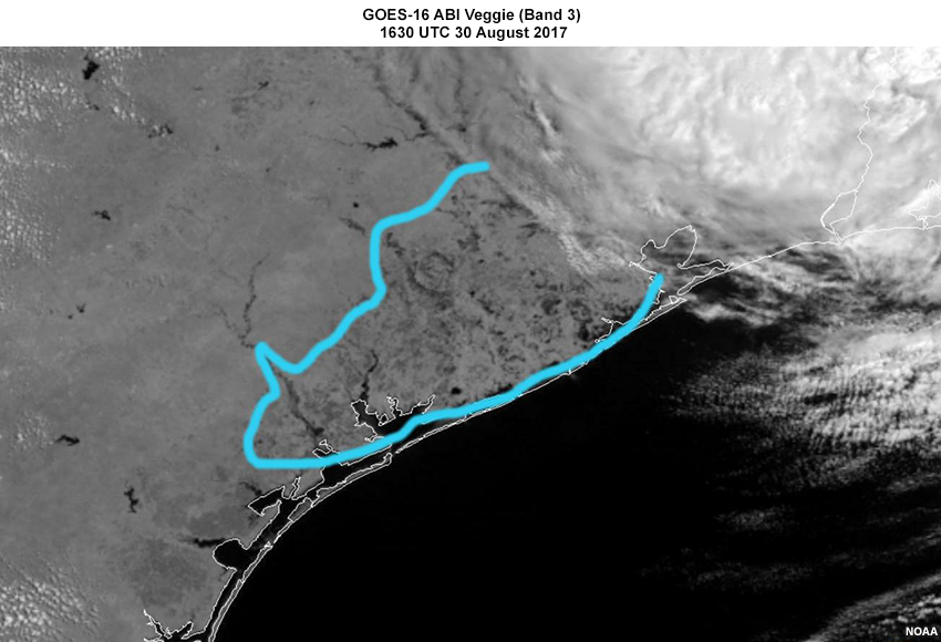
Description:
GOES-16 ABI Veggie (Band 3) 1630 UTC 30 August 2017
File Name:
GOES16_veggie_1630z_30aug2017_DRAW.jpg
Credits:
NOAA
Copyright Terms:
COMET Standard Terms of Use
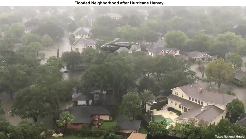
Description:
View of Flooding after Hurricane Harvey
File Name:
HarveyFlood-TexasNationalGuard.jpg
Credits:
Texas National Guard
Copyright Terms:
COMET Standard Terms of Use
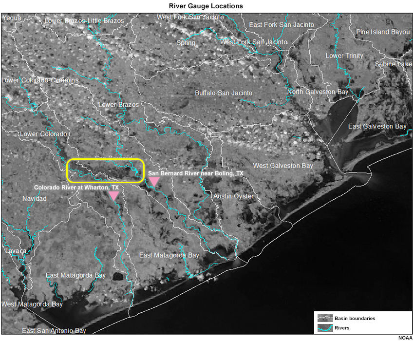
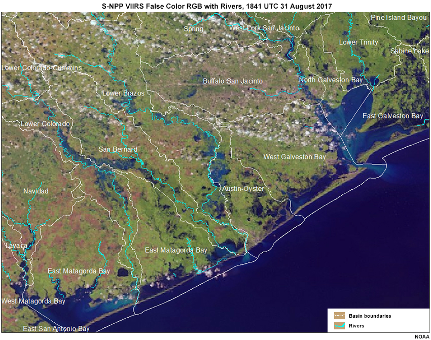
Description:
River Gauge locations on S-NPP VIIRS “Veggie” Band, 1841 UTC 31 August 2017
File Name:
HG_locations.jpg
Credits:
NOAA
Copyright Terms:
COMET Standard Terms of Use
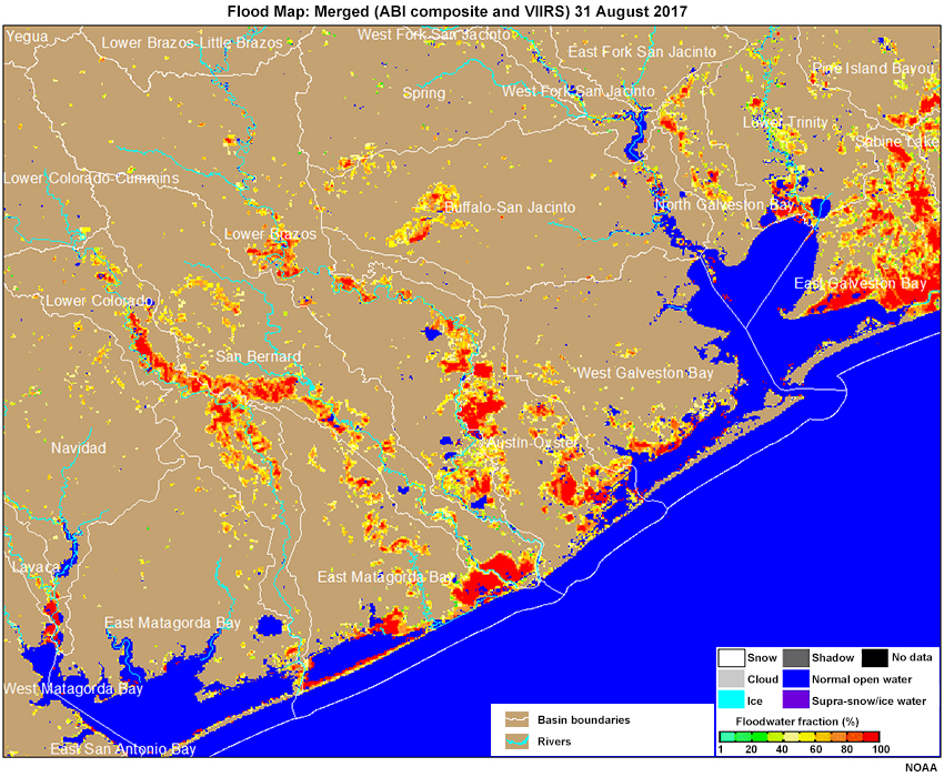
Description:
Merged (ABI composite and VIIRS) 31 August 2017
File Name:
Merged_ABI_VIIRS_floodmap_Aug31_2017.jpg
Credits:
NOAA; The COMET Program
Copyright Terms:
COMET Standard Terms of Use

Description:
Merged (ABI composite and VIIRS) 31 August 2017
File Name:
Merged_ABI_VIIRS_floodmap_Aug31_2017_quiz.jpg
Credits:
NOAA; The COMET Program
Copyright Terms:
COMET Standard Terms of Use
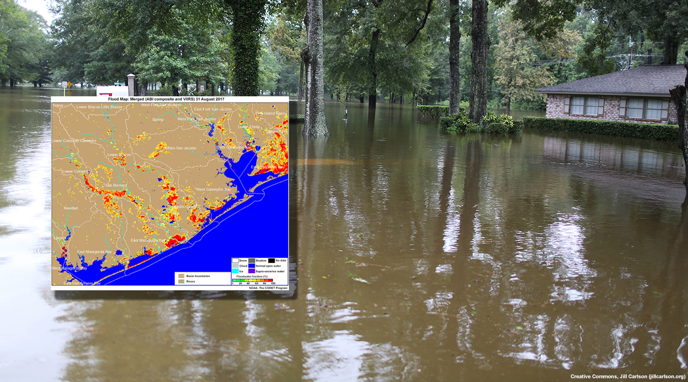
Description:
Flooding following Hurricane Harvey in Texas
File Name:
module-cover.jpg
Credits:
Creative Commons, Jill Carlson (jillcarlson.org)
Copyright Terms:
COMET Standard Terms of Use
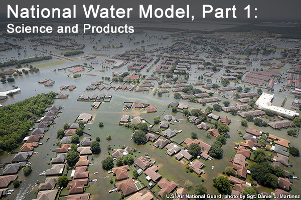
Description:
Flooding associated with Hurricane Harvey in Texas
File Name:
NWM_Thumbnail_large.jpg
Credits:
U.S. Air National Guard, photo by Sgt. Daniel J. Martinez
Copyright Terms:
COMET Standard Terms of Use
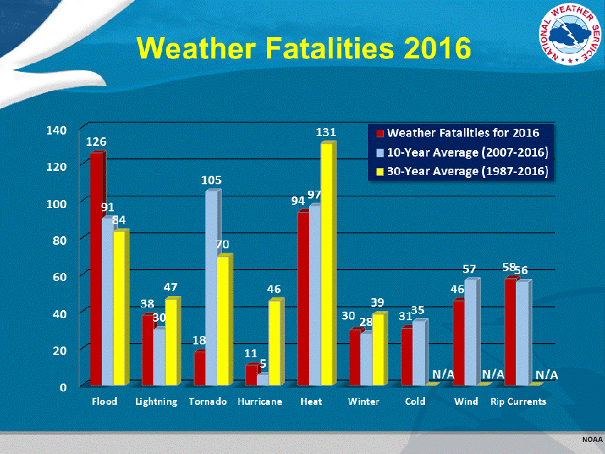
Description:
Bar graph of Weather Fatalities from various disasters including flooding, heat and tornadoes.
File Name:
NWS_hazstat-chart16-lg.jpg
Credits:
NOAA
Copyright Terms:
COMET Standard Terms of Use
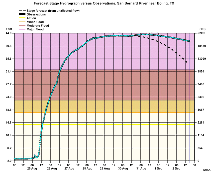
Description:
Forecast Stage Hydrograph versus Observations, San Bernard River at Boling, TX
File Name:
SanBernardRiver_gain.jpg
Credits:
NOAA
Copyright Terms:
COMET Standard Terms of Use
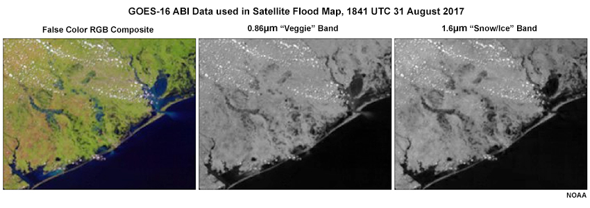
Description:
Satellite data used for flood maps including ABI false color, ABI vegetation band, and ABI snow and ice band.
File Name:
SatData_in_Floodmap.jpg
Credits:
NOAA
Copyright Terms:
COMET Standard Terms of Use
Description:
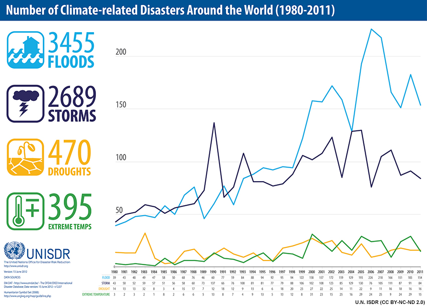
Line graph of change in number of disasters (by disaster type) 1980-2011
File Name:
UN-ISDR_1980-2011_linegraph.jpg
Credits:
U.N. ISDR (CC BY-NC-ND 2.0)
Copyright Terms:
COMET Standard Terms of Use
Description:
Quiz using GOES-16 ABI Veggie (Band 3) 1700 UTC 1 September 2017
File Name:
VeggieFeatures_Question.jpg
Credits:
NOAA
Copyright Terms:
COMET Standard Terms of Use
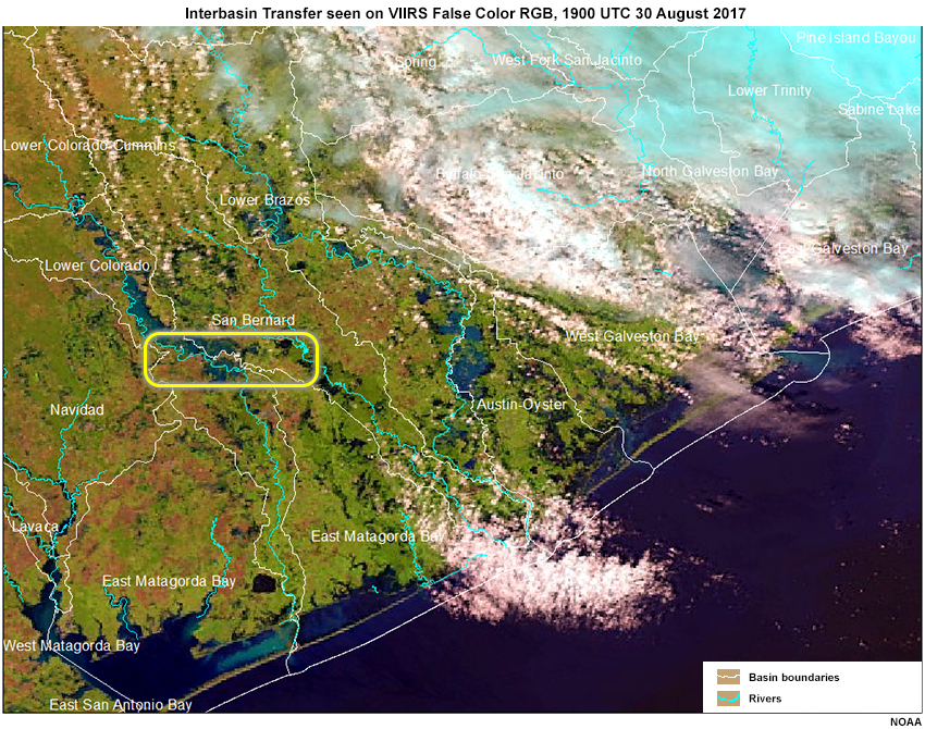
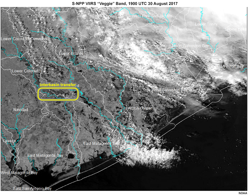
Description:
Interbasin Transfer seen on VIIRS False Color RGB, 1900 UTC 30 August 2017
File Name:
VIIRS_BasinTransfer_30Aug.jpg
Credits:
NOAA
Copyright Terms:
COMET Standard Terms of Use
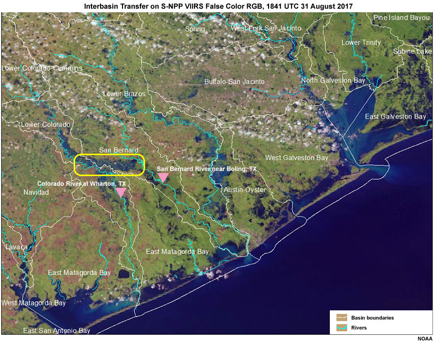
Description:
Interbasin Transfer on S-NPP VIIRS False Color RGB, 1841 UTC 31 August 2017
File Name:
VIIRS_BasinTransfer_31Aug.jpg
Credits:
NOAA
Copyright Terms:
COMET Standard Terms of Use
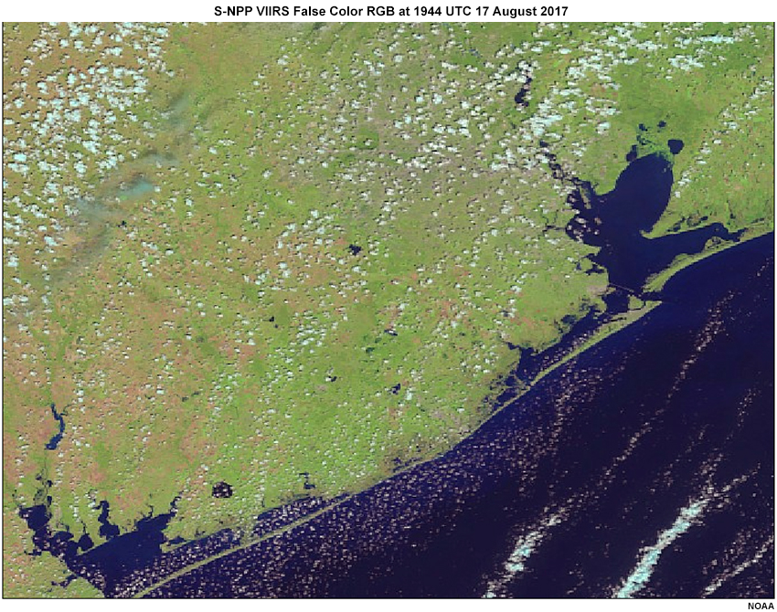
Description:
VIIRS false color flood map from August 17th 2017
File Name:
VIIRS_falsecolor_Aug17_2017_1944_noriverline.jpg
Credits:
NOAA
Copyright Terms:
COMET Standard Terms of Use

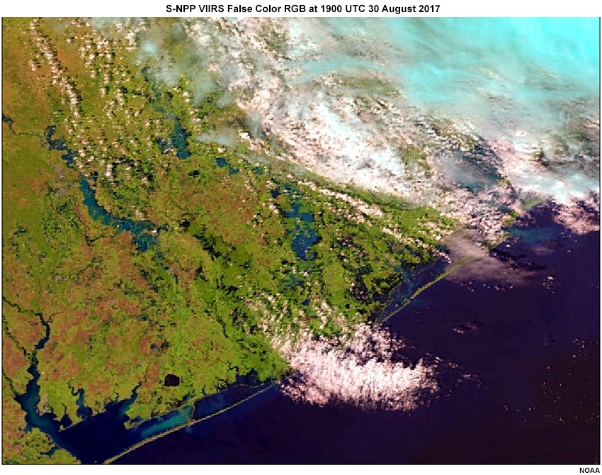
Description:
VIIRS false color flood map from August 30th 2017
File Name:
VIIRS_falsecolor_Aug30_2017_1900.jpg
Credits:
NOAA
Copyright Terms:
COMET Standard Terms of Use
Description:
VIIRS false color flood map from August 30th 2017
File Name:
VIIRS_falsecolor_Aug30_2017_1900_noriverline.jpg
Credits:
NOAA
Copyright Terms:
COMET Standard Terms of Use
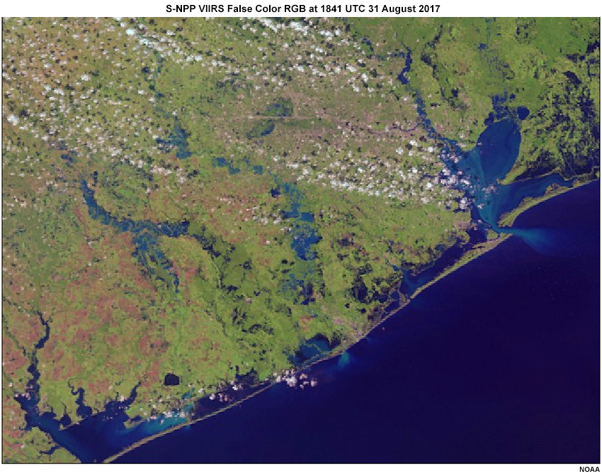
Description:
VIIRS false color flood map from August 31st 2017
File Name:
VIIRS_falsecolor_Aug31_2017_1841.jpg
Credits:
NOAA
Copyright Terms:
COMET Standard Terms of Use
Description:
VIIRS false color flood map from August 31st 2017
File Name:
VIIRS_falsecolor_Aug31_2017_1841_noriverline.jpg
Credits:
NOAA
Copyright Terms:
COMET Standard Terms of Use
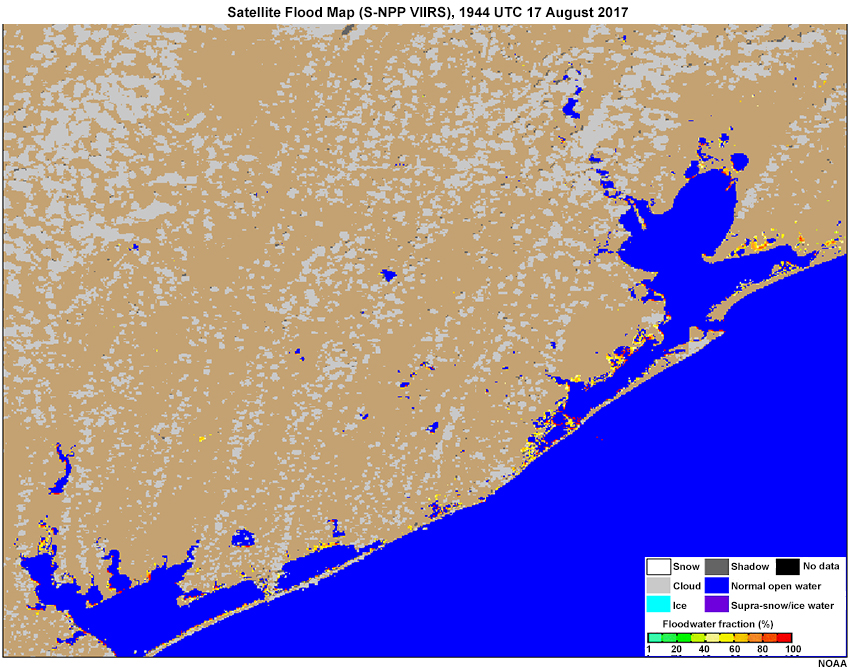
Description:
VIIRS flood map from August 17th 2017
File Name:
VIIRS_floodmap_Aug17_2017_1944_noriverline.jpg
Credits:
NOAA
Copyright Terms:
COMET Standard Terms of Use
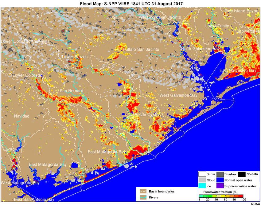
Description:
Flood Map: S-NPP VIIRS 1841 UTC 31 August 2017
File Name:
VIIRS_floodmap_Aug31_2017_1841.jpg
Credits:
NOAA
Copyright Terms:
COMET Standard Terms of Use
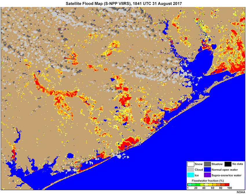
Description:
VIIRS flood map from August 31st 2017
File Name:
VIIRS_floodmap_Aug31_2017_1841_noriverline.jpg
Credits:
NOAA
Copyright Terms:
COMET Standard Terms of Use
Description:
S-NPP VIIRS “Veggie” Band, 1900 UTC 30 August 2017
File Name:
VIIRS_veggieband_Aug30_2017_1900.jpg
Credits:
NOAA
Copyright Terms:
COMET Standard Terms of Use
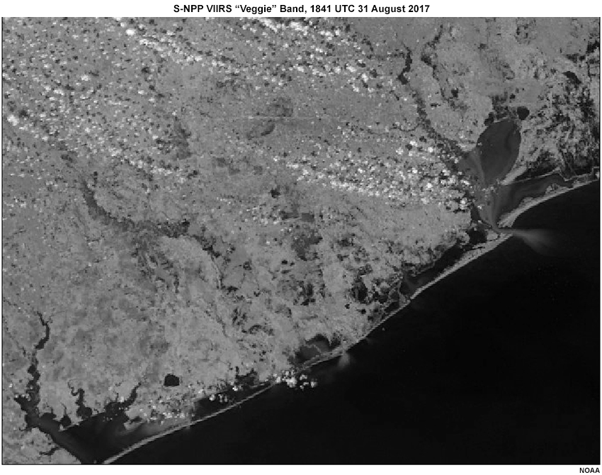
Description:
S-NPP VIIRS “Veggie” Band, 1841 UTC 31 August 2017
File Name:
VIIRS_veggieband_Aug31_2017_1841_noriverline.jpg
Credits:
NOAA
Copyright Terms:
COMET Standard Terms of Use