Transit
Today, when I arrived on the watch floor, I received an OTSR (optimal track ship routing) request for service from the skipper of the USNS Apache, one of Military Sealift Command's four Fleet Ocean Tugs. My name is AG2 Shepherd and I'm an apprentice ship router with the U.S. Navy.
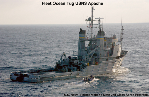
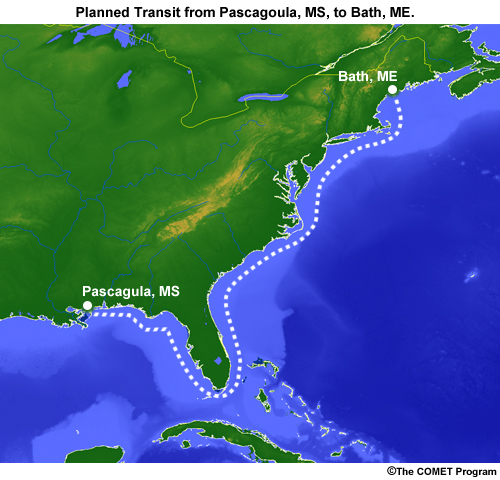
The skipper is tasked with towing a barge from the shipyard in Pascagoula, Mississippi, to one in Bath, Maine. He wants to leave 23 October. The transit is about 2500 miles long. At 10 knots, it will take about 10 days to complete.
The barge will be loaded with the superstructure for a new guided missile destroyer.
I have an apprentice forecaster who entered the movement report request, or MOVREP, into the Joint Metoc Viewer.
Departure: 2012-10-23 Pascagoula, Mississippi
Arrival: 2012-11-2 Bath, Maine
Limits:
Wind: 20 kt
Seas: bow: 8 ft / beam: 8 ft / stern: 8 ft
Speed: 10 kt
The limits are rather conservative, but the superstructure is 60 feet tall, offering ample sail area for any strong wind. And while the tug can take a beating, the barge isn't made to take large seas from any direction. This will be a long, slow transit.