The Case
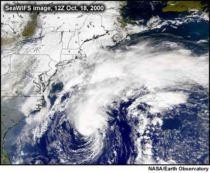
Hurricane Michael was a baroclinically initiated hurricane which formed north of the Bahamas in mid-October, 2000. An upper-level low drifted southeastward from the eastern United States and eventually stalled above an old surface frontal zone. The vorticity associated with the upper low eventually made its presence felt at the surface owing to the statically unstable atmosphere. A "subtropical" low formed, with a broad area of gale force winds well displaced from its core. With time, the circulation contracted and convection became better organized over the center. By October 17, the subtropical depression attained status of hurricane Michael.
Analyze the data associated with Michael's progression from the eyes of a Canadian forecaster in the Maritimes region of the Canadian east coast. What aspects of the data would most influence your forecast decisions? How much trust do you place in the NHC forecasts? If you are going to issue a warning, at what point should you do so? What weather elements do you forecast, for what locations, and when? Review the information provided for this case then respond to a series of questions regarding Michael's movement and potential interaction with a nearby mid-latitude trough.