Satellite Products » Dust RGB
Description
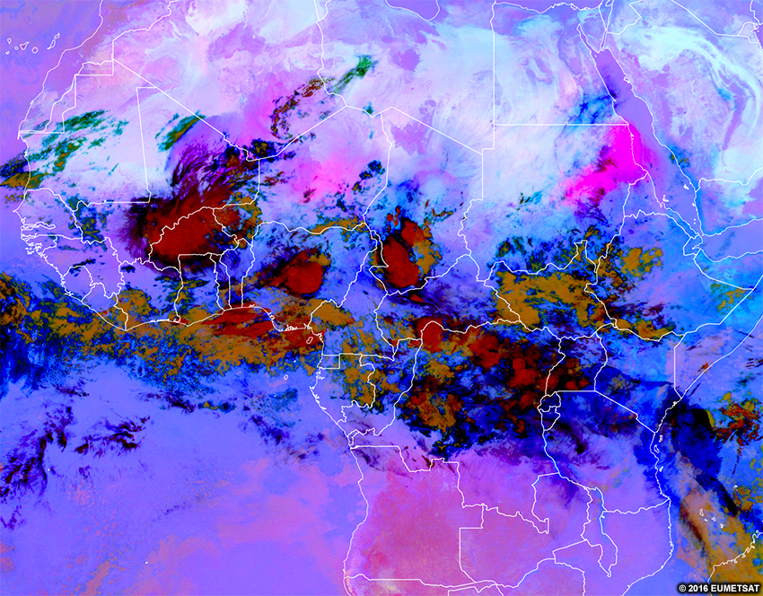
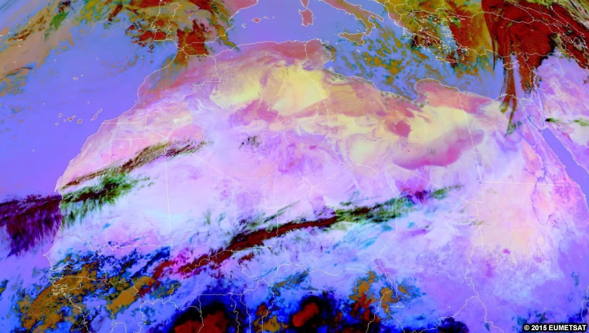
The dust RGB combines information from several infrared channels and channel differences in order to highlight dust. Dust is difficult to identify in other imagery with certainty, but it stands out clearly in shades of bright pink in this RGB.
Effective Use
Since the dust RGB is made from infrared channels, it is useful both during the day and at night. There are some minor time-of-day dependencies to consider:
- During daytime, bright pink areas are always dust. You cannot determine the height of the dust cloud-top during the day.
- During daytime, very thick dust can appear dark magenta.
- At night, dust ranges in colour from pink to purple or purple-blue. The pinker the dust area, the higher its cloud-top is. Likewise, the bluer the area, the lower the dust cloud top.
| Color | Physical Meaning at Night |
| High-level Dust | |
| Mid-level Dust | |
| Low-level Dust |
Overall, the imagery has a bluer hue during the day, since the blue colours are controlled by only the long-wave infrared channel. Thus, as temperatures increase at the start of the day, the blue tones will become stronger.
Here is the real-time imagery from the MSG dust RGB. Explore the imagery by double-clicking (pinching on mobile devices) to zoom and dragging the image to move view. Below the real-time image, you will find a list of questions to ask yourself for exploration and self-evaluation purposes.
* Live data only available for interactive lesson.
Using the real-time imagery, answer the following questions.
- Are features visible at this time of day on the RGB?
- Would these features be visible at other times of day?
- What features really stand out to your eyes in this RGB?
- What range of colours are clouds?
- Do those colours represent cloud-top heights?
- Do those colours represent cloud thickness?
- Do those colours represent temperatures?
- Do those colours represent some other process?
- What range of colours are surface features?
- Do those colours represent the temperature of the object?
- Do those colours represent the albedo of the object?
- Do those colours represent some other process?
- If you are located within the satellite viewing area of MSG, look outside for clouds and surface features. See if those features show up on the imagery by zooming in to your location. What colours do you expect those features to be in this imagery? What colours are those features in the imagery?