Media elements used in this module are protected by a variety of copyright licenses. Please use the "copyright terms" link associated with each item below for more information.
Description:
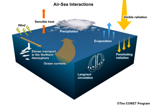
Graphical depiction of air-sea interactions
File Name:
air_sea_interaction_dynamics_1.jpg
Credits:
©The COMET Program
Copyright Terms:
COMET Standard Terms
of Use
Description:
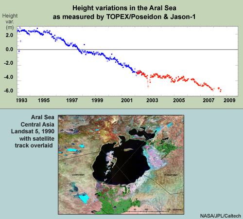
A graphic of the height variations in the Aral Sea as measured by TOPEX/Poseidon & Jason-1
along with a Landsat-5 image of the Aral Sea in Central Asia
File Name:
aralSea_landsatANDj-1hgt_var_graph.jpg
Credits:
NASA/JPL/Caltech
Copyright Terms:
COMET Standard Terms
of Use
Description:
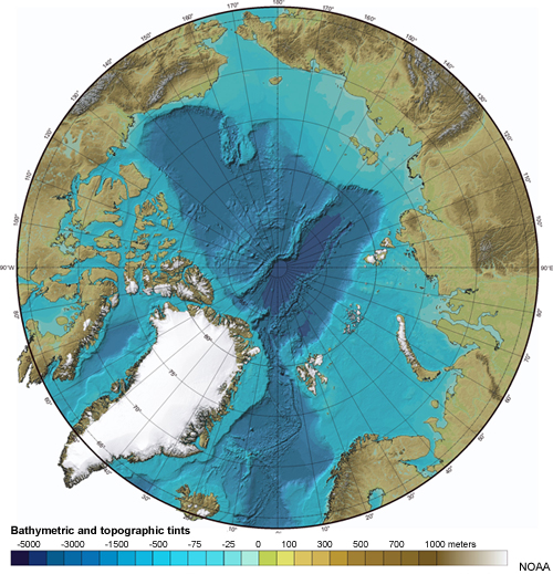
Depiction of the top of the Earth viewed from the arctic with bathymetric and topographic hints
File Name:
bath_northPole.jpg
Credits:
NOAA
Copyright Terms:
COMET Standard Terms
of Use

Description:
Benjamin Franklin's map of the Gulf Stream
File Name:
benFranklinOceanChart.jpg
Credits:
Library of Congress, Geography and Map Division
Copyright Terms:
COMET Standard Terms
of Use
Description:
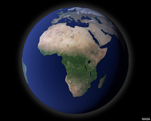
Blue Marble over Africa
File Name:
blueMarble_africa.jpg
Credits:
NASA
Copyright Terms:
COMET Standard Terms
of Use
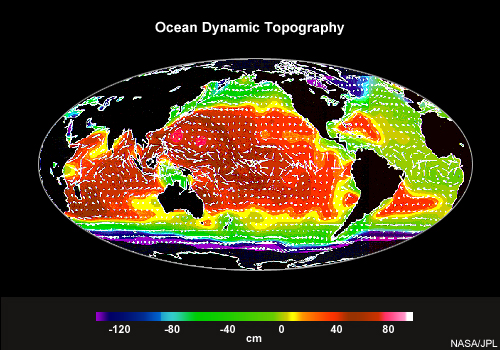
Description:
Global map showing ocean dynamic topography made from data from the TOPEX/Poseidon altimetry satellite
File Name:
dyn_topo_circulation.jpg
Credits:
NASA/JPL
Copyright Terms:
COMET Standard Terms
of Use
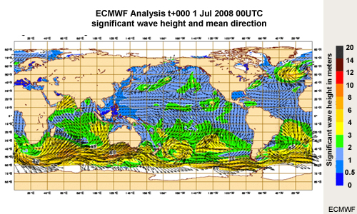
Description:
ECMWF Analysis t+000 1 Jul 2008 00UTC significant wave height and mean direction
File Name:
ECMWF_sig_wave_ht_analysis.jpg
Credits:
ECMWF
Copyright Terms:
COMET Standard Terms
of Use
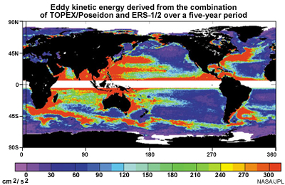
Description:
Eddy kinetic energy derived from the combination of TOPEX/Poseidon and ERS-1/2
File Name:
eddy_kinetic_energyTP_ERS.jpg
Credits:
NASA / JPL
Copyright Terms:
COMET Standard Terms
of Use
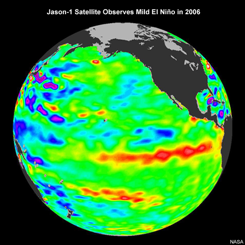
Description:
Jason-1 Satellite Observes Mild El Niño in 2006
File Name:
el_nino_15sept06.jpg
Credits:
NASA
Copyright Terms:
COMET Standard Terms
of Use
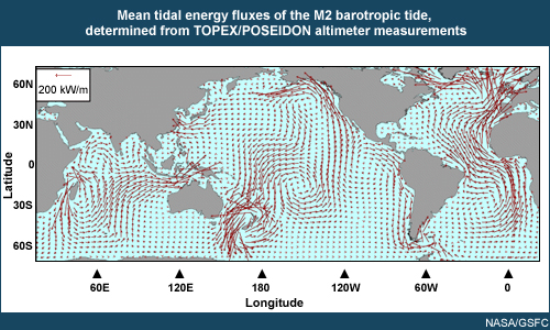
Description:
Mean tidal energy fluxes of the M2 barotropic tide, determined from TOPEX/POSEIDON altimeter measurements
File Name:
flux_energie.jpg
Credits:
NOAA / GSFC
Copyright Terms:
COMET Standard Terms
of Use
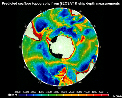
Description:
Predicted seafloor topography from GEOSAT & ship depth measurements
File Name:
geosat_oceanfloor.jpg
Credits:
NOAA
Copyright Terms:
COMET Standard Terms
of Use
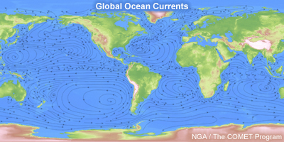
Description:
Global ocean currents
File Name:
global_currents2.jpg
Credits:
NGA/The COMET Program
Copyright Terms:
COMET Standard Terms
of Use
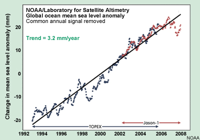
Description:
Plot of change in mean sea level anomalies from 1992 - 2008, with the trend being 3.2 mm/yr
File Name:
global_seaLevelRise_1.jpg
Credits:
NOAA
Copyright Terms:
COMET Standard Terms
of Use
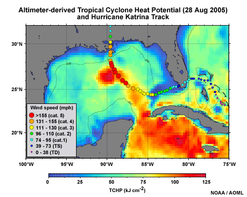
Description:
Altimeter-derived tropical cyclone heat potential for 28 Aug 2005 along with the track of Hurricane Katrina
File Name:
gom_tchp_katrina.jpg
Credits:
NOAA / AOML
Copyright Terms:
COMET Standard Terms
of Use
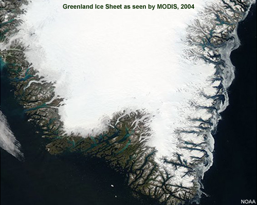
Description:
Greenland ice sheet, MODIS image, 2004
File Name:
greenland_ice_sheet.jpg
Credits:
NOAA
Copyright Terms:
COMET Standard Terms
of Use
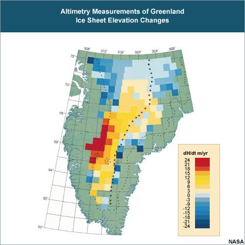
Description:
Map of southern Greenland plotted with altimetry measurements of surface elevation change between 1978 and 1988
File Name:
greenland_ice_sheet_el_changes.jpg
Credits:
NASA
Copyright Terms:
COMET Standard Terms
of Use
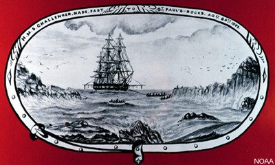
Description:
Drawing from 28 August 1873 of the H. M. S. CHALLENGER at St. Paul's Rocks
File Name:
hms_challenger_atStPaulRock.jpg
Credits:
NOAA
Copyright Terms:
COMET Standard Terms
of Use
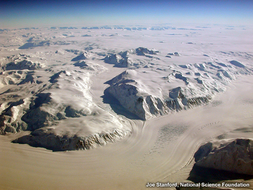
Description:
Photograph of ice and ice flows
File Name:
iceview.jpg
Credits:
Jan Stanford, National Science Foundation
Copyright Terms:
COMET Standard Terms
of Use
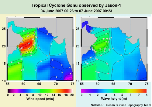
Description:
Wind speed and wave height as observed for Tropical Cyclone Gonu by Jason-1
File Name:
j-1_trackTCGonuWindSpeedWaveHeight.jpg
Credits:
NASA/JPL Ocean Surface Topography Team
Copyright Terms:
COMET Standard Terms
of Use
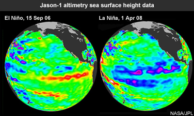
Description:
Jason-1 altimetry sea surface height data showing El Niño in 2006 & La Niña in 2008
File Name:
J1_ssh_06_elnino_08lanina_nasajpl.jpg
Credits:
NASA/JPL
Copyright Terms:
COMET Standard Terms
of Use
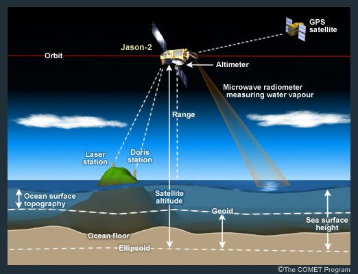
Description:
Graphical depiction of how satellite altimetry works, using Jason-2 as the sample satellite
File Name:
j2_how_alt_works.jpg
Credits:
©The COMET Program
Copyright Terms:
COMET Standard Terms
of Use
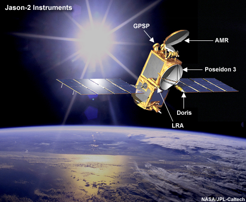
Description:
Conceptual image of the Jason-2 spacecraft in space with its instruments labeled
File Name:
j2_instruments_concept.jpg
Credits:
NASA/JPL-Caltech
Copyright Terms:
COMET Standard Terms
of Use
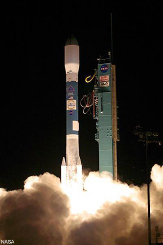
Description:
Photograph of the launch of the rocket with the Jason-2 satellite
File Name:
j2_launch_nasa.jpg
Credits:
NASA
Copyright Terms:
Creative
Commons Attribution 2.0 Generic

Description:
A depiction of Jason-2 observing sea surface height and water vapour in the atmosphere
File Name:
j2_obs_ssh.jpg
Credits:
NASA/JPL-CalTech
Copyright Terms:
COMET Standard Terms
of Use
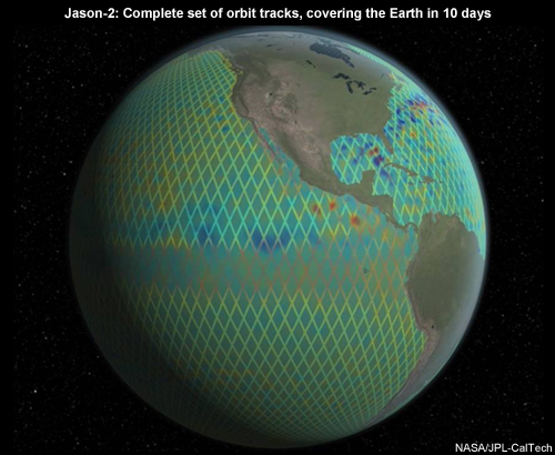
Description:
Jason-2: Complete set of orbit tracks, covering the Earth in 10 days
File Name:
j2_orbital_tracks.jpg
Credits:
NASA/JPL-CalTech
Copyright Terms:
Creative
Commons Attribution 2.0 Generic

Description:
Global map of sea level anomalies made from altimetry data from OSTM/Jason-2
File Name:
j2_seaLevelAnomalies.jpg
Credits:
NASA
Copyright Terms:
COMET Standard Terms
of Use
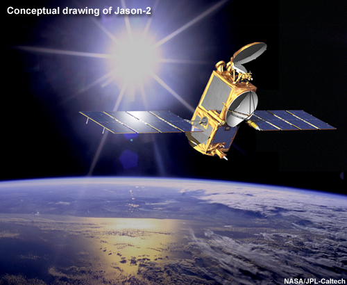
Description:
Conceptual image of the Jason-2 spacecraft in space
File Name:
j2_spacecraft_concept.jpg
Credits:
NASA/JPL-Caltech
Copyright Terms:
COMET Standard Terms
of Use

Description:
Conceptual image of the Jason-2 spacecraft in space
File Name:
j2_spacecraft_concept_small.jpg
Credits:
NASA/JPL-Caltech
Copyright Terms:
COMET Standard Terms
of Use
Description:
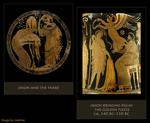
Images of Jason, the ancient Greek mariner from ancient pottery, in the Louvre collection
File Name:
jason_snake_pelias.jpg
Credits:
Image by Jastrow
Copyright Terms:
Creative
Commons Attribution 2.0 Generic
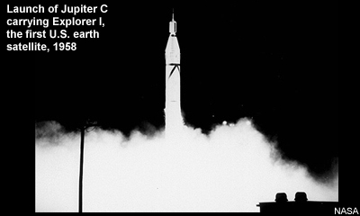
Description:
Photograph of the launch of Jupiter-C, America's first satellite, 1958
File Name:
jupiter_C_launch.jpg
Credits:
NASA
Copyright Terms:
Creative
Commons Attribution 2.0 Generic
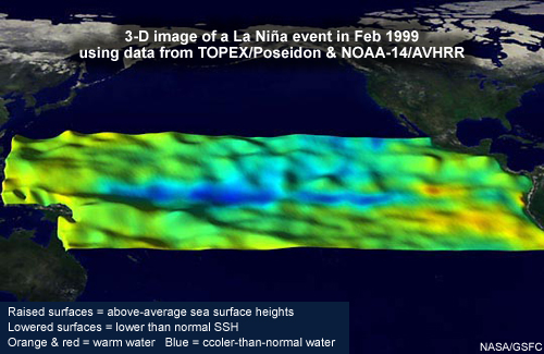
Description:
A 3-D image of a La Niña event in Feb 1999 using data from TOPEX/Poseidon & NOAA-14/AVHRR
File Name:
la_nina02_1999_3D.jpg
Credits:
NASA / GSFC
Copyright Terms:
COMET Standard Terms
of Use
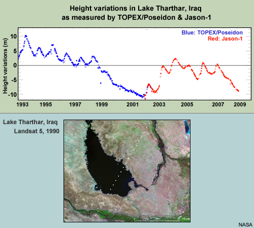
Description:
Two part graphic: Top shows a graph of height variations in Lake Tharthar, Iraq as measured by TOPEX/Poseidon & Jason-1; the bottom shows an image of the lake from Landsat 5, 1990
File Name:
lakeThartharIraq_landsatANDj-1hgt_var_graph.jpg
Credits:
NASA
Copyright Terms:
COMET Standard Terms
of Use

Description:
Map showing the large-scale ocean circulation based on data from the Topex-Poseidon altimetry satellite
File Name:
large_scale_ocea_circ_tp.jpg
Credits:
CLS/CNES
Copyright Terms:
COMET Standard Terms
of Use
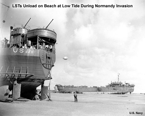
Description:
LSTs Unload on Beach at Low Tide During Normandy Invasion
File Name:
lstatlowtideww2.jpg
Credits:
US Navy
Copyright Terms:
COMET Standard Terms
of Use
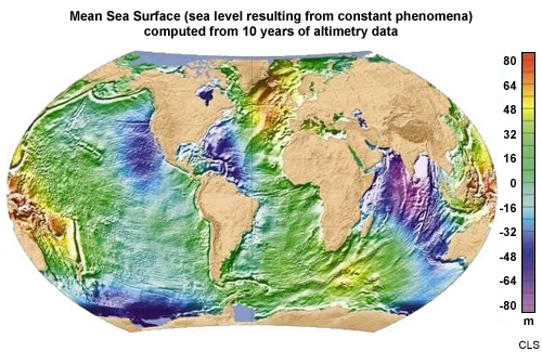
Description:
Mean sea surface, representing the sea level resulting from constant phenomena, computed from 10 years of altimetry data
File Name:
mean_sea_sfc.jpg
Credits:
CLS
Copyright Terms:
COMET Standard Terms
of Use
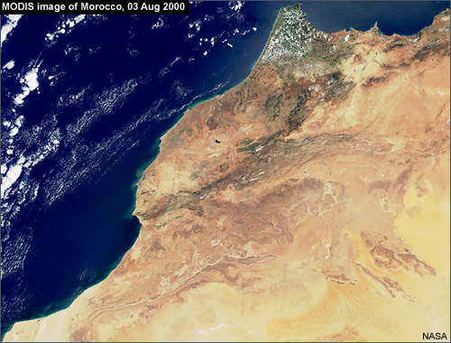
Description:
MODIS image of Morocco, 03 August 2000
File Name:
modis_morocco.jpg
Credits:
NASA
Copyright Terms:
COMET Standard Terms
of Use
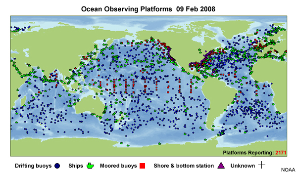
Description:
Ocean observing systems
File Name:
ocean_obs_platforms.jpg
Credits:
NOAA
Copyright Terms:
COMET Standard Terms
of Use
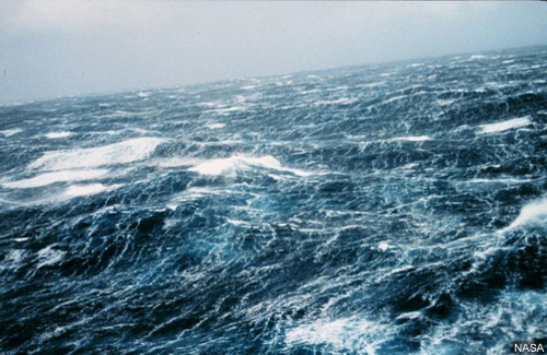
Description:
Photograph of ocean waves
File Name:
ocean_waves_nasa.jpg
Credits:
NASA
Copyright Terms:
COMET Standard Terms
of Use
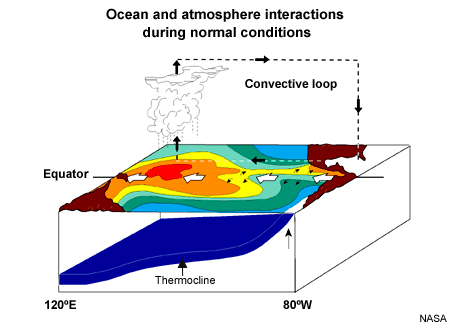
Description:
Graphical depiction of ocean and atmosphere interactions during normal conditions
File Name:
ocean-at_interaction.jpg
Credits:
NASA
Copyright Terms:
COMET Standard Terms
of Use

Description:
Sample IGDR product that shows surface velocity vectors in the Gulf Stream region on 24 Jul 1996
File Name:
offline_igdr.jpg
Credits:
EUMETSAT
Copyright Terms:
COMET Standard Terms
of Use
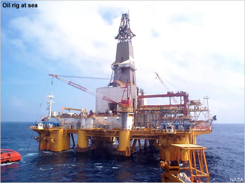
Description:
Photograph of an oil rig at sea
File Name:
oil_rig.jpg
Credits:
NASA
Copyright Terms:
COMET Standard Terms
of Use

Description:
Photograph of Francois Parisot
File Name:
parisot.jpg
Credits:
EUMETSAT
Copyright Terms:
COMET Standard Terms
of Use
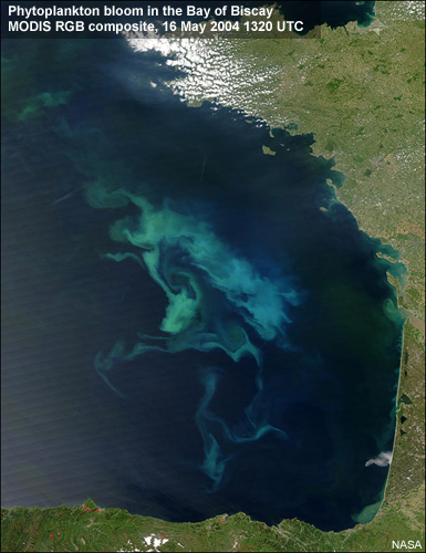
Description:
MODIS RGB composite of phytoplankton bloom in the Bay of Biscay, 16 May 2004
File Name:
phytoBloom.jpg
Credits:
NASA
Copyright Terms:
COMET Standard Terms
of Use

Description:
2 images, one showing sudden phytoplankton blooms between Africa and Madagascar as detected by a vegetation sensor onboard Spot, the other showing how well they correlate with eddies and currents as seen by an altimeter satellite
File Name:
phytoplank_blooms_sat_altimetry.jpg
Credits:
CLS
Copyright Terms:
COMET Standard Terms
of Use
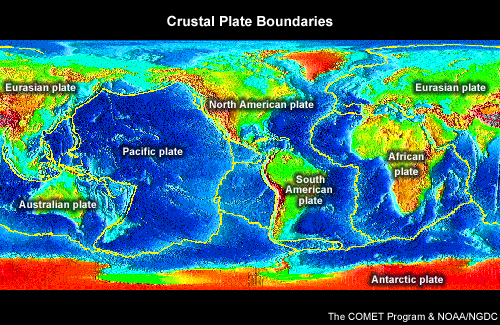
Description:
Global map with major tectonic plates with plates labeled
File Name:
plateswtopo.jpg
Credits:
The COMET Program & NOAA/NGDC
Copyright Terms:
COMET Standard Terms
of Use
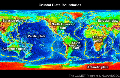
Description:
Global map with major tectonic plates with plates labeled
File Name:
plateswtopo_small.jpg
Credits:
The COMET Program & NOAA/NGDC
Copyright Terms:
COMET Standard Terms
of Use
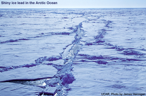
Description:
Photograph of a shiny ice lead in the Arctic Ocean
File Name:
sea_ice_arctic_ocean.jpg
Credits:
UCAR, Photo by James Hannigan
Copyright Terms:
COMET Standard Terms
of Use
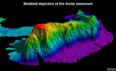
Description:
Modeled depiction of the arctic seamount
File Name:
seamounts.jpg
Credits:
NOAA
Copyright Terms:
COMET Standard Terms
of Use

Description:
Photograph of a helicopter in a search and rescue operation at sea
File Name:
search_rescue.jpg
Credits:
NOAA
Copyright Terms:
COMET Standard Terms
of Use
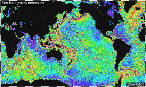
Description:
Map showing sea floor gravity anomalies from Seasat data
File Name:
seasat_global_grav_large_NGDC.jpg
Credits:
NOAA-NGDC
Copyright Terms:
COMET Standard Terms
of Use
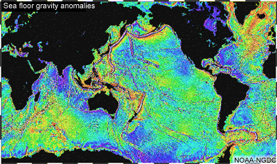
Description:
Map showing sea floor gravity anomalies from Seasat data
File Name:
seasat_global_grav_large_NGDC_small.jpg
Credits:
NOAA-NGDC
Copyright Terms:
COMET Standard Terms
of Use
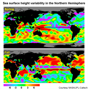
Description:
Maps made from altimetry data showing sea surface height variability in the Northern Hemisphere spring and fall centered on the Pacific Ocean
File Name:
seasons_spring_fall_nasa.jpg
Credits:
Courtesy NASA/JPL-Caltech
Copyright Terms:
COMET Standard Terms
of Use

Description:
Side bar graphic for the navigation system, made with a photograph of a sunset over the ocean
File Name:
sidebar_bg.jpg
Credits:
UCAR Digital Library / NCU
Copyright Terms:
COMET Standard Terms
of Use
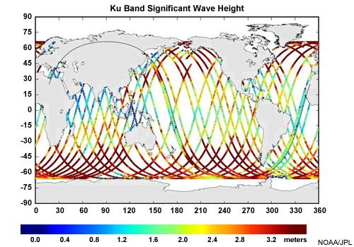
Description:
Jason-2 product showing Ku Band Significant Wave Height
File Name:
sig_wave_height.jpg
Credits:
NOAA/JPL
Copyright Terms:
COMET Standard Terms
of Use
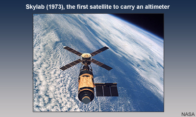
Description:
Depiction of Skylab in space
File Name:
skylab_nasa.jpg
Credits:
NASA
Copyright Terms:
COMET Standard Terms
of Use

Description:
Splash page for the Jason-2 Altimetry module
File Name:
splash.jpg
Credits:
©The COMET Program & EUMETSAT
Copyright Terms:
COMET Standard Terms
of Use
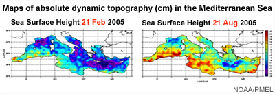
Description:
Maps showing differences in sea surface height on 21 Feb vs. 21 August 2005 in the Mediterranean Sea
File Name:
ssh_21augANDsept08.jpg
Credits:
NASA/PMEL
Copyright Terms:
COMET Standard Terms
of Use
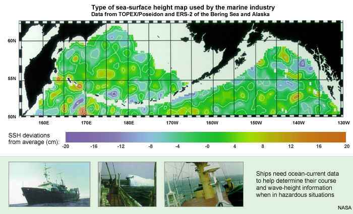
Description:
Sea-surface height map used by the marine industry plus photographs of ships at sea needing wave height and other types of information gleaned from satellite altimetry
File Name:
ssh_shipNeedingData.jpg
Credits:
NASA
Copyright Terms:
COMET Standard Terms
of Use
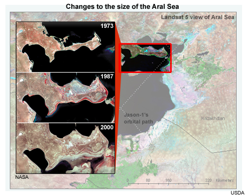
Description:
Aral Sea as viewed by Landsat 5 (1990) overlaid with Jason-1?s orbital path
File Name:
stans_aral_inset.jpg
Credits:
USDA
Copyright Terms:
COMET Standard Terms
of Use
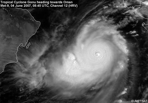
Description:
Tropical Cyclone Gonu heading towards Oman, Met-9, 04 June 2007, 08:45 UTC, Channel 12 (HRV)
File Name:
tc_2007_06_04_0845_m9_ch12.jpg
Credits:
EUMETSAT
Copyright Terms:
COMET Standard Terms
of Use
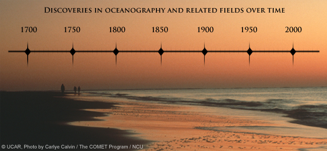
Description:
Timeline with 50 year periods spanning 1700 - 2000 marked
File Name:
timeline50years.jpg
Credits:
© UCAR, Photo by Carlye Calvin /The COMET Program/ NCU
Copyright Terms:
COMET Standard Terms
of Use
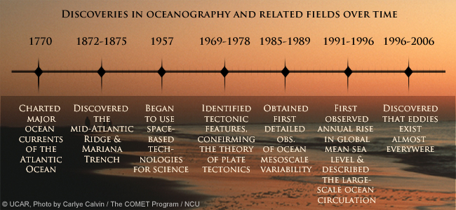
Description:
Timeline with periods of major discoveries in oceanography since 1770 and a discovery mentioned per period
File Name:
timelineFindings.jpg
Credits:
© UCAR, Photo by Carlye Calvin /The COMET Program/ NCU
Copyright Terms:
COMET Standard Terms
of Use
Description:
Timeline with periods of major discoveries in oceanography displayed over a photograph of a coastal/beach scene. Key findings for some of the periods are displayed but the text is very faint so as to be suggestive but not readable.
File Name:
timelineFindings_fuzzy.jpg
Credits:
© UCAR, Photo by Carlye Calvin /The COMET Program/ NCU
Copyright Terms:
COMET Standard Terms
of Use

Description:
Timeline with periods marked where major advances were made in oceanography based on satellite alitmetry
File Name:
timelineSpecificDatesOnly.jpg
Credits:
© UCAR, Photo by Carlye Calvin /The COMET Program/ NCU
Copyright Terms:
COMET Standard Terms
of Use
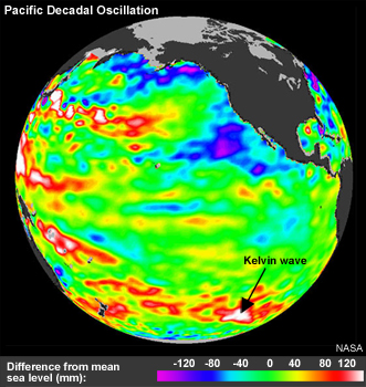
Description:
Global view of Pacific Decadal Oscillation with a Kelvin Wave highlighted
File Name:
topex_pdo_200106.jpg
Credits:
NASA JPL
Copyright Terms:
COMET Standard Terms
of Use
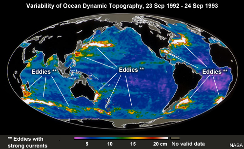
Description:
Variability of Ocean Dynamic Topography, 23 Sep 1992 - 24 Sep 1993
File Name:
tp_eddies_sep92_93.jpg
Credits:
NASA
Copyright Terms:
COMET Standard Terms
of Use
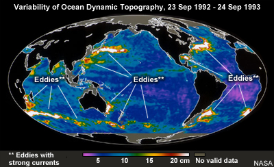
Description:
Variability of Ocean Dynamic Topography, 23 Sep 1992 - 24 Sep 1993
File Name:
tp_eddies_sep92_93_small.jpg
Credits:
NASA
Copyright Terms:
COMET Standard Terms
of Use
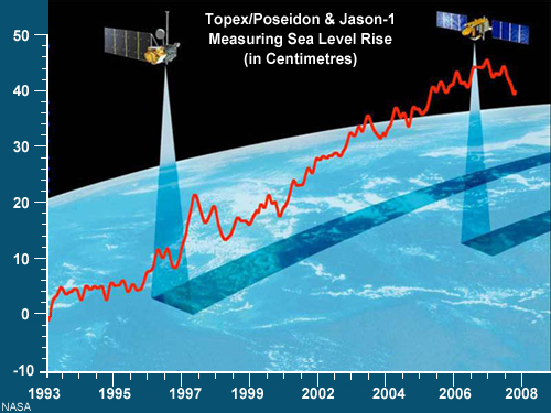
Description:
Graphic showing 2 altimetry satellites over Earth overlaid with measurements of sea level rise from 1993-2008
File Name:
tp_j-1_seaLevelRise.jpg
Credits:
NASA
Copyright Terms:
COMET Standard Terms
of Use
Description:
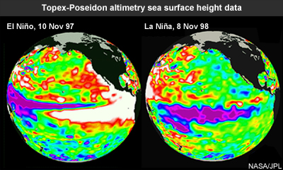
Topex-Poseidon altimetry sea surface height data showing El Niño & La Niña
File Name:
tp_ssh_nov97elnino_dec98lanina_small.jpg
Credits:
NASA / JPL
Copyright Terms:
COMET Standard Terms
of Use
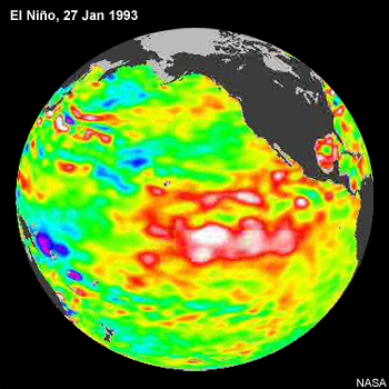
Description:
Map created from altimetry data showing an El Nino episode in the Pacific Ocean, 27 Jan 1993
File Name:
tp_ssh_pacific_elnino_jan1993.jpg
Credits:
NASA
Copyright Terms:
COMET Standard Terms
of Use
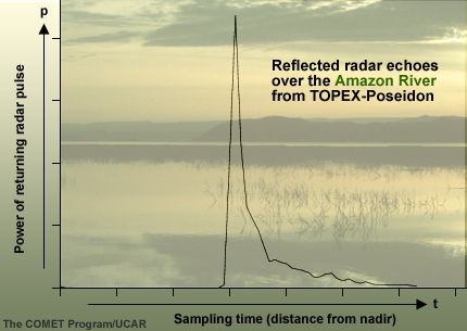
Description:
Plot of reflected radar echoes over the Amazon River from TOPEX-Poseidon
File Name:
tp_waveform_amazon.jpg
Credits:
The COMET Program/UCAR
Copyright Terms:
COMET Standard Terms
of Use
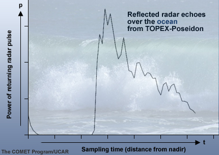
Description:
Plot of reflected radar echoes over the ocean from TOPEX-Poseidon
File Name:
tp_waveform_ocean.jpg
Credits:
The COMET Program/UCAR
Copyright Terms:
COMET Standard Terms
of Use
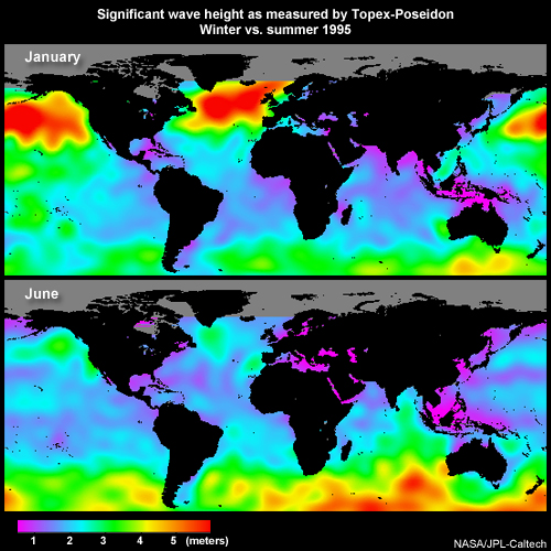
Description:
Significant wave height as measured by Topex-Poseidon Winter vs. summer 1995
File Name:
tp_wind_wave_janjun1995.jpg
Credits:
NASA/JPL-CalTech
Copyright Terms:
COMET Standard Terms
of Use
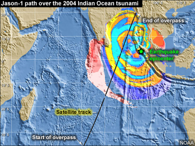
Description:
Map showing Jason-1's path over 2004 Indian Ocean tsunami
File Name:
tsunami_jason_path.jpg
Credits:
NOAA
Copyright Terms:
COMET Standard Terms
of Use
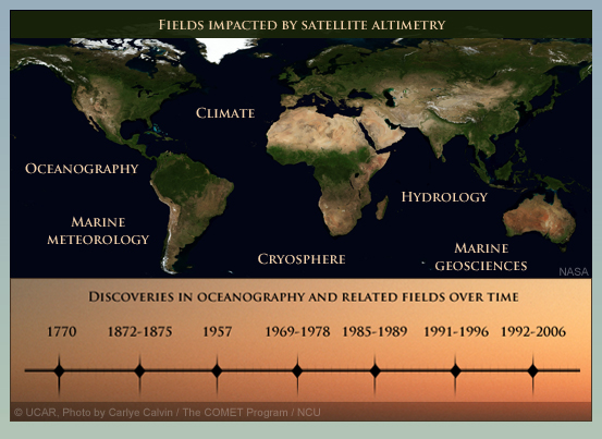
Description:
Combination of two images in the module: the timeline and fields impacted by altimetry data
File Name:
worldMap_timeline.jpg
Credits:
©UCAR, Photo by Carlye Calvin / The COMET Program / NCU
Copyright Terms:
COMET Standard Terms
of Use

Description:
Map of the world with five disciplines labeled whose practical applications benefit from satellite altimetry; each discipline is accompanied by an identifying image
File Name:
worldMap5applications.jpg
Credits:
NASA, EUMETSAT, UCAR, NOAA
Copyright Terms:
COMET Standard Terms
of Use

Description:
Map of the world with five of the Earth science disciplines labeled and accompanied by an identifying image
File Name:
worldMap5disciplines.jpg
Credits:
NASA, EUMETSAT, UCAR, NOAA
Copyright Terms:
COMET Standard Terms
of Use