
Eruption Dynamics
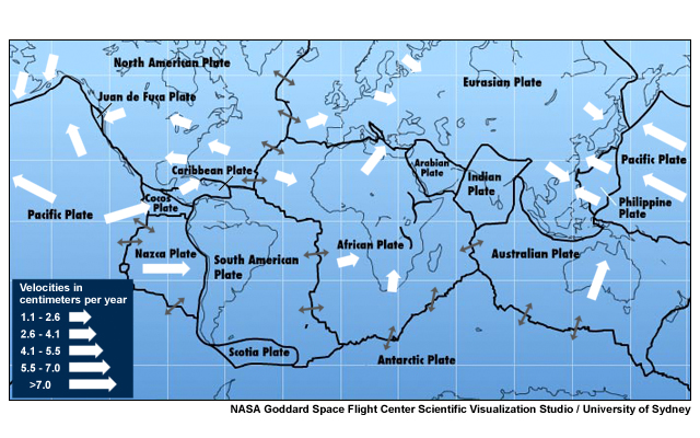
Earth’s outermost solid layer is called the lithosphere. It includes the crust and the upper part of the mantle. The lithosphere is broken into a series of tectonic plates that glide on the fluid-like asthenosphere: a slow-moving layer of semi-solid rock.
Question
Where do you think geological activity like earthquakes and volcanic eruptions occur most frequently? (Choose the best answer.)
The correct answer is d).
The locations where plates interact are known as plate boundaries and are areas of geological activities like earthquakes and volcanic eruptions.
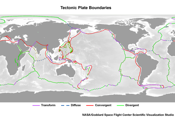
In general, there are three types of boundaries defined by the relative motion of the plates:
- Convergent boundaries — where crust is destroyed as one plate dives under another, such as the Andes Mountains or the Marianas Trench.
- Divergent boundaries — where new crust is generated as the plates pull away from each other, such as the Mid-Atlantic Ridge.
- Transform boundaries — where crust is neither produced nor consumed as the plates slide horizontally past each other, such as the San Andreas fault in California, along east-west portions of the Mid-Atlantic Ridge, in the Caribbean, along the south edge of the South American Plate, and along sections of other plate boundaries, including the Eurasian Plate, Indian Plate, and Arabian Plate.
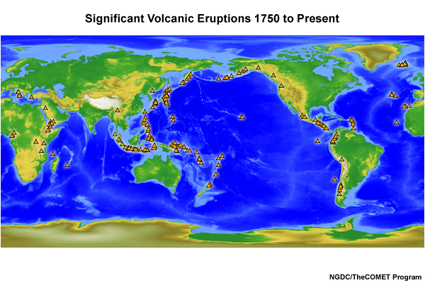
Note that while volcanism is abundant along divergent and convergent plate boundaries, it is far less common along transform plate boundaries. To learn more about plate tectonics, visit http://volcanoes.usgs.gov/about/edu/dynamicplanet/nutshell.php.

Most explosive volcanic eruptions occur along convergent boundaries where one plate sinks (is subducted) under another (1) as can be seen on this image. As the oceanic crust descends under continental crust, it encounters progressively greater pressure. At a depth of about 62 miles (100 km) (2), oceanic crust releases fluids, which rise and initiate partial melting of the overlying continental crust. The molten rock, called magma, rises toward the surface and collects in magma chambers (3). A rupture in Earth’s crust through which magma, volcanic gases and hydrothermal fluid reach the surface is called a volcano (US Geological Survey).