Introduction
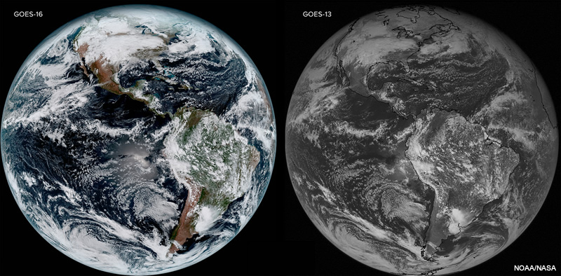
GOES-16, first in the GOES-R series, launched in November 2016 and now provides 16 multispectral bands of satellite data. Visible imagery is now available at 0.5km spatial resolution and infrared imagery at 2.0km resolution (both are four times higher than legacy GOES). Scans every five minutes at the CONUS scale represent a three times greater temporal resolution compared to legacy GOES. In this lesson, we will harness GOES-16’s increased temporal and spatial resolutions to identify convective development and intensity signatures, and compare the experience to using legacy GOES products.
By the end of this lesson, you will be able to:
- Identify common convective development and intensity signatures on longwave IR and visible satellite imagery.
- Observe the difference in resolution between new GOES-16 and legacy GOES-13/15 visible and infrared imagery, and be able to describe the convective signature advantages that GOES-16 provides.