Raw (Not Remapped) AVHRR Imagery (Page 2 of 6)
Return to the previous menu.
This image shows a NOAA-14 AVHRR visible image over the central U.S. It shows the raw satellite view without any re-projection or remapping. So why does the image look less distorted in the center than on the sides? It is because the AVHRR resolution is excellent at subpoint (1.1 km), but degrades toward the scan edge. Thus the states at the edge of the view look "compressed."
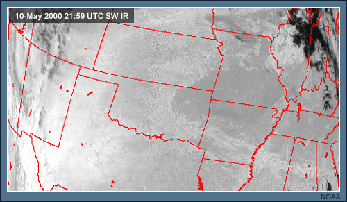
The difficulty with viewing data in these distorted mode is that the feature that you're interested in may be in a "compressed area." The current image is a shortwave (3.7 µm) IR image from the same NOAA-14 satellite pass. You may be able to notice the very small white dot in northern New Mexico. This is a "hot spot" detected by this channel from sub-pixel resolution heat sources on the ground. However, due to image distortion, this region cannot be examined very well. That is why re-projection or remapping of the data is so useful, as you will see in the next set of images.