Feature Identification Exercises
Print Version
Case Example 3: North Dakota
North Dakota Imagery
Page 1: Introduction
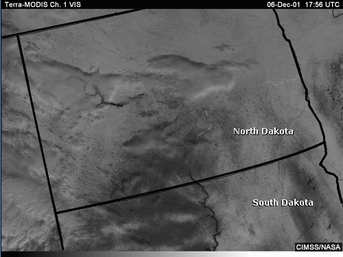
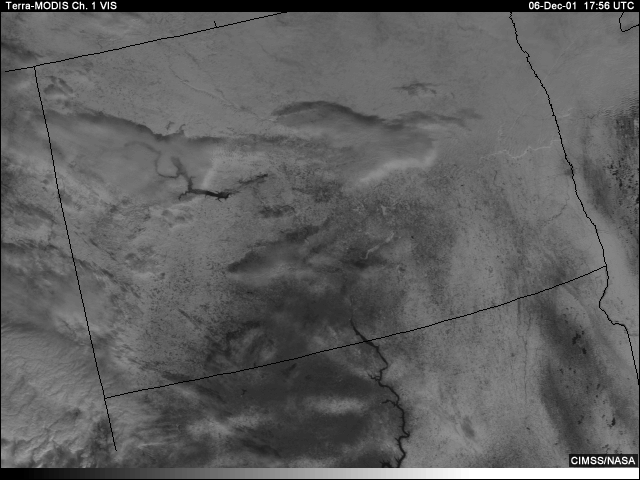
This visible MODIS image was taken over North Dakota. The scene appears to include a mixture of clouds, snow on the ground, small lakes, and various river-like features. Some of the cloud features cast shadows indicating either middle- or high-level clouds. We are unsure whether or not low clouds are present due to the presence of snow-covered terrain across much of the area.
Page 2: Channel Selection: Finding Thin Stratus Cloud over Snow
The visible channel shows patches of thin stratus over snow-covered ground across portions of central and west-central North Dakota. There is also the hint of a cloud/no-cloud boundary over northeastern portions of the state. What channel or channels could shed more light on the presence of additional stratus not apparent in the visible channel image?
visible
1.6
micrometers
3.9 micrometers
11 micrometers
Answer:
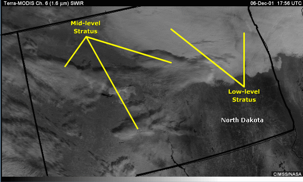
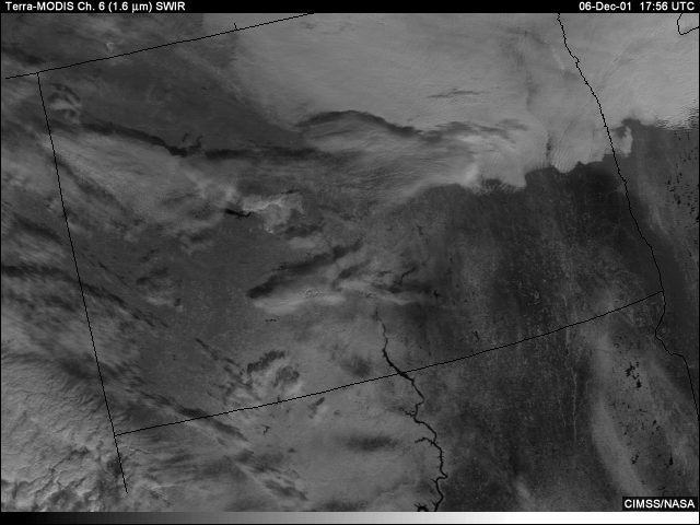
Here, combining MODIS channels 6 and 22, the shortwave IR channels at 1.6 and 3.9 micrometers, produces
the best results. With its increased sensitivity to water and ice clouds, the 1.6-micrometer channel clearly
delineates the presence of additional low-level stratus over northeastern North Dakota. Notice how well this
channel defines boundaries between cloud and snow-covered ground.
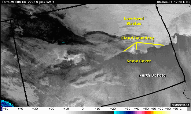
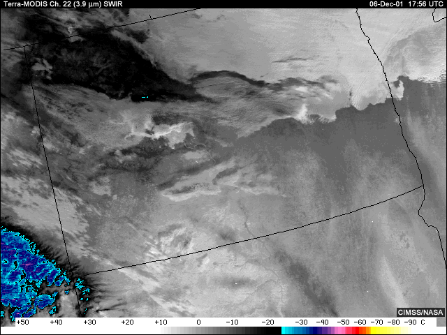
At 3.9 micrometers, low stratus and cloud/no-cloud boundaries also stand out, particularly when clouds appear adjacent to the relatively poorly-reflective and typically colder snow and ice surfaces.
Page 3: Identification Task:
Valley Fog/Stratus Cloud and Ice-Covered Rivers
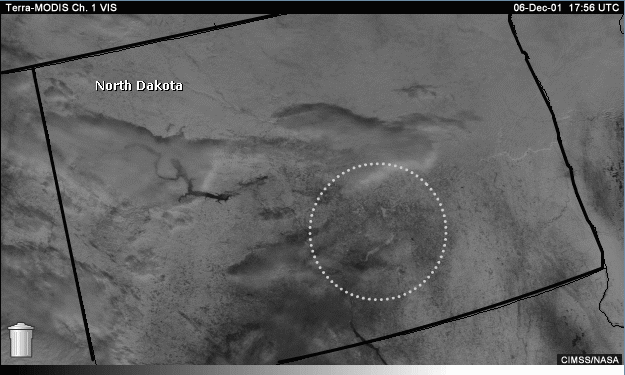
Looking at the visible channel over south central North Dakota, there appears to be a bright, river-like feature. Are these bright areas frozen rivers or valley fog/stratus? (Ignore the trash can.)
Hints:
The bright feature looks like a frozen river and indicates the presence of clouds, snow, or ice cover.The properties of the shortwave infrared channels should then help you determine whether the river-like feature is snow or cloud covered.
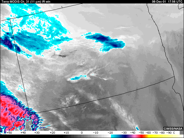
The 11-micrometer channel adds little useful information. The river-like feature appears similar in temperature to adjacent areas making it difficult to isolate.
Answer:
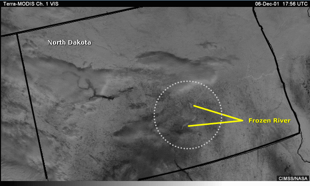
Comparison of the feature in the available channels seems to indicate a frozen surface, possibly a river, covered by either snow, ice, or a combination of both. The visible indicates the presence of clouds, snow, or ice cover.
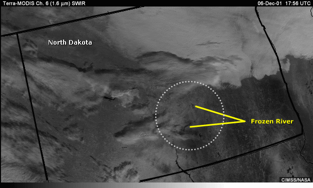
Having ruled out open water, we can use the 1.6-micrometer channel to determine whether the feature is cloud or ground. In this case, the feature appears dark (poorly reflective) at 1.6 micrometers indicating the presence of a frozen surface.
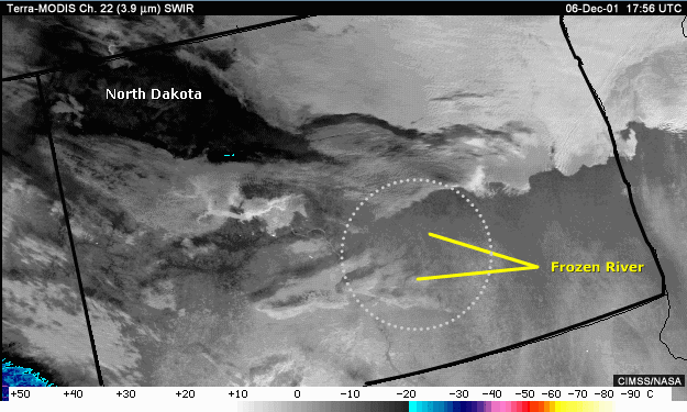
And while the 3.9-micrometer channel hints at a relatively cool surface, it’s difficult to confirm from this channel alone whether the surface is frozen or even relatively cooler open water surrounded by warmer ground.
North Dakota Summary
· A combination of the visible and 1.6-micrometer channels helps
confirm thepresence of a
frozen river that could have been
interpreted as either snow, ice, valley fog, or stratus
with visible imagery alone
· 3.9-micrometer imagery was able to confirm that the low clouds
detected are likely
composed of water droplet due to their
relatively warm/reflective appearance
· Both 1.6 and 3.9-micrometer channel imagery were able to identify
low clouds andcloud
boundaries difficult to see in the visible and
longwave infrared channels