Feature Identification Exercises
Print Version
Case Example 4: Northeast U.S.


Page 1: Introduction
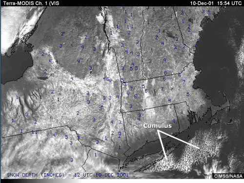
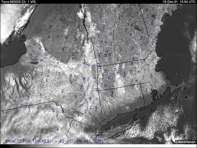
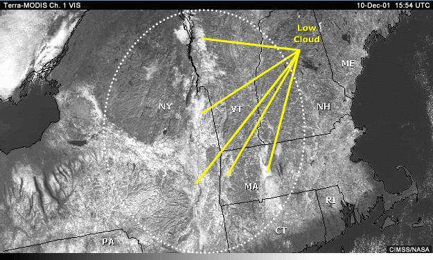
This visible channel image was taken in the wake of an early, winter-like snowstorm that deposited several inches of snowfall over large portions of the northeastern U.S. The blue numbers indicate snow depth in inches. The scene in question appears to be composed primarily of a mixture of snow-covered ground, mixed forest, bare ground, open lakes, and rivers. Patches of cumulus clouds also appear off the coast as the less stable colder continental air is warmed and moistened by relatively warmer ocean waters.
Page 2: Identification Task:
Distinguishing Cloud from Snow on the Ground
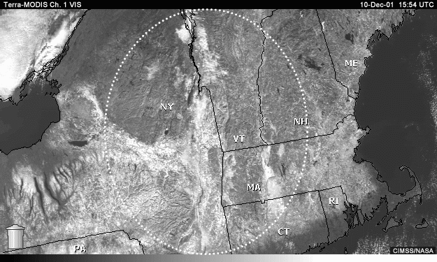
The entire circled area appears covered by snow to some degree. Are there clouds in this scene as well? Locate areas of clouds and snow on the ground.
Hints:
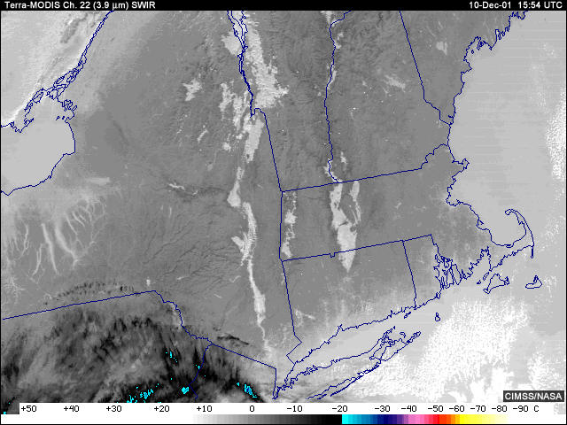
The properties of the shortwave infrared channels should then help you determine whether clouds are
present.
Shadows can also be useful in locating clouds, especially for middle- and higher-level clouds.
Once clouds are identified, the 11-micrometer image can help determine cloud height.
Answer:
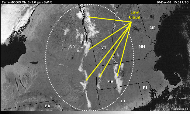
A look at the 1.6-micrometer channel quickly points out that some of the valleys are covered by clouds, probably low clouds.
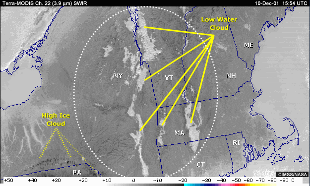
In the absence of the 1.6-micrometer channel, the 3.9-micrometer channel will also indicate the presence of clouds and at the same time provide additional information on cloud phase (water vs. ice).
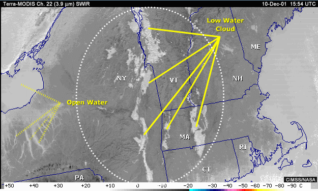
Nearby bodies of open water also appear relatively warm/bright and could be mistaken for clouds.
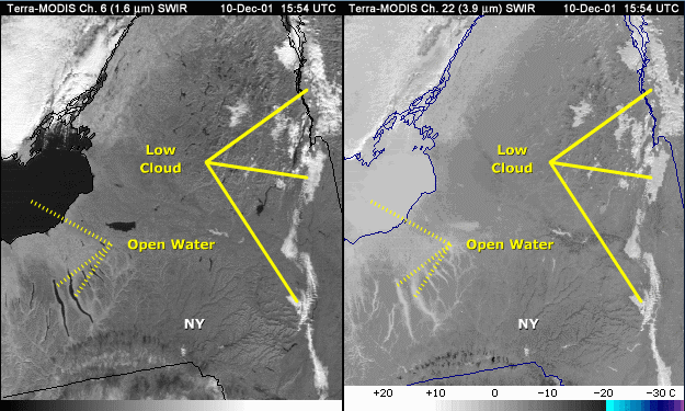
But both visible and 1.6-micrometer channels help rule out the presence of clouds over what is open water.
Page 3: Identification Task: Dark Features in Northeastern New York
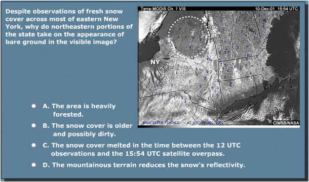
Choose the best answer.
Answer:
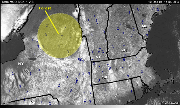
This area is heavily forested, and tree canopies typically mask the ground below. The relatively poorly reflective trees help to darken the underlying snow cover in the visible.
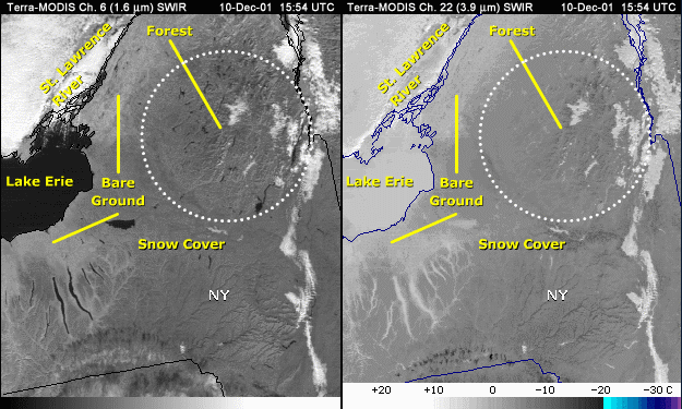
Both the 1.6-micrometer and 3.9-micrometer channels help confirm the presence of snow cover. Recall that at 1.6 and 3.9 -micrometers, snow and ice surfaces are poorly reflective when compared to neighboring bare ground. We notice that the area in question appears darker than nearby bare ground along Lake Erie and on the New York side of the St. Lawrence River.

Answer B is incorrect, since we know the snow cover is relatively new.
Answer C is
incorrect, since we can confirm the presence of snow or ice cover by examining either 1.6-or 3.9-micrometer
imagery.
Answer D is incorrect, since snow would be apparent with the visible channel, even in rugged
mountain terrain.
New England Summary
· The 1.6- and 3.9-micrometer channels confirmed the presence
of clouds
over a snow covered scene where discriminating snow
cover from clouds using visible alone
would have been
nearly impossible
· The 1.6- and 3.9-micrometer channels confirmed the presence
of snow cover
within forested regions where the visible imagery
had difficulty seeing the snow