COMET's Earth Gauge modules, created in partnerhip with the National Environmental Education Foundation (NEEF), treat a variety of environmental education topics. They are designed to meet broadcast meteorologists' needs for communicating to their communities, providing models for how to communicate to a general audience about environmental issues. Each module contains a wealth of take-away material that can be used to enhance your own community outreach and education activities. These modules will also count for continuing education credit under the AMS CBM certification program.
This course discusses climate change, particularly as it is currently being affected by increasing concentrations of greenhouse gases emitted by human activities. It also covers signs of climate change, how scientists study climate, the current thinking on future changes, and what can be done to minimize the effects. The "Resources" section (accessed from the initial page) provides links to images used in the module, an extensive list of references, and a Powerpoint presentation that can be downloaded by broadcasters to modify for their outreach activities.
This course will help meteorologists and others broaden their understanding of the impacts of weather and climate on public health, including the impacts of heat waves and cold temperatures, winter storms and thunderstorms, flooding, drought, poor air quality, tornadoes, hurricanes, wildfire, UV radiation, and others. This course is directed to broadcast meteorologists, in particular, who play a critical role in the community by helping the public to protect against weather-related health threats and by promoting good health. The course also describes the public health communication system, providing information about reliable public health services, tools, and resources.
This short course provides broadcast meteorologists, educators, and the public with an overview of the evolution of our modern urban environment with a focus on impacts on the watershed, air quality, and climate. Each unit in the course includes information on ways to reduce our impact on our water and air with ideas ranging from simple changes in our commuting and housekeeping habits to changes in how we build houses and roads.
This course complements the course Watersheds: Connecting Weather to the Environment and both are part of the Earth Gauge environmental curriculum for weathercasters and educators. This curriculum is being developed by the National Environmental Education Foundation (NEEF) in cooperation with the COMET Program.
This short course provides broadcast meteorologists with knowledge and instructional materials to help them understand watersheds as our environmental home and to help their viewers understand the relationship between the weather and the health and protection of the environment. Environmental impacts in many areas of the country result from the daily actions of people. We can easily see the consequences of a major oil spill at sea that is driven ashore by winds and ocean currents, but what about the fertilizer that people put on their lawns and the de-icer they apply to their driveway, or changing the car’s oil in the backyard, or the pet waste in the yard or local park? Combined with weather, all of these have an impact on both the local environment and the larger regional environment.
Additional MetEd Modules
MetEd offers a large and growing library of Web-based training modules on many weather and related science topics. The following condensed list has been selected as especially relevant to weathercasters and broadcast meteorologists.
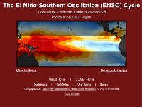
This
presentation, featuring Dr. Vernon Kousky (NOAA/CPC), introduces
both phases of the ENSO cycle, including a discussion of the
associated global impacts of these events. The newly established “Operation
Niño Index” (ONI) is also explained. One of the
students who attended the live presentation commented that, “ENSO
[was the] best presentation of the workshop! Very comprehensive,
from the basics to the more complex issues, easy to follow,
and great use of graphics. The presenter did an excellent job
of relating the presentation topics to forecasters.
This
Webcast, presented by Nolan Doesken, was the first streaming
video presentation released by the COMET Program. This entertaining
lecture serves as a helpful reminder of the problems that often
plague rain gauge performance and includes discussions of the
widely used ASOS rain gauge.
This
module features an audio and visual tour of sites affected
by the Fort Collins, Colorado urban flood that occurred on
28 July 1997. The tour is led by Matthew Kelsch and includes
eyewitness accounts of that night's events from John Weaver.
This interactive virtual field trip module summarizes many
of the important common aspects of flash floods occurring in
urban environments.
Fog frequently forms in response to dynamically
forced changes in the boundary layer. This module examines
dynamically forced fog in the coastal and marine environment,
focusing on advection fog, steam fog, and west coast type fog.
The focus of the module is on the boundary layer evolution
of air parcels as they traverse trajectories over land and
water. The module also examines mesoscale effects that impact
the distribution of fog and low-level stratus over short distances.
A general discussion of forecast products and methodologies
concludes the module.
This module starts with a forecast scenario
that occurs during a winter radiation fog event in the Central
Valley of California. After that, a conceptual section covers
the physical processes of radiation fog through its life cycle.
Operational sections addressing fog detection and forecasting
conclude the module.
Although you are not forecasting for aviation,
this course provides a wealth of material that can help you
improve your fog forecasting skills. The course consists of
11 modules—you can take as many or as few as you wish.
If you register through the MetEd
Registration and Assessment system, your progress through
the course will be tracked. You’ll receive a certificate
of completion for each module quiz you successfully pass and,
if you take all of the modules, you’ll receive a course
completion certificate.
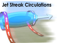
This
Webcast is based on a presentation given by Dr. James T. Moore
of Saint Louis University at the 5th Annual MSC/COMET Winter
Weather Workshop on 30 November 2004 in Boulder, Colorado.
Dr. Moore reviews many aspects of jet streak dynamics including
convergence/divergence, ageostrophic winds, propagation, and
coupled jets.
This
module discusses the role of wind shear in the structure and
evolution of convective storms. Using the concept of horizontal
vorticity, the module demonstrates how shear enhances uplift,
leading to longer-lived supercell and multicell storms. The
module also explores the role of shear in the development of
mesoscale convective systems, including bow echoes and squall
lines. Most of the material in this module previously appeared
in the COMET modules developed with Dr. Morris Weisman. This
version includes a concise summary for quick reference and
a final exam to test your knowledge. Like previous modules
in the Mesoscale Meteorology Primer, this module comes with
audio narration, rich graphics, and a companion print version.
Model
Fundamentals, part of the Numerical Weather Prediction Professional
Development Series, describes the components of an NWP model
and how they fit into the forecast development process. It
also explores why parameterization of many physical processes
is necessary in NWP models.
The module provides background information for the Characteristics
of Operational NWP Models module (also in the NWP PDS), which
contains current information about the characteristics and
architecture of commonly used operational models, their operationally
significant strengths and weaknesses, and model assessment
tools.
The subject matter expert for this module is Dr. Ralph Petersen
of the National Centers for Environmental Prediction, Environmental
Modeling Center (NCEP/EMC).
This
module introduces forecasters to ten of the most commonly encountered
or significant misconceptions about NWP models. This list of
ten misconceptions includes issues surrounding data assimilation,
model resolution, physical parameterizations, and post-processing
of model forecast output.
This
Webcast is based on a COMET classroom presentation by Dr. Gary
Lackmann at the 2nd MSC Winter Weather Course held in Boulder,
Colorado on 22 February 2002. Dr. Lackmann reviews the basic
thermodynamics of freezing and melting and how operational
models represent these processes. He also touches upon the
biases that occur in the models by looking at examples of melting
snow aloft, melting snow at the surface, freezing aloft (ice
pellets), and freezing rain. Dr. Lackmann is a faculty member
in the Department of Marine, Earth, and Atmospheric Sciences
at North Carolina State University.
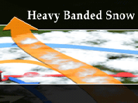
This
webcast is based on a presentation by Dr. Moore MSC/COMET Winter
Weather Workshop in Boulder, CO, 4 December 2002. In it, he
covers the definition of the TROWAL and its role in heavy snow
production in the form of bands primarily located to the northwest
of the surface low. The various conveyor belts associated with
mature winter cyclones are emphasized. The roles of mid-level
frontogenesis and conditional symmetric instability in these
systems are discussed in the context of heavy snow development.
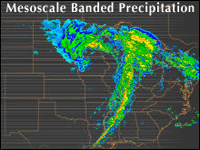
Precipitation
frequently falls and accumulates in discrete bands with accumulations
that vary markedly over short distances. This module examines
several mechanisms that result in mesoscale banded precipitation,
focusing primarily on processes at work in midlatitude cyclones.
The module starts with a review of the Norwegian and conveyor
belt cyclone models. Then several banding processes are examined
in detail, including deformation/frontogenesis, the Trowal
(Trough of Warm Air Aloft), frontal merger, CSI/slantwise convection,
and melting/evaporation-induced circulations. The module concludes
with discussions of the representation of banded precipitation
by NWP models and the detection of banded precipitation with
satellite sensors.
A series of nine presentations introduces broadcast meteorologists to the new capabilities of the GOES-R series, and how the imagery will improve forecasting. Learners can receive a certificate which to document continuing education credits toward maintaining certification for the AMS CBM and NWA Seal of Approval.
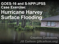
Through the use of interactive exercises the learner will become familiar with use and interpretation of satellite imagery in regions with surface flooding. The lesson will use data from both the S-NPP Visible Infrared Imaging Radiometer Suite (VIIRS) and the GOES-16 Advanced Baseline Imager (ABI). The satellite-derived flood map and the data that go into the flood map are both highlighted in the lesson.
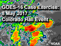
This lesson harnesses GOES-16's increased temporal and spatial resolutions to identify convective development and intensity signatures on traditional longwave IR and visible band imagery, and compares the experience to using legacy GOES products.
This course includes four core lessons illustrating the capabilities offered by the next generation of polar-orbiting satellites:
Suomi NPP: A New Generation of Environmental Monitoring Satellites
Introduction to VIIRS Imaging and Applications
Advances in Space-Based Nighttime Visible Observation, 2nd Edition
Microwave Remote Sensing: Overview, 2nd Edition
Optional lessons provide information about the benefits of JPSS observations for monitoring river ice and flooding, wildland fires, climate, and land and ocean surfaces, as well as for atmospheric profiling and numerical weather prediction.
The three core lessons in this course provide an introduction to the GOES-R satellite capabilities:
GOES-R: Benefits of Next-Generation Environmental Monitoring
GOES-R ABI: Next Generation Satellite Imaging
GOES-R GLM: Introduction to the Geostationary Lightning Mapper
The course provides training for forecasters, decision makers, students, researchers and others who have either a need or interest to develop or improve their understanding of the capabilities, value, and anticipated benefits from the GOES-R suite of instruments engineered for improved monitoring of meteorological, environmental, climatological, and space weather phenomena and related hazards.
The
purpose of this computer-based course, Community Hurricane
Preparedness, is to provide emergency managers and decision
makers who cannot attend the course with basic information
about:
How hurricanes form
The hazards they pose
How the NWS forecasts future hurricane behavior
What tools and guiding principles can help emergency managers
prepare their communities
This
website provides an overview of factors that affect the ignition
and spread of wildfire. Information is presented with 3-dimensional
graphics and animations as well as audio descriptions and commentary
provided by a fire behavior expert. You don't need extensive
background in fire science or weather forecasting to use this
site.
This
module provides insight into how nearshore circulation and
wave dynamics are involved in rip current formation. Topics
covered in this module include: nearshore terminology, circulation
and waves, rip current characteristics, and rip current forcing
mechanisms. This module is the second of three modules covering
the forecasting of rip currents.
This
interactive learning module introduces the systems and processes
through which the Earth's magnetic field and upper atmosphere
are influenced by the sun, eventually leading to the magnificent
auroral displays. Developed especially for university professors
and students in the fields of physics and astronomy, this module
includes sections on the history, lore, and science of the
aurora, the magnetosphere, the thermosphere-ionosphere, basic
electromagnetism, and upper-atmospheric physics.
This module is an introduction to waves and their associated characteristics. Several types of waves are presented, from the common wind wave to the rare tsunami wave. The basic physical, mathematical, and statistical traits of waves are discussed, along with how they change once waves become swell. This material serves as a building block to subsequent modules on wave generation, propagation, and dispersion.
Many other online training
modules are offered on MetEd to serve your professional development
needs. Browse them via the TOPICS tab at the top of this page
or the complete
alphabetical listing.


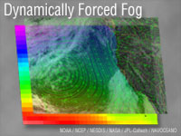 Dynamically
Forced Fog
Dynamically
Forced Fog