1.0 Introduction » 1.1 Overview
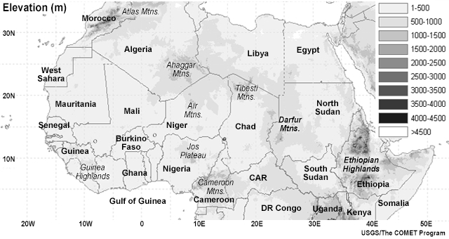
A weather forecaster’s knowledge of climatology is important to the success of a forecast, particularly for the initiation and/or decay of the weather phenomenon. This is particularly true for convective systems over Central and West Africa, where convection has a strong diurnal cycle and usually develops over particular geographic regions, such as high terrain and coastal regions (see map), and during specific time intervals.
Instability indices derived from conventional upper air observations, such as radiosonde profiles, are important to forecasting convection, particularly in the short range. However, the lack of upper-air data over most of Central and West Africa limits the use of these products for forecasting convection. Fortunately, similar information can be obtained from satellite-derived instability indices made from EUMETSAT’s Meteosat satellite series. These products, which are the focus of this lesson, can be used to assess the instability potential for convective development, particularly in the short range (2 to 12 hours).