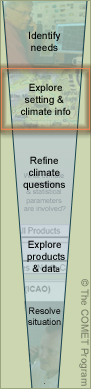
Step 2: Explore the physical setting and basic climatological information
 Having
defined the general needs of the situation, you’re ready to gather information about the area’s
physical setting/location and its weather and climate. This will help you focus in on the appropriate information
when you examine actual climate products. For example, if you’re asked to determine visibility conditions
for two locations, you’ll gather general information, such as wind speed and direction, regardless
of the location. But you’ll focus on conditions that can set up fog in coastal areas and those that
create dust storms in inland arid regions.
Having
defined the general needs of the situation, you’re ready to gather information about the area’s
physical setting/location and its weather and climate. This will help you focus in on the appropriate information
when you examine actual climate products. For example, if you’re asked to determine visibility conditions
for two locations, you’ll gather general information, such as wind speed and direction, regardless
of the location. But you’ll focus on conditions that can set up fog in coastal areas and those that
create dust storms in inland arid regions.
You should gather information about the following:
-
The physical setting
-
Latitude (tropical, mid-latitude, or polar)
-
Climate type
-
Elevation
-
Topography (mountains, flat, or valley)
-
General land type and physical geography (urban, rural, heavily forested, grassland, and variations within the area, etc.)
-
Proximity to large bodies of water
-
-
Basic weather and climate variables
-
Temperature observations, averages, and extremes
-
Frequency of occurrence of weather phenomenon such as thunderstorms, wind or dust storms, and hurricanes, etc.
-
Wind speed and direction
-
Pressure, moisture, and visibility information
-
The following sources provide this kind of information and are available from the 14th WS websites (and possibly your forecast office). Note that some products may not be available for all locations.
-
Climate narrative: A compilation of known climate and weather information for the area of responsibility; may include season by season overviews, climatic weather effects that impact the region, plain language descriptions of weather drivers, and graphs of frequency of occurrence and ranges of several weather elements; note that the amount and availability of information varies by location; climate narratives are available from the 14th WS and on DVD
-
Topographic maps of the area to determine its elevation, latitude, longitude, and proximity to large bodies of water and mountain ranges
-
World climate maps to determine the area’s general climate classification; this offers general information about temperatures, precipitation patterns and terrain influences
-
Terminal Forecast Reference Notes (TFRN): Contain some but not all forms of climatic information, including forecast weather map scenarios, percentage frequency tables, wind roses, and seasonal weather narratives and tables showing days or hours per month with various weather occurrences; these are very informative when data receipt is limited or unavailable
-
Air Force Technical Library, which has a multitude of information and references serving the information needs of meteorologists, climatologists, space scientists, and experts in all other disciplines of interest to military meteorology, with tailored scientific and technical information. Accessible through the 14th WS website
-
Solar, lunar, and tide tables for sunrise/sunset times, full moon/new moon, and high/low tide