Use of Climate Information
Climate information is useful to you, as a DoD forecaster, in two broad types of situations:
-
When you are assigned to a new location
-
One with existing climatological information, such as a base in the United States; in this situation, the challenge is to find the data sources and products from the 14th WS and other sources that will familiarize you with the area and know how to interpret them
-
One with little or no climatological information (a 'bare base' operation); here you need to learn as much as possible from existing data, such as regional maps, and use strategies, such as interpolation, to infer the area’s weather and climate from nearby areas or those with similar characteristics
-
-
When you are asked to handle specific questions and requests, such as those posed on the first page; in these types of situations, the challenge is to know what products to use and how to interpret the data
 The
scenarios in this module address both types of situations and include:
The
scenarios in this module address both types of situations and include:
1. Being assigned to a location with existing information
2. Being assigned to a location with little existing climate data
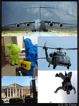
3. Being asked to determine when to hold helicopter or airdrop maneuvers
4. Being asked to determine where to build a Hazmat facility
5. Being asked to calculate the amount of energy needed at a particular location
Various climate products are presented in the scenarios, from the more general products in the initial scenarios to more specialized ones later on. For this reason, it is recommended that first-time users go through the scenarios in order. Note, though, that the scenarios are independent, can be taken in any order, and can serve as reference material when you are working on the job.