Produced by The COMET® Program
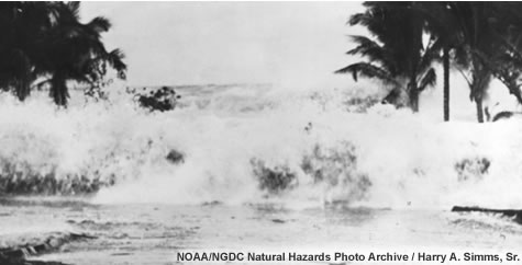
Earth's Destructive Forces
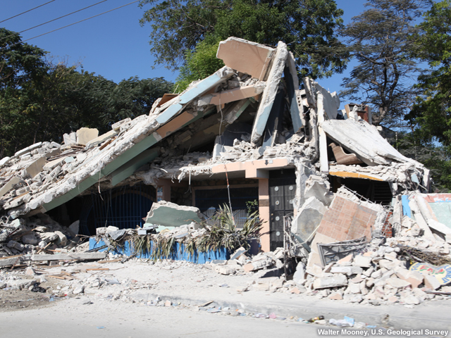
Earthquakes...
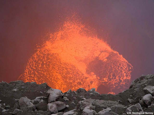
volcanoes...
tsunamis...
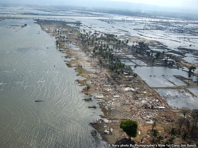
each of these offers dramatic evidence of Earth's power and can be overwhelmingly destructive.
Are these natural hazards related? If so, what do they have in common? In this lesson, you'll find out, as we explore where tsunamis occur.
Exploring Natural Hazards
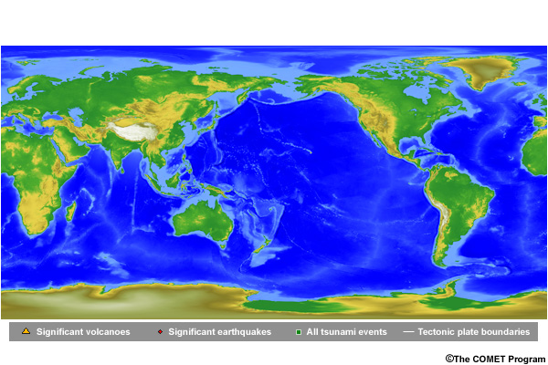
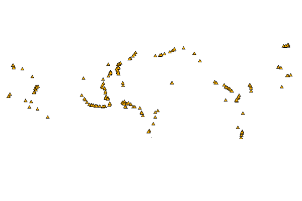
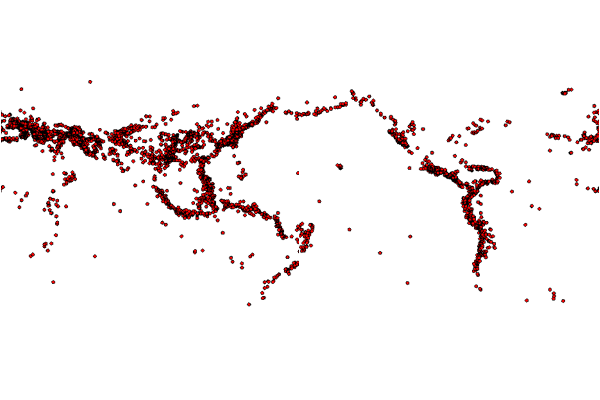
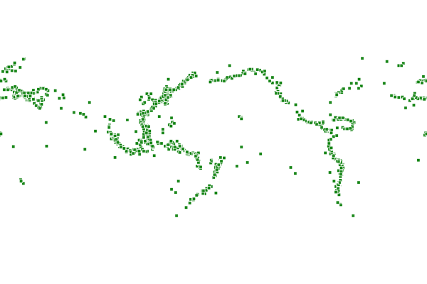
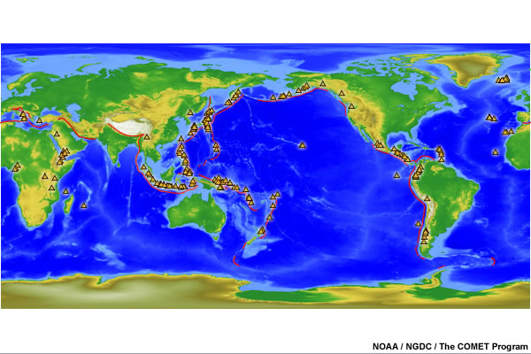
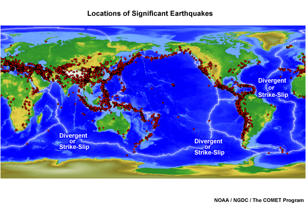
Earth's crust is not one solid expanse of stone. It is broken up into many large pieces, or tectonic plates, that float on top of the more liquid interior of the planet. These plates typically move very slowly, at a rate of only 1-10 centimeters per year, but sometimes they can move more rapidly and generate earthquakes with tremendous force. The boundaries of these tectonic plates are shown on this map. After clicking the image, use the buttons to compare historical natural hazards information from the U.S. National Geophysical Data Center, or NGDC.

Question
What can you say about the relationship between the locations of tectonic plate boundaries, large volcanoes, large earthquakes, and tsunami impact locations? (Choose all that apply.)
The correct answers are a), c), e) and f).
If you look closely, you'll see that in most cases large volcanoes, large earthquakes, tsunamis, and many of the tectonic plate boundaries are located in the same areas. These areas are around the perimeter of the Pacific Ocean, along a plate boundary in the Indian Ocean, and near plate boundaries within the Caribbean and Mediterranean Seas. However, many tectonic plate boundaries have no or very few earthquakes on them. And some tsunamis occur far from earthquake locations and plate boundaries. Let's explore why.
Subduction Zones and Tsunamis
Tsunamis are not scattered randomly around Earth. They occur more frequently in certain locations. The most common sites are associated with earthquakes that occur at tectonic plate boundaries called "subduction zones." A subduction zone is a place where one plate is moving under another.
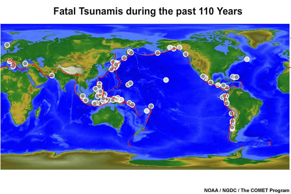
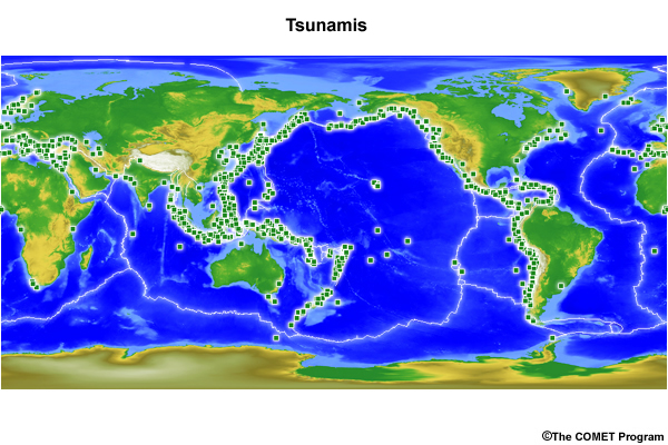
Here is a map that shows Earth's subduction zones (red lines). On top of that are plotted the locations of earthquakes that produced major tsunamis in the past 110 years. As you may have noticed, they overlap a lot.
Triggering a Tsunami
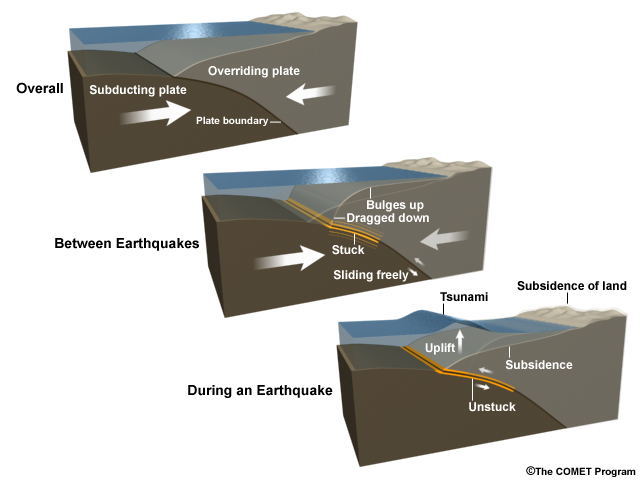
At subduction zones, one of the tectonic plates that make up Earth's crust is traveling down into the mantle underneath an overriding plate. The plates catch on one another because the surface between them is irregular and jagged. As the lower plate continues to travel down, stress builds between the two plates.
Eventually, the boundary, or fault, ruptures and the upper plate suddenly rises, while further back from the fault, the plate drops. These zones are mostly under oceans or seas near coastlines, so as the plate moves up and down, so does the water on top of it. The rising rock pushes water into a momentary ridge, which gravity immediately forces into series of spreading tsunami waves.
Another far less common reason subduction zones make tsunamis is that these zones also tend to create volcanoes, although volcanoes form elsewhere too.
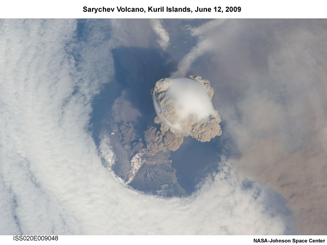
Erupting volcanoes at the coast can also sometimes create tsunamis.
Landslides and Faults
Earthquakes can also trigger landslides both underwater and at the surface. Tsunamis caused by landslides can also be created around subduction zones.
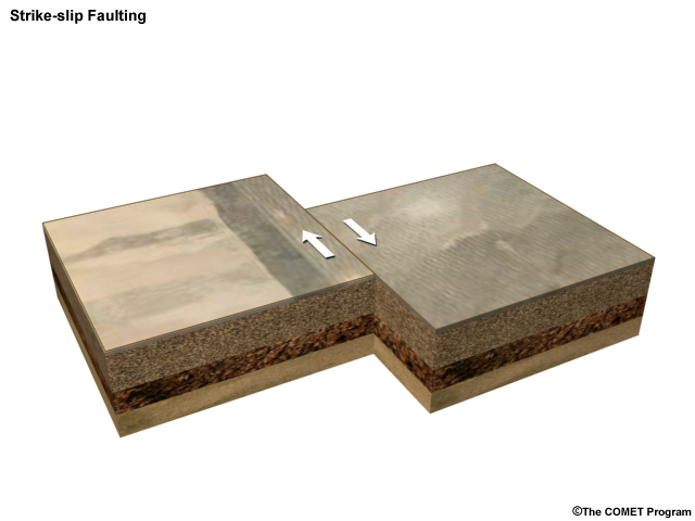
Earthquakes can happen at other types of plate boundaries too (including "strike-slip" or "transform" faults) where plates move past each other...

...and also at divergent faults (or spreading centers), where plates move away from each other. But earthquakes at these places are typically not as large and do not produce much uplift, so waves are less likely to be created.
Earthquakes cause tsunamis much less commonly in these places.
Submarine Landslides
Submarine landslides can occur anywhere slopes become overly steep underwater.
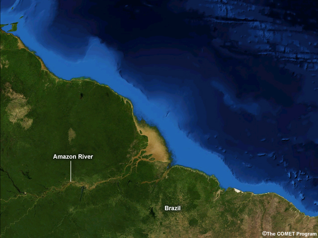
Note the large brown area of delta at the mouth of the Amazon in the center of the image.
This often happens in the sediment fans of river deltas, where muddy rivers drop their silt upon reaching the ocean.

Note the steep continental shelf off the east coast of the U.S.
But anywhere a steep slope exists underwater—whether around the base of an island, atoll, underwater seamount, continental slope or canyon—landslide-generated tsunamis can occur. These are frequently (but not always) triggered by earthquakes.
Distant Tsunamis
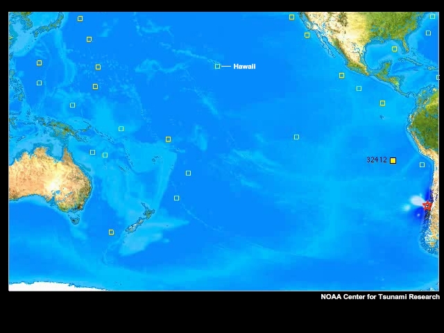
Finally, you may have noticed that some tsunamis have occurred far from any tectonic boundary, for example, in Hawaii and on other islands in the Pacific.
Question
Why do you think these might have occurred? (Choose the best answer.)
The correct answer is b).
These long-distance tsunamis are called "Teletsunamis."
A Computer Model Animation of the 2010 Chile Tsunam
Because tsunamis can travel through the sea to distant locations, they can affect some islands and coasts that are far from any tectonic boundary or source of landslides. One of the most famous of these was the 1960 tsunami that struck in Hawaii after traveling all the way from Chile, much larger than the recent 2010 tsunami shown here, also from an earthquake near Chile.
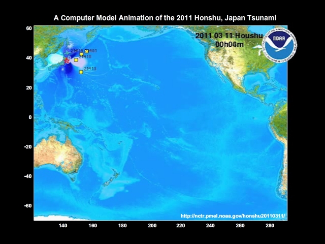
The March 2011 earthquake off the coast of Japan resulted in a tsunami that not only devastated parts of Japan, but caused damage in Hawaii and other islands, including the Galapagos. Waves were as high as 2 ½ meters (over 8 feet) in California and 1 ½ meters (nearly 5 feet) in Chile on the extreme far side of the basin from the earthquake source.
In reality, while coasts closest to subduction zones have the most threat for a tsunami, nearly every coast can be vulnerable to a large tsunami that travels from far away.
Summary
Earth's crust is made up of large pieces, called tectonic plates, that move very slowly on top of the more liquid interior.
Volcanoes, large earthquakes, and tsunamis often occur along these plate boundaries, though tsunamis can also occur at places distant from the source earthquake locations.
Subduction zones are places where one plate moves under another. Because the surfaces between the plates are irregular, the plates catch, allowing stress to build and eventually causing an earthquake. In these earthquakes, the upper plate rises, pushing water along with it and creating a tsunami.
Landslides, particularly submarine landslides, can also trigger tsunamis. These landslides are frequently but not always caused by earthquakes.
Tsunamis can travel across oceans to locations far from earthquakes so that every coast, even if not along a subduction zone, can be at some risk of a tsunami.
Click here to return to the Prologue Page.