Produced by The COMET® Program
Teletsunamis
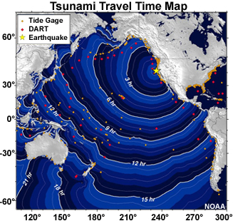
Travel time map for a hypothetical earthquake along the northwest U.S. coast
Tsunamis that cross oceans to reach locations more than 1000 kilometers away are called teletsunamis, from the Greek word "tele," meaning distance or distant. These tsunamis travel a few hours or more before reaching distant shores, giving scientists time to estimate wave arrival times and wave heights at locations far from the source.
Modeling
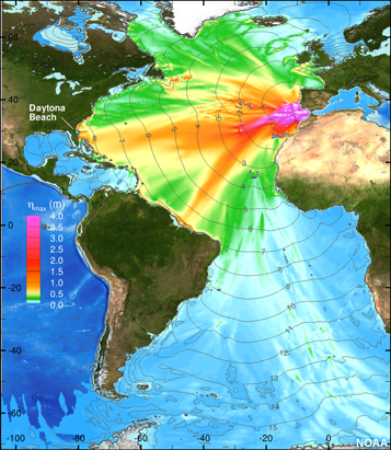
Wave energy model plus travel times for earthquake originating near Lisbon
Scientists can predict how fast a teletsunami will travel and which coastal areas are particularly at risk by modeling how the tsunami moves across the ocean. The models require information about the seafloor terrain, or bathymetry, as well as the shapes of all land features within or bordering the ocean basin. The size and location of the initial earthquake is also important, particularly for estimating the initial heights of the waves. The initial wave heights are refined as sea level gauge data become available.
Models of Real-life Tsunamis
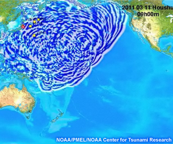
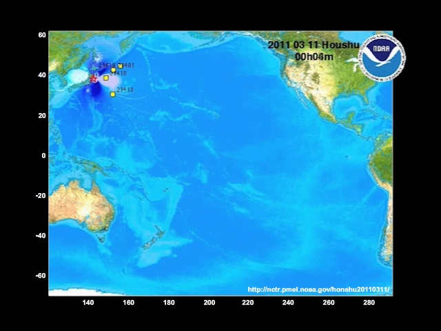
Simulated tsunami wave from Honshu, Japan propagating across the Pacific Ocean
In the exercise at the end of this lesson, you can watch how tsunamis from large earthquakes at various locations move across the ocean basins. As you view the models of tsunamis generated at different locations, notice:
- how far the waves travel
- how fast the waves spread across various regions of the ocean
- how the waves bend or bounce off coastlines as well as undersea features
Go to the next page to view an animated model of the tsunami originating near the Samoa islands in 2009. Text labels help explain what you are seeing.
Samoa Island Tsunami
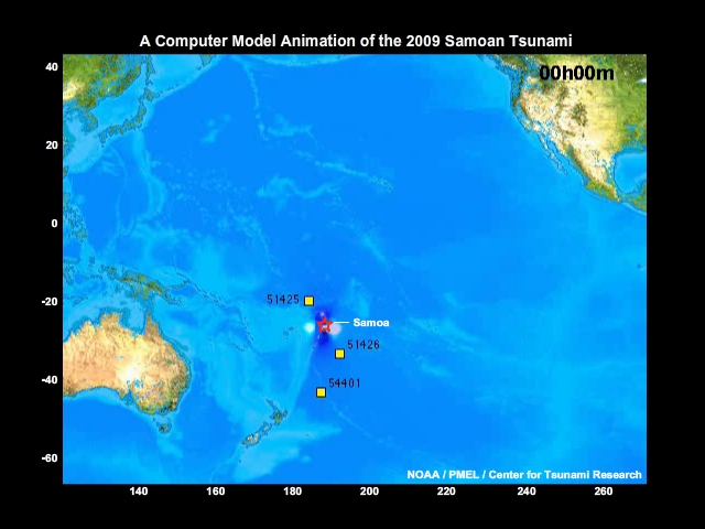
Animation Labels:
- 8.1 magnitude earthquake triggers tsunami
- Note wave reflections off topographic features that complicate wave pattern
- Waves reach Hawaii
- Note how waves wrap around New Zealand
- Waves reach and reflect off U.S. West Coast
Tsunami Viewer
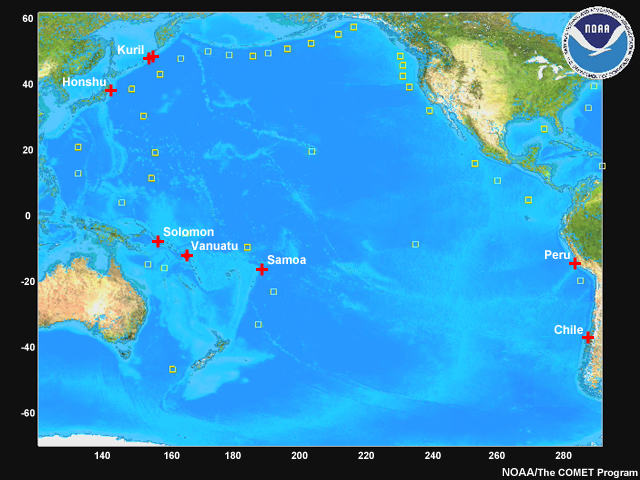
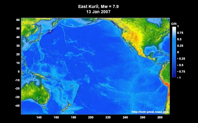
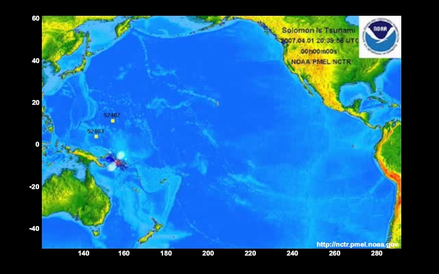
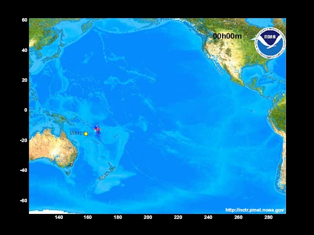
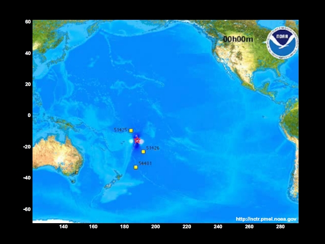
1. Kuril Islands, Mw 8.3
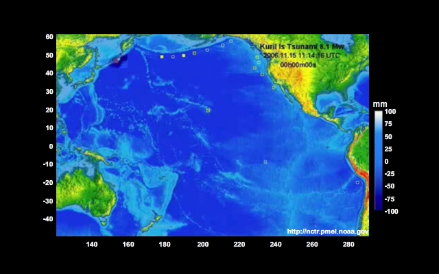
2. Kuril Islands, Mw 8.1
3. Honshu, Japan Mw 9.0
4. Solomon Islands, Mw 8.1
5. Vanuatu, Mw 7.6
6. Samoa, Mw 8.0
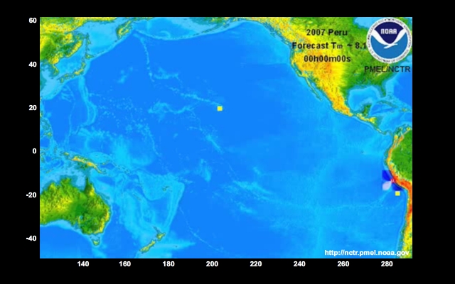
7. Peru Coast, Mw 8.0
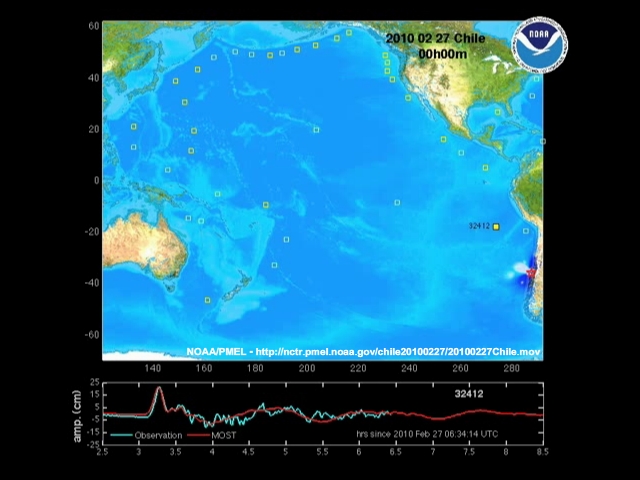
8. Concepcion, Chile, Mw 8.8
Summary
A teletsunami or distant tsunami crosses an ocean to reach locations more than 1000 kilometers away from its source.
Because it can take time to reach distant shores, scientists are able to estimate wave arrival times and wave heights for far-away locations.
These estimates come from computer models that account for seafloor terrain and all land features within or around the ocean basin.
Initial model output is based on information about the size and location of the source earthquake and refined as sea level data become available.
The models provide information about how far and how fast the waves travel and how they are affected by coastlines and undersea features.
Click here to return to the 4.5 Hours Page.