Introduction
A fire weather forecaster (or Incident Meteorologist) operates in a world of uncertainty, when viewed from a forecasting and fire-environment perspective. Both perspectives change seasonally, weekly, daily, and hourly because they require continuous monitoring and adjustment in order to reduce the uncertainty in a given situation. This process of monitoring information and adjusting our perspective is known as Situational Awareness (SA).
Most of the training a forecaster initially receives is directed at reducing the uncertainty in the weather forecast. With experience, a forecaster begins to consider other factors that may increase the significance of the expected weather. For example, a 3-inch snow storm may or may not create significant impacts, but whether most of that snow falls during a morning commute would be an important factor to assess in this situation.
Effective service to the fire community drives forecasters to monitor additional data sets that include information about fuels dryness, location and number of firefighting resources, and status reports from incidents. This multiplies the inputs into decision making, and produces increased variability and uncertainty. Managing this variability comes with experience. By working to enhance your SA, you can become effective at staying a step ahead of evolving situations.
Simulation
There are three questions in this simulation. To complete the simulation successfully, you will need to select the correct answer for all three questions. Feedback is available only after you complete the simulation. You will have three attempts to complete the simulation successfully. Launch the simulation using the button below when you are ready.
Scenario
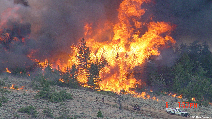
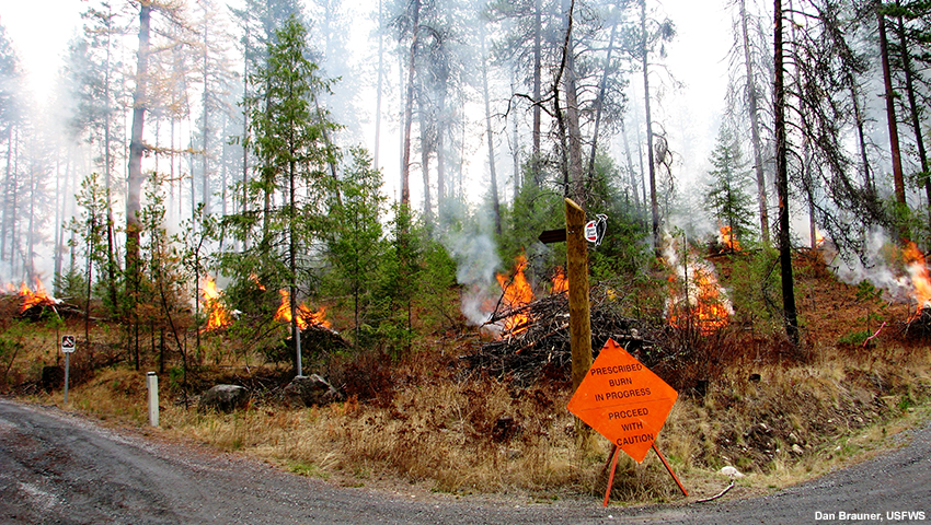
In July, a combination of drought and lightning strikes have led to numerous large fires across western Montana and central Idaho, leading to one of the most active and destructive fire seasons in recent memory. Thousands of firefighters and multiple Incident Management Teams are deployed across the region. The Liberty Fire in West Central Montana near the town of Arlee is burning near 6000 ft and has a large spike camp at 5000 ft.
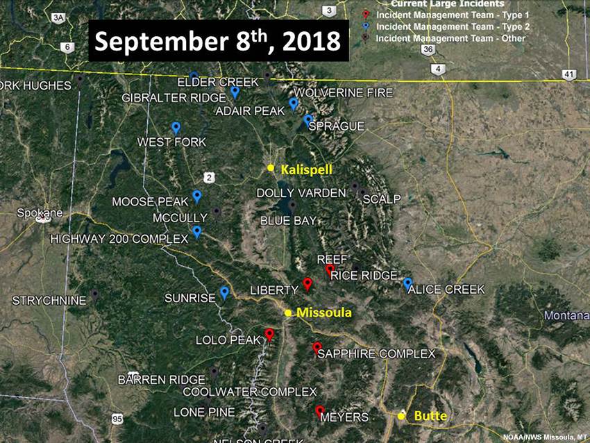
It is September 8th, and forecast models are beginning to hint at a dramatic shift in the weather pattern. The forecast shows a deep upper-level trough coming in that could bring significant precipitation to the region around September 14th. Forecasters have low confidence in this forecast, as it is almost a week in advance. However, their confidence is growing as the ensembles are beginning to depict the change in the weather pattern with time.


Situational Awareness Cycle
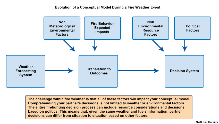
The diagram below shows the components of a Fire Weather Situational Awareness Cycle, and their relationship to each other. The SA cycle is never static and is constantly evolving.
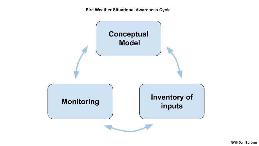
This cycle can flow in either direction, but it is important to go through the whole cycle as you begin to make changes. It is best to start with the conceptual model. After you create a conceptual model, you select a set of inputs to continuously monitor, and then you employ processes to monitor them. Depending on the situation, you may decide first on the level of monitoring that needs to occur, which will determine what tools you will use. Both the conceptual model and inventory of inputs may need to change as a result of the monitoring process. The speed at which this cycle occurs is dependent on the situation.
Question
Review the situations and answer the questions below. Use the pull-down menu to select the best answer.
It is early May and the fuels in the western U.S. are green.
The correct answers are highlighted above.
How you monitor the fire environment on a given day may depend on the fuel situation in a given month or the goals of your partner agencies. For example, in May, you may choose to watch long-term drought indices while waiting for fuels to dry and fire season to develop - this is a slow movement through the SA cycle. However, in August you may be looking for potential fire hot spots on satellite, assessing upstream observations and partner agency report forums, and listening to radio chatter. This requires very quick movement through the SA cycle, perhaps hourly or at a more frequent interval.
Here is another example of how the focus within your process of monitoring the fire environment can vary:
In May, fire may not be a concern, but what if a partner agency wants to burn a logging debris (slash) pile and is worried about smoke dispersion? This concern changes your conceptual model from monitoring for fire starts to thinking about the strengths of inversions and wind speeds. This adjustment requires a change in the other two components of the cycle - the inputs to monitor and how often to monitor them. In the following sections of this lesson, we will explore the individual components of the Fire Weather Situational Awareness Cycle in more detail.
Conceptual Model
A conceptual model is a mental representation of the variables at work in a given situation. Fire weather situations are complex and constantly evolve. A conceptual model is also a way to organize information to help anticipate the evolution of a complex situation. By comparing incoming information to this model and looking for discrepancies, you can determine whether you have a full understanding of what is happening or need to refine the details.
Let’s begin with a simple meteorological conceptual model of an inversion. In an inversion, warmer air lies over cooler air, suppressing any vertical motion. Now let’s add smoke to this model.
Question
What are the day- and night-time impacts of smoke from a fire under an inversion? Describe the day-time and night-time impacts in a few sentences.
Compare your answer to this expert description:
During the day, the inversion may keep smoke from mixing, reducing sunlight and decreasing temperatures. During the night, the smoke stays trapped by the inversion, decreasing visibility and causing poor air quality.
By adding the smoke element to the inversion conceptual model, the model becomes slightly more complex.
With regards to fire weather, conceptual models take on expanding complexity due to the need to respond effectively to these questions:
- What are my decision maker’s concerns (operational thresholds)?
- How should I communicate the meteorological threats to them?
Let’s look at the following example:
It is early fall and a state land management agency is doing prescribed burns near a Rocky Mountain resort town to clear heavy spring grass growth and mitigate fire risk. The most important part of the burning is planned mid-slope above the town, which lies in a valley. There is a window of good weather tomorrow due to high pressure over the region, but that is expected to form an inversion overnight.
Question
Based on the fire weather situation above, which of the following elements need to be considered when creating a fire weather conceptual model? Select all that apply.
All of the elements above need to be considered when creating a conceptual model of a fire weather situation. Some may increase or decrease in significance as the situation evolves.
Question 1 of 2
A major concern is that the burn window coincides with the start of a popular early fall festival that increases traffic to the town’s airport. Compared to the previous information you were given, which elements have increased in significance? Select all that apply.
The correct answers are k) and l).
Your initial conceptual model may have included a concern for homes next to hills covered with very tall grass - a property threat. The presence of the airport and the timing of the public event increases concerns about politics and commerce.
Question 2 of 2
Based on the information provided above, what aspects of the following components may play an important role in how this situation evolves? Write phrases that describe your conceptual model of the situation so far.
|
A. Weather |
|
|
B. Terrain |
|
|
C. Short- and long-term climate trends, especially drought indices |
|
|
D. Fuels Growth |
|
|
E. Politics |
Compare your answer to these expert descriptions:
|
A. Weather |
good weather, high pressure over the region, inversion overnight |
|
B. Terrain |
burning is midslope above town in a valley |
|
C. Short and long term climate trends, especially drought indices |
another wet spring next season |
|
D. Fuels Growth |
heavy spring grass growth |
|
E. Politics |
fall festival that increases traffic to the town’s airport |
Monitor and Update Conceptual Model
After learning about the planned fall festival in the resort town, you decided to emphasize different aspects (variables) of the fire weather situation as you begin to monitor the prescribed burns. In other words, you updated your conceptual model for the prescribed burn.
The process of evaluating which variables to monitor and updating your conceptual model accordingly is an essential skill of SA. Your ability to effectively serve the fire community will require you to make changes in your conceptual model. If these model revisions impact the users, you will need to communicate the information to your agency partners. Let’s continue with the scenario.
Question
The fire crews believe they will complete the burn quickly enough to mitigate the impacts from the smoke that gets trapped by the strong inversion expected tonight. Based on your forecast, they have started the burn. Since there was a weak inversion this morning, they are expecting fire activity to be less intense before noon. However, they anticipate fire activity to increase in intensity by 1400 local time as temperatures become warmer.
You are monitoring the weather situation. At 1000 local time, you receive a report from an observer on a ridge overlooking the fire that shows increasing winds and temperatures. From your vantage point, you can see that the smoke from the burn is only rising up to 1500 feet and then spreading out. The airport is reporting calm winds and obscuration due to smoke.
Will you update your conceptual model? Choose the best answer.
The correct answer is a).
By 1100 local time, the radio lights up with fire teams retreating and requesting air support because of rapid fire growth and spotting towards homes. The inversion began eroding earlier than expected, and the smoke was not enough to hold back the heating. The airport is located in the valley and its observations were affected by the inversion, so the observations differed from those of the fire observer.
Your willingness to adjust your conceptual model is just as important as considering the variety of inputs into the model. While this may seem obvious, humans are naturally inclined to seek validation for their perceptions, which makes it difficult to admit we have more work to do.
Monitor and Update SA Tools
It is July 14th and your office is preparing for a day of convective activity. You are monitoring the weather and fire situation for the Preacher Fire. It has been burning in your area for a few weeks. At 1445 local time, dispatch centers for the Preacher Fire updated their Impact Event Mapper System (a tool for integrating land management agency fire information into AWIPS) with the location of a new fire start, but did not request a spot forecast from your office. Your office has access to the Mapper, too.
Question
Will you add the location of this fire to your radar display? Choose the best answer.
The correct answer is b).
Even though the dispatch center did not request a spot forecast, it is a good idea to add the new fire start to your locations to monitor during the convective event. That is exactly what the staff of the NWS office did as they provided support for the Preacher Fire.
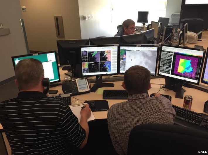
You and your staff should maintain or develop a broad set of tools to effectively monitor fire weather situations. Some of these resources are routine and you are likely to use them on a daily basis; other resources you may employ only during certain situations. It is a good practice to frequently try to identify resources used by other NWS offices and partner agencies. Think of the whole set of monitoring processes as a toolkit: you do not use every tool each time you make a repair, but having the correct tool makes the job much easier.
Building Up Your SA
When beginning a shift, especially after days off, your SA is usually weak because you have not been involved in operations. You may have heard fire information from the news or other sources, but your conceptual model is rudimentary at this point. You will need to rely on pre-established monitoring tools to start your Situational Awareness Cycle. These tools should give you a big picture of the fire environment, so you can begin to refine your conceptual model and determine what information to monitor.
Question
Which of the following tools can you use to build up your situational awareness after days off? Select all that apply.
The correct answers are a), b), and c).
Because other weather concerns may take precedence over fire weather during a shift change briefing, a backup method of communicating information is valuable. Internal logs and communications, fire environment analysis and shift logs are good tools you can use during your daily self-brief after some time off. They will help you build up your conceptual model and have a sense of the big picture.
Common operating pictures are not necessarily effective for building up SA because you would not necessarily know which information is important when just beginning a string of shifts. However, the Common Operating Picture would be useful for maintaining SA once established.
Let’s look at each of these in more detail in the next section.
Building Up Your SA » Daily Self-Brief
A daily self-brief usually includes reviewing two types of information: 1. internal logs and communications, and 2. intelligence information from partner agencies, including fire activity and fuel dryness information. This self-brief will vary in length and detail. It can range from a quick glance at the shift logs and spot forecast activity to a more in-depth study of information during the core of fire season, when incident status reports may indicate increasing concerns on a given fire or the strategies being employed. One benefit of the weather.gov/spot website is that it enables you to monitor activity for your office as well as other surrounding offices.
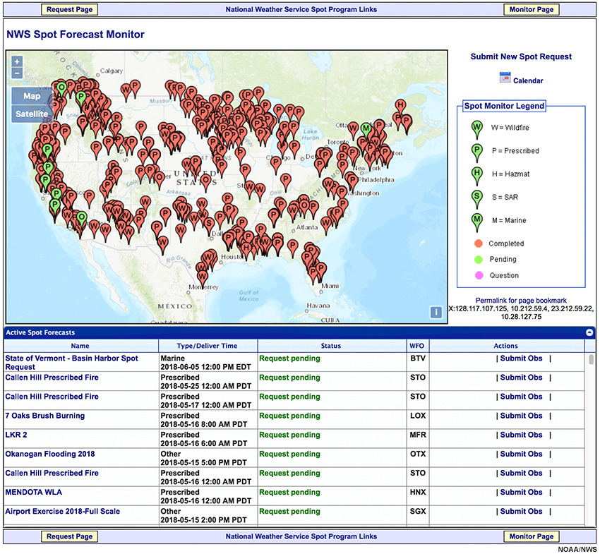
A screen grab of the National Weather Service Spot Forecast Monitor webpage.
Fire Environment Analysis
Your fire program leader or a member of your management team should periodically provide the office with a big-picture assessment of the fire environment, which can include:
- summaries of fuels information,
- information relayed from other agency communications, or
- highlights of conversations with land management agencies about their fuels and fire concerns
View an example of an office Situational Awareness Briefing.
Shift Logs and Shift Briefings
Your office’s daily log- and shift-briefings are opportunities for passing along information from shift to shift. The briefings can include information about new fire incidents, or about prescribed fire projects which require certain weather elements to be successful.
Question
You are a fire program manager for an NWS office. A new shift of forecasters replaces the current one. How will you make sure they are brought up to speed? Select all that apply.
The correct answers are a) and d).
Partner agencies become concerned if they have to reiterate information that they have already shared with a forecast office in a previous call. You and your staff are responsible for documenting your interactions with the partners so that the following shift can use that information to continue providing effective and focused decision support.
Inventory of Inputs
Your ability to remain situationally aware can be challenged by the constant flow of information and evolving situations in the operational WFO environment. Emerging technologies can create dashboard-style displays that enable forecasters to quickly scan information and decide if there is something that merits further investigation.
The key with any of these technologies is using good practice and developing habits to configure the SA displays to match the challenges you expect to face.
There are four broad categories of tools that can provide information supporting your SA. They are:
- Observed data
- Climate trends and fuels' receptiveness to a fire
- Fire activity and fire behavior
- Status of firefighting resources
Question
Match the tool to the category that it best fits in. Use the pull-down menu to select the best answer.
The correct answers are highlighted above.
The next several sections will provide a brief overview of the tools and the primary information to draw from each tool. These tools are useful to the fire weather focal point, IMET, and other forecast staff. The section on Fire Weather and Fuels Data and Guidance Matrix provides more detail about these tools.
Inventory of Inputs » Common Operating Pictures
On days with ongoing fire concerns, there is a crucial need to monitor the environment efficiently since the weather may have its own significant level of complexity. Common Operating Pictures (COP) are map-based web pages that can be used to organize multiple inputs you want to monitor, such as fire locations and where fire resources are located. These COPs can come in varying detail, but a simple example is the National Interagency Fire Center National Fire Situational Awareness webpage.
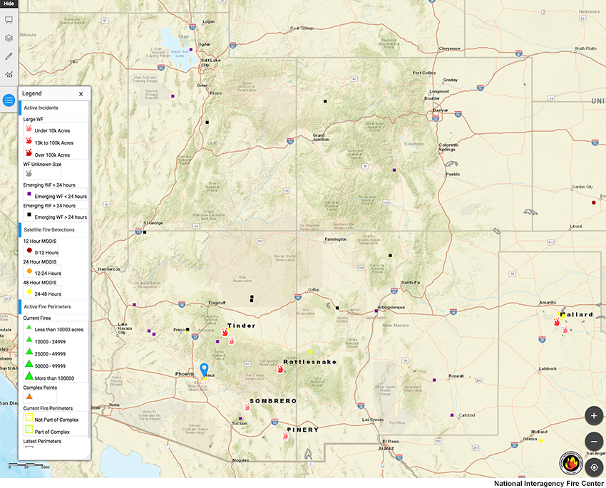
A screen grab of the National Interagency Fire Center National Fire Situational Awareness webpage.
Other agencies maintain detailed COPs with more data for internal use, which you can sign up for by contacting these agencies. For example, the Enterprise Geospatial Portal (EGP) provides "standardized geospatial information for the full range of wildfire activities ranging from response to planning". You can sign up for EGP at this address: https://famit.nwcg.gov/applications/EGP.
Much of this information can be ingested into AWIPS to complement weather data and help you create strong SA. The ability to incorporate different local, state and federal resources will vary from office to office. Work with your internal and external agency partners to develop the strongest COP possible for your region.
Question
Which element of the Situational Awareness Cycle is key in configuring informational displays? Choose the best answer.
The correct answer is a).
To determine the challenges you expect to face, you must keep your conceptual model updated. Also, you must move through the entire SA Cycle, perhaps multiple times in a day, to ensure that these tools are providing you with relevant information. The SA wall in your office is one of the tools which will require periodic reconfiguration to match current challenges. Are you monitoring fuels status or sources of partner agency websites to identify emerging wildfires? The answer can depend on the time of year and other weather considerations. If you do not think proactively about your SA display, it will be like a dull saw, which takes a lot of effort to use but delivers less than desirable results.
Inventory of Inputs » Satellite
The impacts of the new GOES R-S satellites on supporting fire weather are profound. They offer multiple channels that detect infrared energy, allowing for faster detection and detailed information regarding fire evolution and intensity. New applications are being developed to leverage these technologies.
A polar-orbiting satellite instrument known as the Visible Infrared Imaging Radiometer Suite (VIIRS) can also be useful. The near and shortwave infrared imagery can show fire “hotspots”.
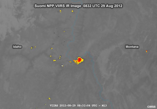
Suomi NPP VIIRS infrared image showing a fire on the Montana/Idaho border 0832 UTC 29 Aug 2012.
The VIIRS Day-Night Band can reveal smoke plumes, even at night.
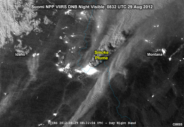
Suomi NPP VIIRS DNB nighttime visible image showing a smoke plume over Montana and Idaho 0832 UTC 29 Aug 2012.
Inventory of Inputs » Radar
Question
What are the two primary uses of radar data in fire weather? Select all that apply.
The correct answers are a) and b).
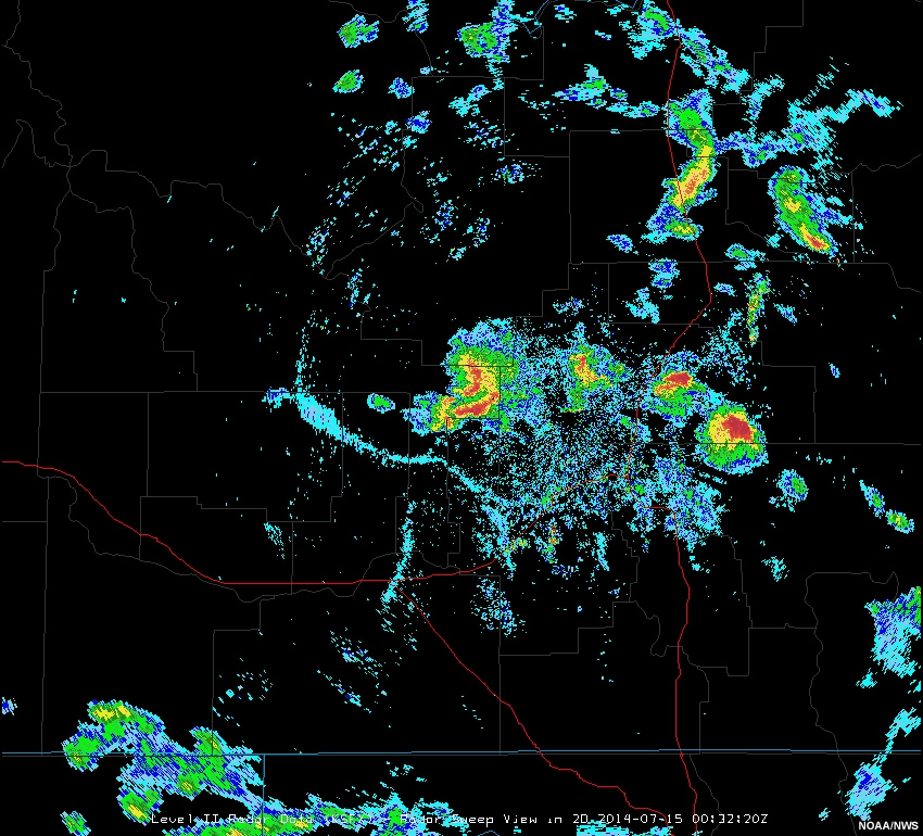
There are two primary uses of radar data in fire weather. Detecting smoke plumes helps indicate the current fire activity. Also, monitoring outflow boundaries or fronts is important, as these features can cause dramatic changes in fire behavior. The coupling of dual-polarization data and high-resolution satellite data will likely lead to enhanced knowledge of internal large-fire dynamics that could have future applications.
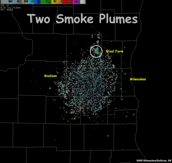
Radar reflectivity loop showing two smoke plumes resulting from prescribed burns by the Wisconsin Department of Natural Resources.
Inventory of Inputs » Weather Stations
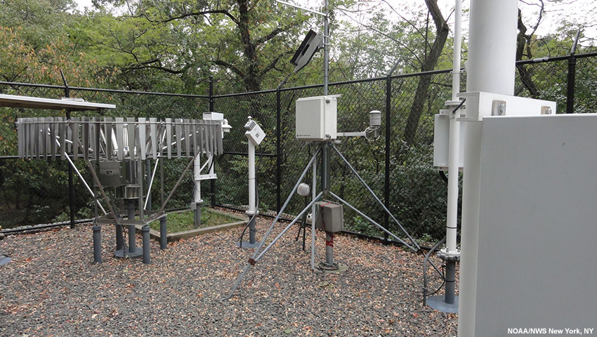
Fire activity can occur anywhere within a forecast region. Meteorologists may need to consider observational data that they use less frequently because the weather stations are not near populated areas. This involves understanding the data sets and the reasons for a given station’s existence, because different owners will site stations for different reasons.
Question
You are providing decision-support for a fire in a remote location. The only weather station nearby is a Department of Transportation weather station next to a road. Over the last three days, you have noticed that the temperatures reported by the fire crews are higher than those reported by the weather station. What do you think might be responsible for the difference? Choose the best answer.
The correct answer is d).
The Department of Transportation temperature sensor near the road is in a low-lying area in order to provide more accurate road surface temperature and visibility information. On the other hand, a land management agency RAWS may be in an area more representative of the surrounding landscape and vegetation. However, data sparseness may lead to utilizing any available data, so users should be aware of the nuances of the stations.
Inventory of Inputs » Drought Information
A basic understanding of fire behavior allows you to interpret data from a number of sources that monitor the fuel availability and fire activity. Different size fuels respond to precipitation and drought on different time scales, so there is a considerable variation in interpreting and analyzing this information. For example, a rain event a week ago may have lingering impacts on shrubs and large pieces of wood on the ground. However, if it is August, the grasses may have become dry enough to support fire activity again. Good fire weather SA will require learning to use multiple data sets from multiple sources to get a full picture.
There are other federal meteorologists in Predictive Services that monitor longer term situations in which fuel conditions reach unusually dangerous levels. They may produce Fire Behavior Advisories that advise firefighters to take exceptional caution and include information on the antecedent conditions that produced the situation.
Inventory of Inputs » Fire Activity and Behavior Reports
Firefighting agencies issue daily situation reports that enable decision-makers to assess the situation and determine allocations of resources over large geographic scales. Also, firefighting agencies update the public about fire situations through various portals.
Question
How can meteorologists use these reports to improve the effectiveness of their decision-support? Select all that apply.
The correct answers are a), c), and d).
Reports are useful to help meteorologists determine which fires are most active, which residential areas are under threat, and what may be some of the problems challenging firefighters, including weather concerns. This information can help forecasters adjust their conceptual models, so it is important to become familiar with these reports, especially their issuance times.
Inventory of Inputs » Real-time Information
One must be prepared to transition from routine monitoring of fuels to the exponential increase in complexity and information flow resulting from fire activity and evolution. Fire activity affects every aspect of your operations: from validating your conceptual model of the fire environment to identifying fast-evolving situations that may require emergency notifications.
Access to up-to-the-minute information may impact your decision to communicate to a dispatch office or a fire incident team. Never is this more critical than during thunderstorm outflow situations, as mentioned in an earlier scenario. Each office will have a unique set of information sources to tap into, but here are a few suggestions:
- Local radio communications using a scanner.
- Automated Flight Following, which depicts the location and types of firefighting aircraft.
- Fire Agency Situational Awareness webpages, which will take different forms based on location.
- Social media, especially during times of the year where fire agencies are not staffed as prominently. An example is the dry period before spring rains arrive, but after most snow cover has melted.
These resources are unlikely to be employed every day. However, at some point in your career you will face a situation which unfolds so quickly that the need for up-to-the-minute information is crucial to being successful.
Evaluate and Adjust Staffing Levels
SA evolves as fast as the weather. On days when the weather is changing very quickly, such as a day with thunderstorms, fire weather forecasters may have to go through the SA cycle more frequently. An honest evaluation of SA includes determining if the SA cycle is being managed adequately and if additional resources are needed. Just like other forms of weather, workload shedding to other offices (Mutual Aid) or bringing in additional staff for overtime may be required.
Question
It is July and a combination of drought and lightning strikes have caused numerous large fires across your County Warning Area. Thousands of firefighters and multiple Incident Management Teams are deployed across the region. Your staff is providing 8 to 12 spot forecasts per day, as well as participating in multiple conference calls and briefings. The short-term forecast calls for an active convective day tomorrow. Based on this information, how will you adjust the effort of your staff in order to address the situation? Select all that apply.
The correct answers are b) and c).
Given the staff fatigue and the potentially dangerous situation that could develop over the fires, it is prudent to shed workload to other offices or bring in additional staff for overtime. This will ensure that your office continues to provide excellent decision-support services to the Incident Management Teams.
Fire Weather and Fuels Data and Guidance Matrix
No training can cover all of the inputs needed to successfully maintain Fire Weather Situational Awareness across the nation. Explaining broadly how these tools are used to monitor SA may help you consider other resources and tools that are unique to your office.
A Fire Weather and Fuels Data and Guidance website has been developed that allows forecasters to learn and utilize inputs operationally. Expect this resource to grow as forecasters from across the nation identify useful resources to contribute to this list. While this will help you and future employees at your office, this will be invaluable to IMETs and Deployment Ready Meteorologists who are requested to areas well beyond their home office.
Summary
This module introduced the Fire Weather Situational Awareness Cycle. The cycle begins with a conceptual model, moves into selecting inputs from an inventory, and then initiates the monitoring process.
Fire weather situations are complex and continuously evolve. Using this Situational Awareness Cycle will assist meteorologists in providing effective decision support to fire partners.
Situational Awareness is something we often do without realizing it. We make adjustments when we are driving, when we are alone versus watching children, or in our work environment when we determine the problem of the day. Fire weather is different because the majority of us are not wildland firefighters by training, and may have grown up or live in areas where wildfire concerns are limited.
Participating in exercises about Fire Weather Situational Awareness helps you develop a foundational “playbook” that you can adapt based on the challenges before you, even if you do not have direct prior experience with them. The goal is to have you simulate the SA process so that when you have to do it in a real-time stressful situation, you have a sense of “I have done this before”. This slows down your thinking and allows you to make good, clear-cut adjustments to keep you ahead of the evolving event. According to Chesley Sullenberger in “Miracle on the Hudson”, this is known in military and aviation training as “default to training”. The idea is that you have practiced stressful operations sufficiently enough that when you encounter a real situation, you know where to begin your thoughts/actions to safely accomplish the stated goals.
You have reached the end of the lesson. Please complete the quiz and share your feedback with us via the user survey.
Contributors
COMET Sponsors
MetEd and the COMET® Program are a part of the University Corporation for Atmospheric Research's (UCAR's) Community Programs (UCP) and are sponsored by NOAA's National Weather Service (NWS), with additional funding by:
- Bureau of Meteorology of Australia (BoM)
- Bureau of Reclamation, United States Department of the Interior
- European Organisation for the Exploitation of Meteorological Satellites (EUMETSAT)
- Meteorological Service of Canada (MSC)
- NOAA's National Environmental Satellite, Data and Information Service (NESDIS)
- NOAA's National Geodetic Survey (NGS)
- National Science Foundation (NSF)
- Naval Meteorology and Oceanography Command (NMOC)
- U.S. Army Corps of Engineers (USACE)
To learn more about us, please visit the COMET website.
Project Contributors
Project Lead
- Tsvetomir Ross-Lazarov — UCAR/COMET
Instructional Design
- Tsvetomir Ross-Lazarov — UCAR/COMET
Project Scientist
- Vanessa Vincente — UCAR/COMET
Science Advisors
- Dan Borsum — NOAA/National Weather Service, Fire Weather Professional Development Series Executive Producer, Weather Forecast Office Billings, MT
- Todd Lindley — NOAA/National Weather Service, Science and Operations Officer, Weather Forecast Office Norman, OK
- Robyn Heffernan — NOAA/National Weather Service, National Fire Weather Science and Dissemination Meteorologist, Boise, ID
- Scott J. Carpenter — NOAA/National Weather Service, Regional Response & Preparedness Specialist Incident Meteorologist, Western Region Headquarters-Salt Lake City, UT, Regional Operations Center (ROC) / Operations and Decision Support Division
- Noel "Shad" Keene — NOAA/National Weather Service, Forecaster and Incident Meteorologist, Weather Forecast Office Medford, OR
Program Manager
- Tsvet Ross-Lazarov — UCAR/COMET
Graphics/Animations
- Steve Deyo — UCAR/COMET
Multimedia Authoring/Interface Design
- Gary Pacheco — UCAR/COMET
COMET Staff, August 2018
Director's Office
- Dr. Elizabeth Mulvihill Page, Director
- Tim Alberta, Assistant Director Operations and IT
- Paul Kucera, Assistant Director International Programs
Business Administration
- Lorrie Alberta, Administrator
- Auliya McCauley-Hartner, Administrative Assistant
- Tara Torres, Program Coordinator
IT Services
- Bob Bubon, Systems Administrator
- Joshua Hepp, Student Assistant
- Joey Rener, Software Engineer
- Malte Winkler, Software Engineer
Instructional Services
- Dr. Alan Bol, Scientist/Instructional Designer
- Sarah Ross-Lazarov, Instructional Designer
- Tsvetomir Ross-Lazarov, Instructional Designer
International Programs
- Rosario Alfaro Ocampo, Translator/Meteorologist
- David Russi, Translations Coordinator
- Martin Steinson, Project Manager
Production and Media Services
- Steve Deyo, Graphic and 3D Designer
- Dolores Kiessling, Software Engineer
- Gary Pacheco, Web Designer and Developer
- Sylvia Quesada, Production Assistant
Science Group
- Dr. William Bua, Meteorologist
- Patrick Dills, Meteorologist
- Bryan Guarente, Instructional Designer/Meteorologist
- Matthew Kelsch, Hydrometeorologist
- Erin Regan, Student Assistant
- Andrea Smith, Meteorologist
- Amy Stevermer, Meteorologist
- Vanessa Vincente, Meteorologist