![]() Mid-Altitude Radial Convergence (MARC)
Mid-Altitude Radial Convergence (MARC)
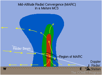
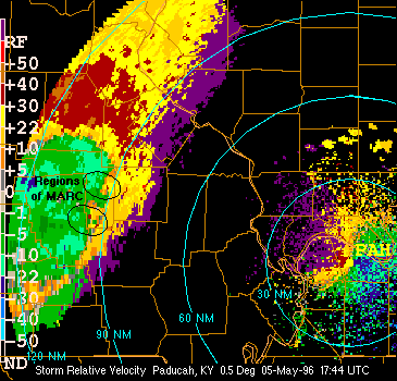
| MARC is a Doppler velocity
signature that serves as a precursor to the initial onset of damaging downburst winds in
a squall line. Preliminary squall line case studies have shown a good correlation between
values of MARC velocity differentials of at least 25 to 30 m/s (50 kts or greater) to
successive damaging surface wind gusts. Strong mid-altitude radial convergence or MARC is
often observed along the forward flank or leading edge of an organized bowing convective
system. The region of strong outbound velocities signifies a component of the system's
updraft current and front-to-rear flow (when viewing a storm approaching from the west).
The region of strong inbound velocities depicts the storm's convective-scale downdrafts
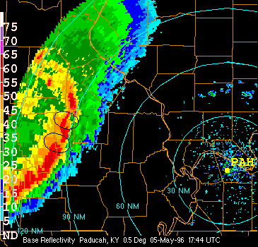
and origins of the mesoscale rear-inflow jet. These enhanced velocity differentials or
areas of strong radial convergence are usually located in, or just ahead of the high
reflectivity cores along the leading edge of the convective line. (See the example to the
right.)
Two of the major advantages of using the MARC signature as a precursor to damaging winds include: 1) potentially longer lead times (typically from 10 to 30 min before the first report of severe wind gusts), and 2) the relatively large distance from the radar at which one can detect this signature. One major limitation of using this signature occurs when the mid-level convergence is orthogonal to the radar beam, and velocities and convergence values are greatly underestimated. Summary of MARC Characteristics:
For more information on the MARC signature refer to Schmocker et al. (1996). |
   |